Toggle navigation
Mountains
Routes
Images
Trip Reports
Forum
What's New
People
Areas & Ranges
Articles
Trailheads
Canyons
Huts & Campgrounds
Albums
Logistical Centers
Fact Sheets
Lists
Custom Objects
Gear
Plans & Partners
WELCOME TO SUMMITPOST
SIGN IN
REGISTER
Leuthold Couloir
Additional Parents
Image
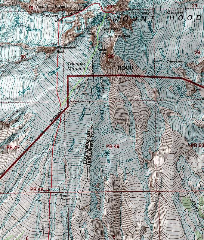
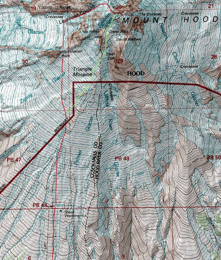
Leuthold Couloir Topographic Map
View High-Resolution Image
Leuthold Couloir Topographic Map
The red line shows the ascent route of the Leuthold Couloir while the green line shows the descent route via the old chute. Map data by
MyTopo
, generated by
TrailTopo
, lighting fixed with PhotoShop CS2, and the route lines drawn in my me.
« PREV
NEXT »
Josh Lewis
on
Jun 29, 2013 9:51 pm
Comments & voting
Other parents
Image Type(s):
Topo/Diagram
Image ID:
854683
4643 Hits
71.06
% Score
1
Votes
Log in to vote
Comments
No comments posted yet.
to post!
Don't have an account?
Leuthold Couloir
(Route)
« PREV
Viewing
#56 of 61
GALLERY
NEXT »
Josh Lewis's Image Gallery
« PREV
Viewing
#4143 of 4303
GALLERY
NEXT »
×
You need to login in order to vote!
User Name
Password
Remember me
Forgot your password?
Log me out when I close my browser.
Keep me logged in all the time.
sign in as a user
Don't have an account?
Register now for FREE
Rating available
Suggested routes for you
People who climb the same things as you
Comments Available
Create Albums
Register Here


