Toggle navigation
Mountains
Routes
Images
Trip Reports
Forum
What's New
People
Areas & Ranges
Articles
Trailheads
Canyons
Huts & Campgrounds
Albums
Logistical Centers
Fact Sheets
Lists
Custom Objects
Gear
Plans & Partners
WELCOME TO SUMMITPOST
SIGN IN
REGISTER
Bisaurín
Additional Parents
Image
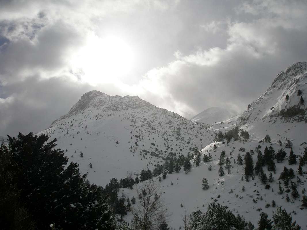
La Cuta
View High-Resolution Image
La Cuta
The summit of La Cuta stands in the range covering the south side of the Barranco de Agüerri, on the normal route from Gabardito to Agüerri or to the Collado del Foratón. February 2007
« PREV
NEXT »
eza
on
Feb 21, 2007 1:40 pm
Comments & voting
Other parents
Lat/Lon:
42.79210°N / 0.644°W
Image Type(s):
Informational
,
Scenery
Image ID:
271862
1870 Hits
71.06
% Score
1
Votes
Log in to vote
Comments
No comments posted yet.
to post!
Don't have an account?
Bisaurín
(Mountain/Rock)
« PREV
Viewing
#72 of 82
GALLERY
NEXT »
eza's Image Gallery
« PREV
Viewing
#1017 of 1490
GALLERY
NEXT »
Agüerri
(Mountain/Rock)
Loading....
GR-11 Trail (II) Zuriza-Panticosa
(Route)
Loading....
×
You need to login in order to vote!
User Name
Password
Remember me
Forgot your password?
Log me out when I close my browser.
Keep me logged in all the time.
sign in as a user
Don't have an account?
Register now for FREE
Rating available
Suggested routes for you
People who climb the same things as you
Comments Available
Create Albums
Register Here


