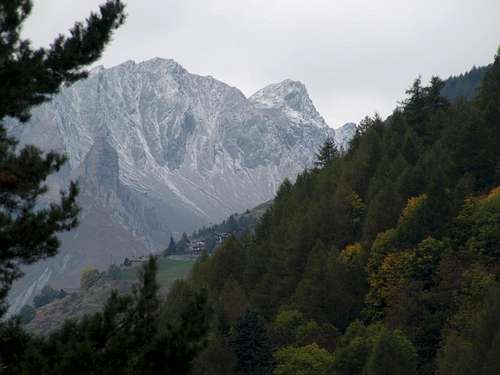
For every trip in each of them presents this trio almost unbreakable, because it represents the history, culture and civil-religious (the latter widely spread over the entire territory of the Aosta Valley) traditions in the Centuries and Millennia to the firsts, and meeting to the Eternity for the latest. When we think of a valley, immediately it comes to mind its highest mountain, or more beautiful that inevitably stands as a symbol of that. So for the Mont Blanc or the Grandes Jorasses in the two Courmayeur Vény and Ferret Valleys, Mont Velan and Grand Combins into the Great St. Bernard adjacent Valley, Matterhorn in Valtournanche, Lyskamm in Ayas, Monte Rosa at the Lys Valley or Gressoney, Grand Paradis in Cogne and Valsavarenche, Grande Rousse to Val de Rhêmes, Sassière to Valgrisa and Rutor in La Thuile. But even those
flaunt their favorite mountain as the Grande Rochère, Mont Fallère, Pointe Chaligne, Aiguille d'Artanavaz,
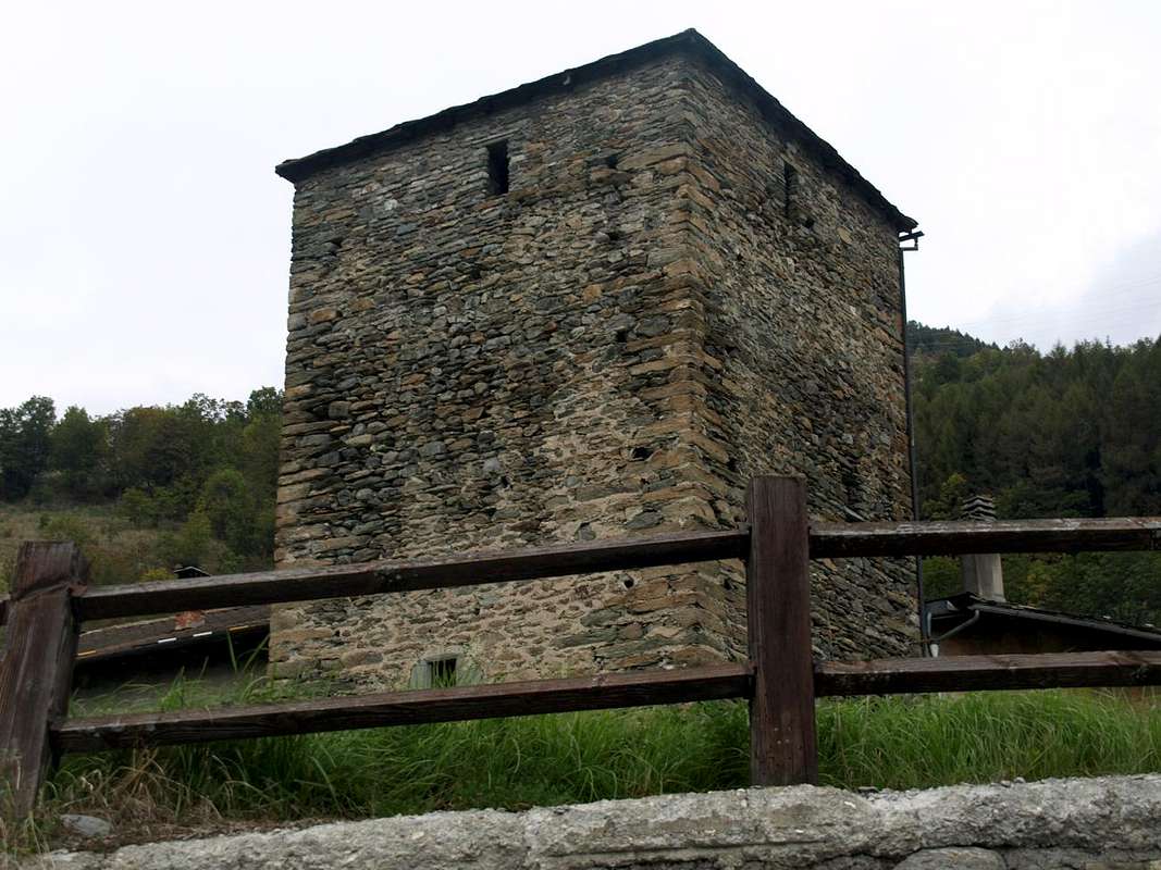
, Becca de Luseney, Becca de Viou, Faroma, Aver, Monte Zerbion, Torché, Mont Glacier or Rosa dei Banchi, Punta Tersiva or Emilius in their valleys. A combination that becomes even more distinctive if we add a Church, a Tower or a Castle that represent in terms Religious or what heraldic, chanting the History and the Life of the Population. One aspect that the Mountaineers,
to reach the goal and yet ignore the Hikers preferring to leave out the majesty of the views or the exclusive admiration for Nature. Fall in this way into oblivion if not in total anything despite the remaining observations that these may be the key to understand the uses and customs of a place, always a bit different from each other. A total disregard for all that has kept alive a mountain, a valley or just a country. An oversight almost incomprehensible as unforgivable, that we think to regain at least part of reviving the life of mountains, always inscrutably still in place, with that of the local.
Tutte le valli hanno una Chiesa, un Castello, Torre od entrambe ed una Montagna che le contraddistiguono. Caratteristica per ciascuna valente pur per la Valle.
Infatti ogni viaggio effettuato in ognuna d'esse presenta questo trinomio quasi indissolubile, poiché rappresenta la storia, la cultura e la tradizioni religiosa (quest'ultima largamente diffusa sullo intero territorio della Valle di Aosta) e civile nei Secoli e nei Millenni per le prime, nonché l'incontro con l'Eternità per l'ultime. Quando pensiamo ad una valle, subito ci viene in mente la sua montagna più elevata o più bella che inevitabilmente si erge a simbolo della medesima. Così per il Monte Bianco o le Jorasses a Courmayeur, Mont Velan e Grand Combins al Gran San Bernardo, Cervino in Valtournanche, Lyskamm ad Ayas, Monte Rosa nella Valle del Lys o di Gressoney, Gran Paradiso a Cogne e Valsavarenche, Grande Rousse in Val di Rhêmes, Sassière a Valgrisa e Rutor a La Thuile. Ma anche quelle
ostentano la loro montagna preferita come la Grande Rochère, Mont Fallère, Pointe Chaligne, Aiguille d'Artanavaz,
, Becca di Luseney e Becca di Viou, Monte Faroma, Becca d'Aver, Monte Zerbion, Becca Torché, Mont Glacier o Rosa dei Banchi, Punta Tersiva o Monte Emilius nelle rispettive vallate. Connubio che diventa ancor più caratterizzante se acciò aggiungiamo una Chiesa, una Torre o un Castello che le rappresentino sotto il profilo Religioso oppure quello araldico, scandendo la Storia e la Vita di quella Popolazione. Un aspetto che gli Alpinisti,
di raggiungere la meta ignorano e che pure gli Escursionisti tralasciano preferendo la maestosità dei panorami o l'esclusiva ammirazione per la Natura. Cadon così nel dimenticatoio se non nell'oblio più totale le restanti osservazioni nonostante che queste possano costituire la chiave di volta per comprendere usi e costumi d'una località, sempre un pò diversi l'un dall'altro. Una totale disattenzione per tutto ciò che ha tenuto in vita una montagna, una valle o semplicemente un piccolo paese o villaggio alpino. Una dimenticanza quasi incomprensibile quanto imperdonabile, che pensiamo di recuperare almeno in parte riallacciando la vita delle montagne, sempre imperscrutabilmente ferme e piazzate al lor posto, con quella delle .
, we move decisively further West towards always those of Etroubles, Saint Oyen e Bosses just at the entrance on the long and large Great Saint Bernard Valley, which, however, immediately after discards right (North). Indeed topographically even this large area obliquely addressed Northwest is divided into two distinct parts that mark the transition from Central Baltea Valley to that of Great St. Bernard Pass on the way to these Communes in North-northwest and a serie of secondaries Vallons that in semicircular deployment East/West reachs to West-northwest the Comba du Merdeux with above Malatrà Pass
.
Even among these is necessary a further division, separating all that is located in the South of the
from that which is placed in the north of the same hill that also marks the boundary with the adjacent Val Ferret. Therefore it is necessary to distinguish in two sectors the visit of this valley that can be done in the day, some parts by car and the remainder on foot, following the course of Artanavaz that, being born at the foot of Malatrà, ending his race reaching the two Buthiers of Ollomont and Valpelline in the location of
between the Rhins Fraction towards Valpelline and the Municipalities of Roisan and Gignod in the South:
A)- Ars o d'Arsy Vallon.
Dopo avere visitato la collina sopra i Comuni di Aosta e Gignod, ci spostiamo decisamente verso Occidente verso quelli sempre di Etroubles, Saint Oyen e Bosses insino all'ingresso nella lunga e larga Valle del Gran San Bernardo, che però subito dopo scartiamo a destra (Nord). Topograficamente questa grande area obliquamente rivolta a Nordovest si divide in due distinte parti che segnano il passaggio dalla Valle Centrale della Dora Baltea a quella del Gran San Bernardo sulla via per questi Comuni verso Ovest-nordovest formando una serie i valloni secondari che con dispiegamento a raggiera Est/Ovest raggiungon la Comba du Merdeux col suo soprastante Colle di Malatrà
(2922 m).
Anche tra questi é necessaria ulteriore suddivisione, separando ciò che é situato a Meridione del corso del
Rio Artanavaz o Buthier de Bosses da quello che si trova collocato a Settentrione del medesimo colle che inoltre segna il confine con l'adiacente Val Ferret. Risulta necessario disgiungere in due settori la visita di questa valle che può essere effettuata in giornata, un pò in auto e per la parte restante a piedi, seguendo il corso dello Artanavaz che, nascendo alle falde lel Malatrà, termina la sua corsa raggiungendo i due Buthiers d'Ollomont e di Valpelline nella località di
Moulin de Variney (784 m) tra la Frazione di Rhins verso la Valpelline ed i Comuni di Roisan e Gignod a Mezzogiorno:
Primo Settore o Meridionale (Itinerari da 1a)- fino alla Variante 7b)- ):
A)- Vallone d'Ars o d'Arsy.
B)- Vallone di Flassin. C)- Comba di Citrin. D)- Bacino di Serena.E)- Combe du Merdeux.
Secondo Settore o Settentrionale (Vie da 8)- fino alla Variante 10b)- ):
F)- Vallon des Ceingles.G)- Combe des Thoules.H)- Bacino di Crevacol.
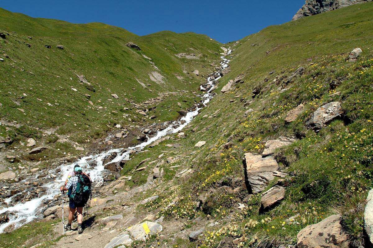
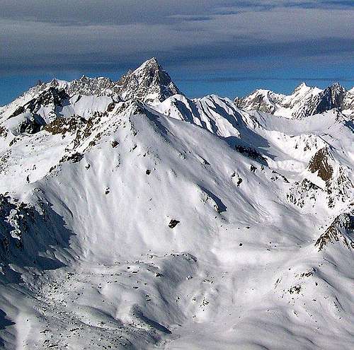
From the mid to the more upper part of Comba du Merdeux,
by Osw 2015
Getting There
By car:
- From TORINO, MILANO, etc: Motorway A5. Exit at IVREA or Quincinetto (PIEDMONT)
From IVREA Town: in West to Pont Saint Martin, Donnas, Bard, Verrès, St. Vincent, Châtillon, Nus, Quart Municipalities .
From Courmayeur Resort: in East to Morgex, La Salle, Saint Pierre, Sarre, Aosta Municipalities.
![]()
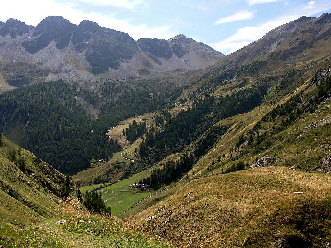
From Gignod Common towards the lower and Western parts of Gran San Bernardo Valley
From Aosta towards Signayes, Variney Fractions; from these to Gignod Commune (988m) with Great Saint Bernard State Road n° 27 to alternative nearby Condemine Hamlet (1137m). Leaving left (South) the same continue on Main Road and, passing the locality La Clusaz (1199m) and Echevennoz Hamlet (1233m) reach Etroubles (1264/80m; 14,8 Km. from Aosta City), Saint Oyen (1377m; 18,6 Km. by Aosta) and Bosses-Mottes Fraction (1660m; 20,6 Km. Aosta) Municipalities.
![]()
- From FRANCE: through the Mont Blanc Tunnel to Entrèves-crossroads to Vény/Ferret Valleys - Mountain Guides of Courmayeur - La Saxe Rock Gym - Courmayeur. By Little Saint Bernard Pass, closed since November until half May to La Thuile Valley - Pré Saint Didier - Courmayeur.
It is not necessary to take Motorway A5: you can drive on State Road n° 26, in the direction of AOSTA - IVREA - TURIN.
By plane:
- Aeroporto Internazionale "Corrado Gex" Saint Christophe (Aosta)
Some way to routes in semicircular deployment
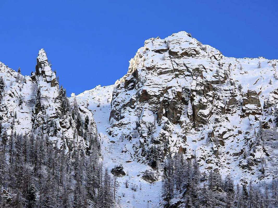
![]() Côte Citrin with Northern view from St. Rhémy-en-Bosses,
Côte Citrin with Northern view from St. Rhémy-en-Bosses,
by Antonio 20061a)- Tardiva Hill
(2410m) through Western Slope:
(1264m): from Echevennoz Hamlet, immediately after Gignod and always on Great St. Bernard State Road (
1233; "Ei qui ven à nos" or is water that is in us, by the course of the stream that comes from above Arsy Vallon;
"Hostel Marietty"), reached by a short detour from the Main Road, and starting from Dessus via a short private road, or more to the right (West) with the path
n° 4 to arrive at a small village (
1408m, up to here with the private road which, passing high above Echevennoz from Northwest to Southeast, connects the Villages above Lavanche
(around 1300 metres) to this Gariache
(1472m)). From this, with the path to the South and through the forest to reach Eteley
(1716m), and the next route that comes from Etroubles, this via, in our opinion, certainly is the most recommended among the three described as more practical and the most direct (
E/F; 2h'00/2h'15). Continue through path
n° 4/5 (
see below; E/F: 1h'00/1h'15 arriving on the pass.
1b)- Always to the Tardiva Pass and Costa Tardiva (2418m): from Etroubles Commune
(1270m) via the path
n° 5A/5 concomitant with the dirt road until the junction
about 1400 metres immediately after the village neighbor Alp Lavanche and before Champ-Reclos
(1425m). Left on the left (Southeast) a secondary deviation, it continues in the opposite direction on the main road to gradually reach the Pastures of Yettes
(1591m), and through the Bois (Wood) de Peson and discarding the right to further branching Teppes Damon Pastures
(1879m), those following of Eteley. Continuing towards the vallon floor and crossing the Torrent d'Ars, you reach a junction immediately before the Alp Praz-Gallet
(1626m), which is to the left; this finally with a long diagonal to the South-southeast into forest to reach the Ars or Arsy Alpage, whence the preceding route (
E/F; 2h'15/2h'30). From Ars Torrent, leaving right (West) the alpage continue to the South-southeast and with same path reach the Passo Tardiva (
E/F; 3h'00/3h'30).
2)- Mont Fallère (3061m) by Northern Face throuhg Arsy Vallon and homonym Tsa: from the Alps of Arsy, reached with one of the two regulated approaches described above, climb progressively towards addressing Southeast through grassy slopes and bumps of debris; left to right (West) of the three very mini Arsy Ponds, directed towards the base of the North Pillar in altituidine
2776 metres. Do not get this but, going off to the right (West), and go up through the end boring or very fine and
"chopped" debris in the beginning of the season, with snowfields slope from 30° to 38° (usually very hard snow, which requires the need to have with him an ax, or even crampons); then arrive with increasingly steep climb in altitude
around 2970/80 metres. Relying more and more diagonally to the left in the last
70 metres, throuhg easy but enough steep and broken small rocks, to reach the Great Shoulder or Eastern Top and with a crossing of
about 220 metres on the Eastern Ridge, equipped with chains, to achieve the true Summit (
EE/A/from F to F+; 2h'00/2h'30 by the Tsa of Arsy;
3h'30/4h'15 in total from various starting points).
From Col d'Ars towards Comba Citrin bypassing Mont Fallère,
by emilius 2006, andreaperino 2006 & sarme 20073)- Col d'Ars and Mont Labiez
(2534m, 2832m) by the Chaz Arsy
(2263m): reached the hill along the
unnumbered path in West, concomitant in the first part with a dirt road, after continue more in North-northwest on watershed, formed by easy rocks, up to the Mont Labiez (
E/F; 7h'15/7h'45).
4)- Traverse Testa Cordella/Monts Flassin Northern and Southern (2323m, 2767m, 2758m) through Flassin Vallon: from Alp Flassin Superior or Tsa leave the path
n° 7 that climbs to Col Citrin, or continue with the same rejoining the hill; instead of wanting to change the path, go up through the path
n° 7B to the Northwest and arrive at an old alp in ruins (2439m) From this continue reaching the small Summit of Testa Cordella
(2663m); from this easy trail to the South, after a small saddle
2606 metres, reaching the Antetop North
(2767m), from which, as in the previous route, the Summit (
E/F+; 1h'15/1h'30 from the Tsa of Flassin).
5)- Col Citrin and Punta Valletta (2484m, 2801m) through Citrin Vallon: reached the hill from Bosses-St. Leonard
(1519m) through the path
n° 8/VA continue in Northwest and by the easy Southeast Crest
pathless but with sparce but almost always evident traces reach the Summit (
EE/F/F+; 4h'30/5h'00).
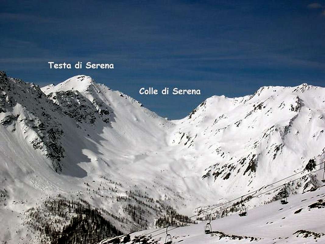
6)- Serena Hill and Testa (2547m, 2830m) along the Comba Serena: reached the hill from Bosses-Mottes
(1676m) through the path
n° 9 continue in Southeast and by the easy Northwest Crest
without path, but through enough evident traces and bypassing a serie of blocks, reach the Summit (
EE/F/F+; 4h'45/5h'15).
7)- Malatrà Hill (2922m): from Saint-Oyen, Mottes Fraction (
1660m; parking under Saint Bernard Road) also from Bosses-Cuchepache/Ronc Fractions
(+; 1648m; 1775m) towards Comba Merdeux, Montagna Merdeux Dèsott (Low;
1919m), Muanda or Moindaz Alp
(1973m), Tsa de Merdeux Upper Alp
(2285m), with various paths sometimes concurrent with the farm dirt road to the isolated little Villages of Devies and Maytie on
Alta Via n° 1. Through the same towards the Malatrà Hill, with small path-traces alwais of or nearby the
Alta Via n° 1, (2928m), between Mont Quichette
(3043m) and Aiguille of Artanavaz (
3071m;
E/F+; 4h'15/4h'30 from Mottes Fraction).
"Lower" Variant 7b)- : from Maytie
(1676m) towards Limassey Alp
(1808m) by private road and from this, through
unnumbered small path to Potz-Ardusi and Muanda Alps
(1784m, 1973), along the Torrent de la Belle Combe, at the entrance in Merdeux Comba towards the last Alp of Merdeux Damon (
2285m;
T/E; 1h'10/1h'20 by Mottes).
From Testa Crevacol towards Comba Thoula with Pt. & Gr. Golliaz,
by Osw 19968)- Petit Golliaz
(3234m) with approach through Combe du Merdeux : from the Tsa su Merdeux (
2285m;
see the subsequent Route n° 9) towards Col de Belle Combe, before in North through
not numbered small path after West on moraines, (
3000m;
EE/F+; 2h'30/3h'00 from Tsa) and through quite easy Southwestern Crest, formed by rocks very broken and debris bypassing some short distance to the left (West) (
EE/A/F+/PD-; 1h'00/1h'15 by Bellecombe Pass;
5h'00/5h'30 from Bosses-Mottes).
9)- Grand Golliaz or Golliat (3237m): by Mottes
(1670m) Village of Bosses, reachable from the State Road n° 27 of Gran San Bernardo, towards West, descending a little to pass under the highway
Alta Via n° 1 nearby the
"big bend". Cross the Rio Artanavaz on a small bridge the on to the Pastures of By
(1767m), Potz-Ardusi
(1784m) and Manda or Moindaz
(1973m), bordering the waterfalls of Thoules Torrent. You can arrive here also starting from the Devies car parking, just beyond the
"big bend", through the Pastures of Merdeux Desot
(1919m) and Côtes
(1930m). By Moindaz cross twice the torrent and follow the Eastern bank till the Pastures of Comba Toula and near the Saint Rhémy Hill; follow the path coming from it and, passing some dry couloirs Westward, up toward the moraine of the small Glacier des Bosses, always more in the process of withdrawal. Get it at
about 2700 metres, leaving on the left the path to Col de Sauliè, collocated between Aiguille de Saulié and Petit Golliaz. On along the moraine (steep and tiring) to get the remains of the glacier; after a short and steep (35/38°) slope face the rocky bar in the middle, starting from left, then to the right along a system of ledges with some debris tracks (from I° to II°-/II°; often little cascades of water or layers of ice on the rock). Once at the upper debris/snow band, toward Northwest to a narrow very steep rocky-debris gully of
100 metres around on the South-southeast side getting the big cairn on the summit (
EEA/F+/PD-; 4h'45/5h'15).
Direct Variant 9b)- by State Road: in the lower part you can get the high Comba des Toules from the hairpin bend
2079 metres of the State Road n° 27 beyond the Praz d'Arc Pasture along the military road, concomitant with the trail
n° 12A, towards the immediately above Saint Rhèmy Hill
(2540m).
10)- Hill and Testa Crevacol (2498m, 2610m): from Bosses-Cuchepache Fraction
(1648m) towards Arp du Jeux Pasture (1994m), Plan de Moudzon Tableland, forks
2052 metres, 2130 metres, unnamed alp
(2379m), winding road
2446 metres to Crévacol Hill
(2498m), always
without path but through a combination of various dirt roads, and finally towards rhe Crévacol Testa (
2610m, nearby the Forest Rangers Bivouac private and always closed;
E/F; 2h'45/3h'00).
Variant n° 10b)- towards nearby Mont Bortsalet
(2513m): from Bosses-Cuchepache to preceding unnamed alp, same route
pathless but before on dirt roads after traces, to Mont Bortsalet, through West Slope, with dirt road, or from Crévacol Hill with small path and traces on crest watershed (
2513m;
E/F; 2h'20/2h'40).
![]() By Comba du Merdeux going up on final part East Slope Malatrà Pass,
By Comba du Merdeux going up on final part East Slope Malatrà Pass,
by emilius 2003