

Tomek Lodowy - Apr 18, 2011 4:51 pm - Voted 10/10
great topobrilliant job
Tomek

Boriss Andean - Apr 18, 2011 5:10 pm - Hasn't voted
Re: great topoThanks Tomek!
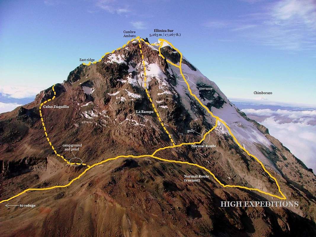
Even though this picture was taken in 2010, this topo pic shows the routes as they can be climbed in 2011.
Probably ¨La Rampa Route¨could be climbed soon again, if the mountain keeps getting all that new snow on its slopes.
Hope the peak keeps the little remaining glacier it still has.
RolandSkis - Aug 17, 2011 1:52 pm - Hasn't voted
la rampaany news on how la rampa is looking now?
Boriss Andean - Aug 20, 2011 1:09 pm - Hasn't voted
Re: la rampaI'm not currently in Ecuador now, but a friend of mine climbed La Rampa a couple months ago.
Conditions were perfect except for a short rock band section located a few meters above the base of it. He had to negotiate a small waterfall in order to climb up to the ice/snow section below Cumbre Ambato.
From what I've gotten to know, Illiniza Sur got some new fresh snow in the last couple days, but usually that snow doesn't last too long in the summer months.
RolandSkis - Aug 21, 2011 9:55 pm - Hasn't voted
Re: la rampagreat thanks for your reply--there has been alot of snow these past few days so it probably at least worth taking a look!


Comments
Post a Comment