
Viewing: 1-2 of 2

Aaron Johnson - Jul 12, 2004 9:38 pm - Voted 10/10
Morgan-Nice work. Was my advice from the thread helpful?

mpbro - Jul 13, 2004 11:53 pm - Hasn't voted
Re: Morgan-Hi Aaron,
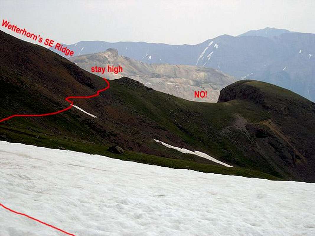
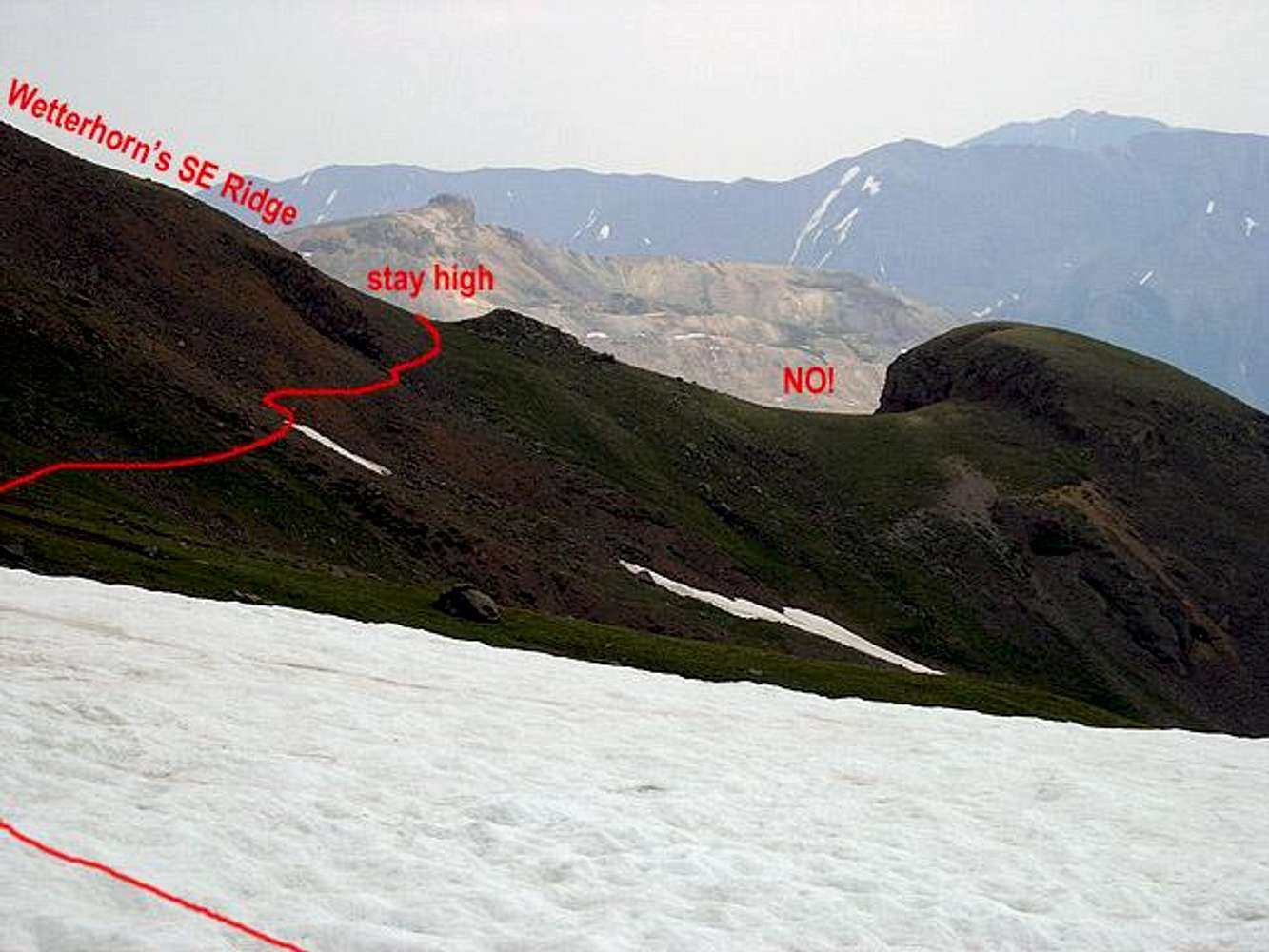
Yes it was! Thanks. The problem for us was that a snowstorm started soon after this photo was taken. In the melee, we went a bit too low. Wasn't a big problem, since I realized the mistake and contoured back to the trail, but we were on the verge of going into the wrong creek drainage! Yikes!
We did some hiking and fishing around Sneffels today. Didn't climb it, but went to the highest of the Blue Lakes before getting rained on pretty hard. Caught a 13" Cutthroat in the lowest Blue Lakes.
Viewing: 1-2 of 2


Comments
Post a Comment