Toggle navigation
Mountains
Routes
Images
Trip Reports
Forum
What's New
People
Areas & Ranges
Articles
Trailheads
Canyons
Huts & Campgrounds
Albums
Logistical Centers
Fact Sheets
Lists
Custom Objects
Gear
Plans & Partners
WELCOME TO SUMMITPOST
SIGN IN
REGISTER
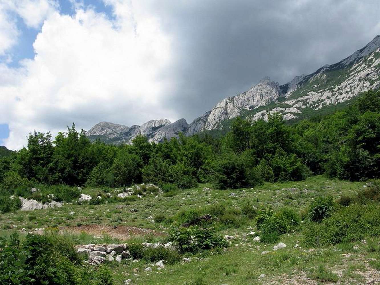
Hiking towards Struge
View High-Resolution Image
Hiking towards Struge
Hiking towards
Struge
at the upper
Velika Paklenica
valley. In the distance on the left is
Viserujna
(1.632 mtrs),
Buljma pass
(1.400 mtrs) in the middle and
Rapavac
(1.617 mtrs) on the right. Jun 2009.
« PREV
NEXT »
Branko
on
Jul 10, 2009 2:48 am
Comments & voting
Other parents
Lat/Lon:
44.35960°N / 15.50220°E
Image Type(s):
Hiking
,
Informational
,
Panorama
Image ID:
528285
1234 Hits
74.92
% Score
5
Votes
Log in to vote
Comments
No comments posted yet.
to post!
Don't have an account?
Struge route (VPP)
(Route)
You are at
the First
Image
Viewing
#1 of 1
GALLERY
You are at
the Last
Image
Branko's Image Gallery
« PREV
Viewing
#1053 of 1286
GALLERY
NEXT »
Struge route (VPP)
(Route)
Loading....
×
You need to login in order to vote!
User Name
Password
Remember me
Forgot your password?
Log me out when I close my browser.
Keep me logged in all the time.
sign in as a user
Don't have an account?
Register now for FREE
Rating available
Suggested routes for you
People who climb the same things as you
Comments Available
Create Albums
Register Here


