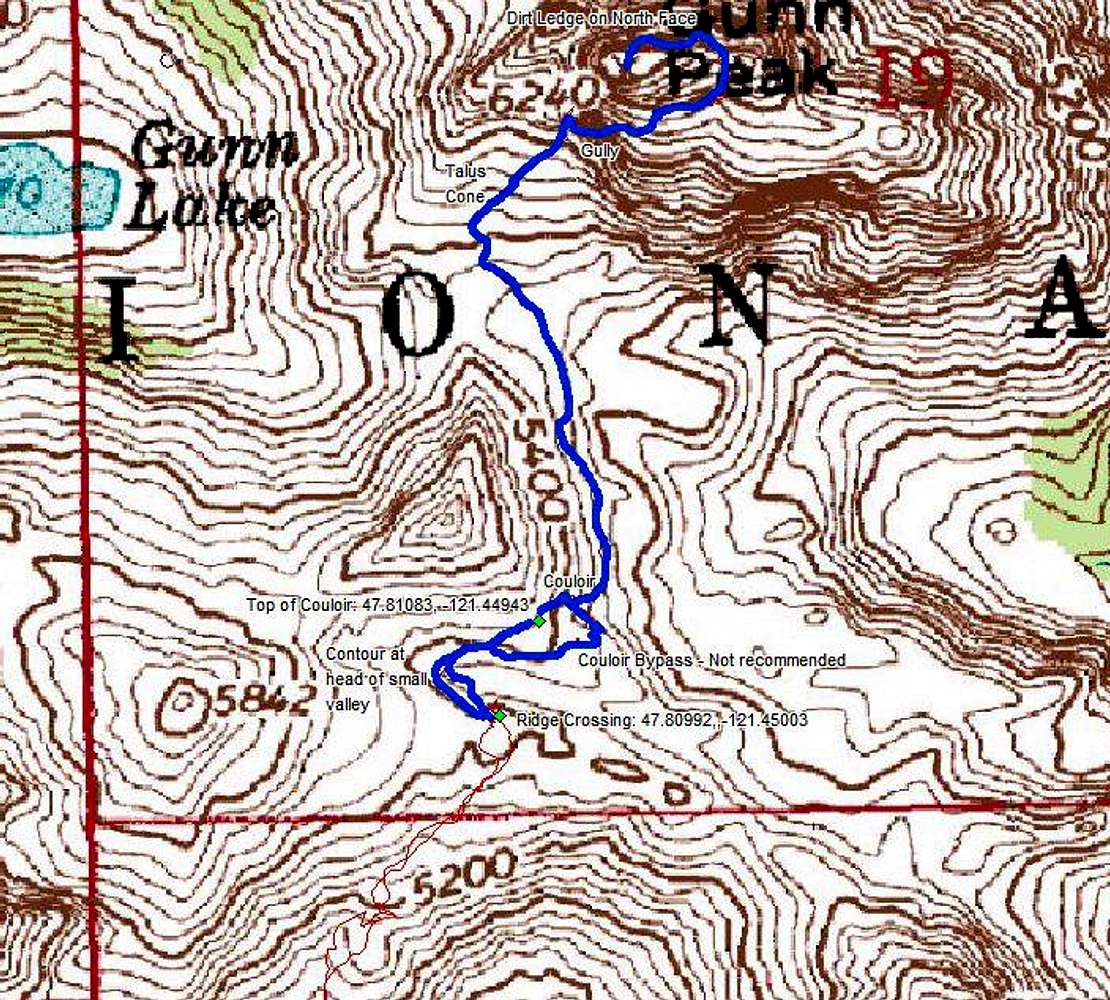
This is a courtesy map of our GPS track on Gunn during the summit area. It is provided merely as a reference to confirm the route. By the time you are at this point in the route, the terrain will be open and you should be route-finding visually. All of the key features of the route: a gully down off of 5760+, the hidden ramp/gully S of the summit, the notch E of the summit and the N side ledge are the sorts of things that don't really show on the topo. A good route description is the key; but this map can serve as a supplement to that.
The waypoints are a good guideline but should not be viewed as absolutely correct. A GPS does have a margins of errors and the route on Gunn has cliffs within a distance that is sometimes less than that margin of error. Use at your own risk.
Thanks to Greg Slayden of
peakbagger.com for providing this map.


