Intro/Stats
Granite Pk, MT (12799')-Highest Point in Montana
Froze-to-Death Mtn, MT (11765')
Tempest Mtn (12500')
Mt Peal (12409')
Via East Rosebud/Phantom Creek/Froze to Death Plateau
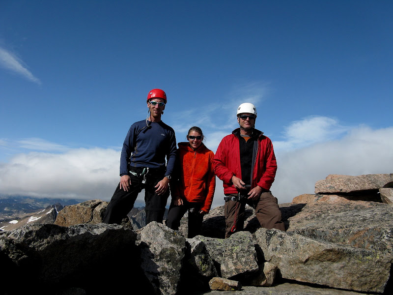
Participants: Sarah T. Meiser, Dwight Sunwall, & Kevin Baker
Aug. 15-18, 2009
Slideshow with music
Granite Peak is the highest mountain in the wild and rugged state of Montana, which I had barely set foot in once on a visit to Yellowstone. It was first climbed in 1923, the last of the state highpoints to be climbed. It is considered to be one of the toughest highpoints due to the long approach, frequent unpredictable storms, and 4th to low 5th class scrambling required. I would put it at #4 in difficulty behind Denali, Rainier, and Gannett. Many highpointers have had to make multiple attempts to claim this elusive summit and I was hoping not to suffer the same bad luck.
Dwight and Sarah were up for an exciting challenge like Granite even though they are not your traditional highpointer! I have a 100% success rate on primary summits with them, so we would form a solid team! We would only have 2 days available to make a summit bid, but could add a third summit day if we could possibly push all the way to high camp in one day. We had no problems finding the East Rosebud/Phantom Creek trailhead on Sat morning, electing to take this trail over the standard Mystic Lake trail as it makes a gentle ascent to Froze to Death Plateau.
Day 1 & 2-Approach, Froze-to-Death, & Tempest
Day 1-Pack into low camp (8900')
4.6 miles, 2740' gain
Dwight brought his scale and Dwight and Sarah's packs weighed in at 38 pounds and mine was 42. Not bad for 4 days! We set out at 11:15am Sat and quickly suffered two setbacks. About 10 minutes up the trail I discovered that I left my headset in the car to my satellite radio. I dropped the pack and raced back to get this luxury item! Another 5 minutes up the trail and Sarah realized she had left her orthotics in the car! I guess we both get an asterisk for extra vertical! We were quite pleased with this luxurious trail that has been well maintained, as it gently climbs to Slough Lake.
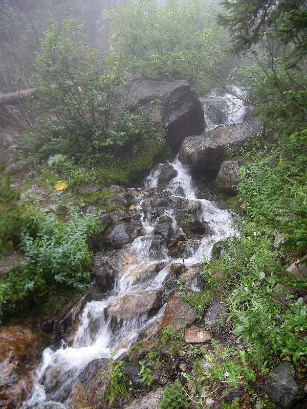
A cool waterfall off the trail:
We met a group coming down who turned around at the snow bridge despite good weather. For one older guy, it was his second attempt on Granite. It started raining pretty hard right when we got to Slough Lake, so we waited it out in the trees for awhile. We headed back up when the rain let up, and luckily it stopped later on. We ended up deciding on splitting up the approach into 2 days and camped in the trees at 8900' just off the trail.
Day 2-Froze-to-Death Mtn/High Camp/Tempest Mtn/Mt Peal attempt
9 miles, 4000' gain
It rained off and on during the night and we were less than enthused to find out what it was like on the infamous Froze to Death Plateau. We set out at 6:15am in hopes of tagging unranked 11er Froze-to-Death along with ranked 12er Tempest beyond high camp if the weather held. We enjoyed the trail to the saddle and it was apparent that we were going to be in and out of the clouds all day.
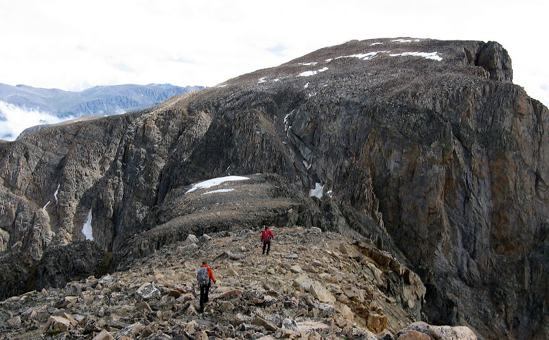
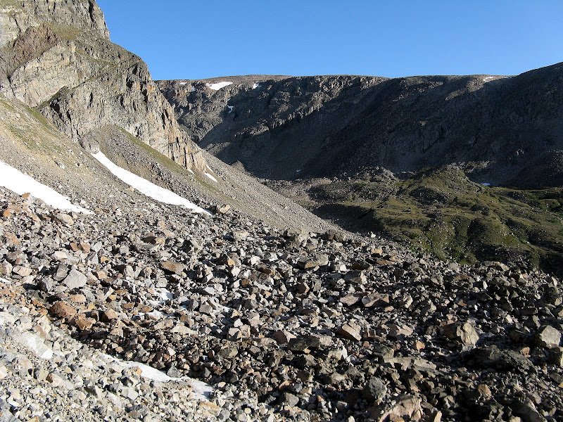
The plateau was initially easy off trail hiking on patches of grass and talus, but once we beelined it up to the ridge to go over Froze-to-Death, tedious boulder hopping over huge blocks ensued. This was tough with full packs on!
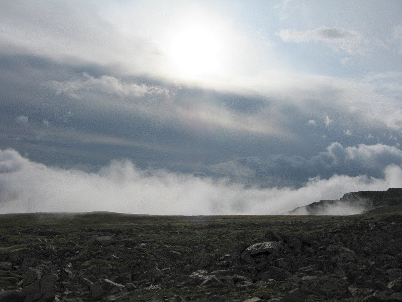
A sea of boulders on Froze-to-Death:
Boulder hopping was the common theme throughout this trip, so we just had to deal with it. The slog over to the lower rock shelters at 11600' seemed to take forever, so we were glad we didn't do this in one shot.
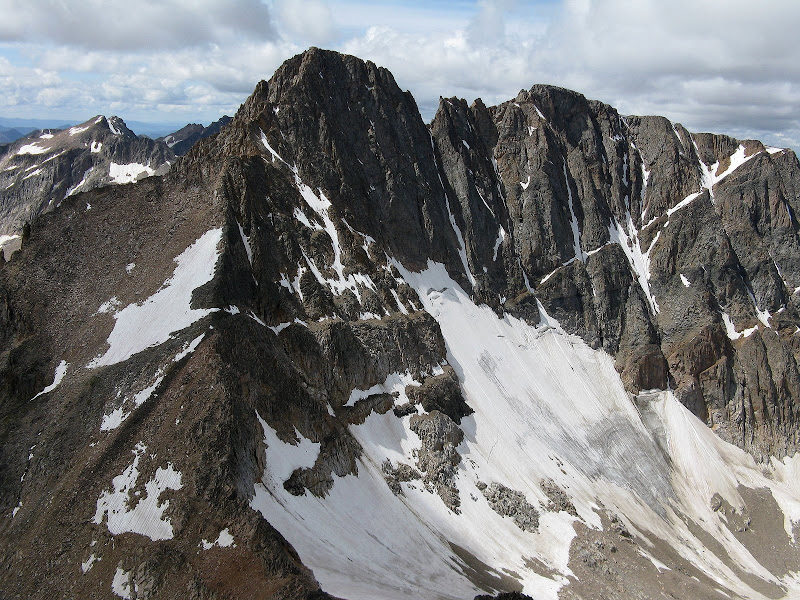
After setting up camp, it looked like the weather would hold long enough for the short 900 foot climb up nearby ranked 12er Tempest, the 8th highest peak in MT. We found bits of a trail to the north ridge and did some easy talus hopping to the summit. Here we got a nice preview of Granite for the next day. Luckily, the standard route is not on the north face!
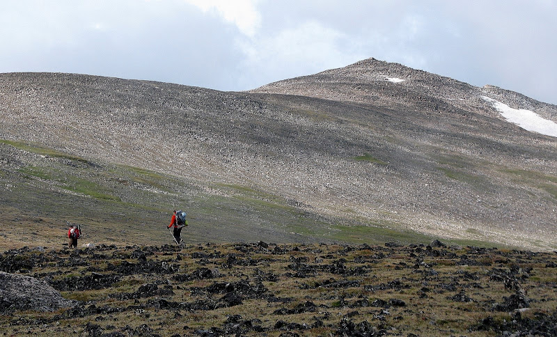
Dwight decided to see if we could traverse over to 12er Peal which is only a mile away, but I was pretty sure the ridge had some deep notches that could not be avoided. That ended up being the case, so we got some more boulder hopping in back to camp.
No dice on Peal's dramatic n.w. ridge:
We made it back to camp in time for dinner before it got dark. The winds really picked up and it snowed on and off for a few hours. I probably only got a couple hours of sleep worrying about the weather and how tricky the terrain would be if there was significant snow.
Summit Day
Day 3-Granite Peak from high camp
4 miles RT, 2400' gain
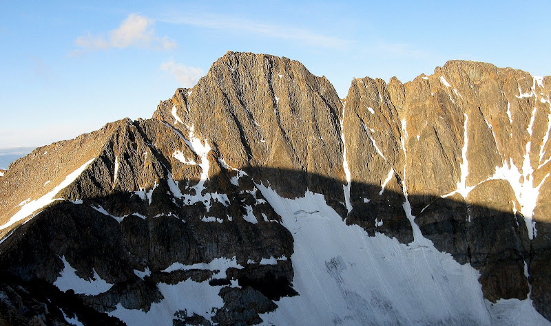
The winds didn't subside enough at dawn and Dwight reported a temp of 28! I had all my clothes on as we set out at 6:30, hoping the winds would subside when we dropped down the trail on the west side of Tempest. Skies were clear though and it looked like we might get a window to summit. The snow did not accumulate much at all and would likely not be an issue on the south face.
Early morning light on Granite:
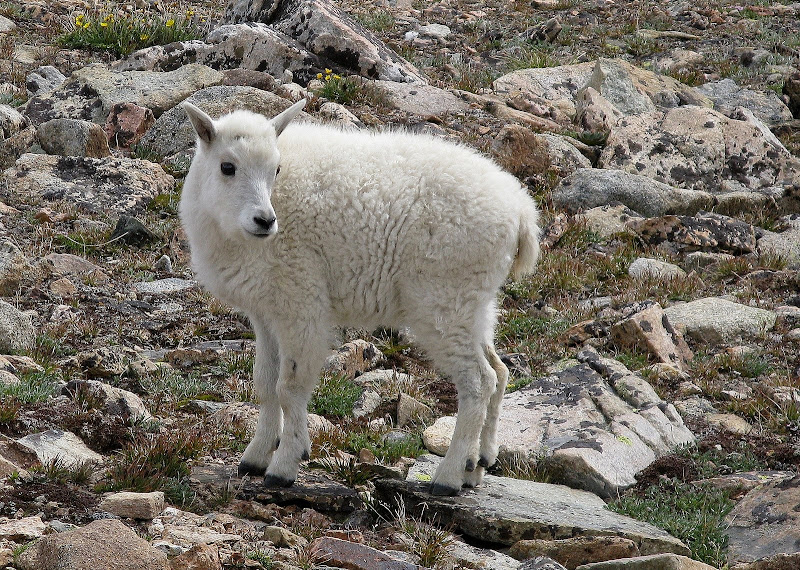
Since we got a bit of a late start due to the cold temps, we tried to keep our breaks very short. The traverse down to Bivouac Saddle wasn't too bad, although there was still plenty of loose boulder hopping as the trail was sporatic. I stowed my poles at the saddle, and a mean mountain goat tore up the handles on one of them. Was this little guy the culprit? We later saw them high on the ridge following us up Granite. Wonder if he signed the summit log?
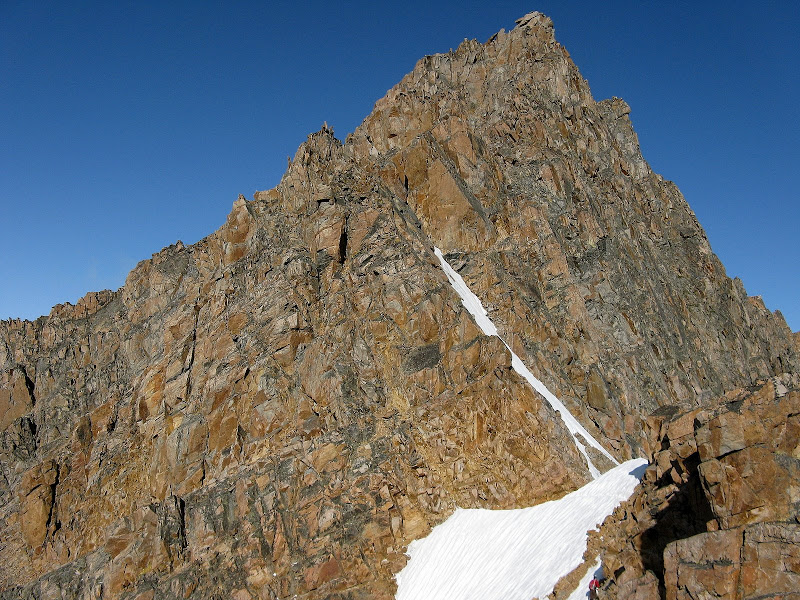
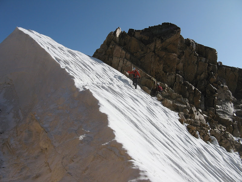
The next leg of the climb is up the east ridge via a trail on the left to the snow bridge. We followed the trail here and there, avoiding a few minor snowfields with some class 3 scrambling on the ridge. We climbed through a notch and got our first view of the snow bridge and lower sections of climbing.
We were able to cross some minor patches of snow prior to the snow bridge and decided to play it conservative and setup a belay across the snow bridge. Even though there were steps in place from previous climbers, the snow was too hard to self belay with an ice axe. The bridge was probably still a good 10 feet tall, so there must have been a lot of snow up here last winter! Sometimes this bridge is totally gone by Aug.
Dwight belays Sarah across:
Snowbridge crossing
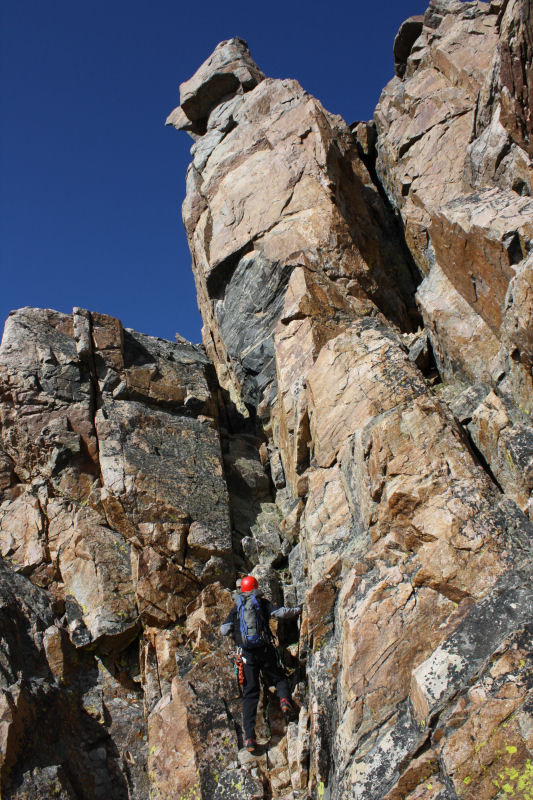
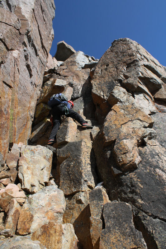
We all made it across pretty quick and were eager to get started with the climbing! We used Alan Ellis's excellent route description from summitpost and pretty much nailed the route. The initial climbing is a series of 3 chimneys, which are no harder than class 4. We took turns leading and it was loads of fun. We thought the lower portion of the route was pretty obvious as there were slings at the top of the chimneys.
Kevin heading up chimney #2. Pic by Sarah T. Meiser.
Dwight climbing one of the chimneys. Pic by Sarah T. Meiser.
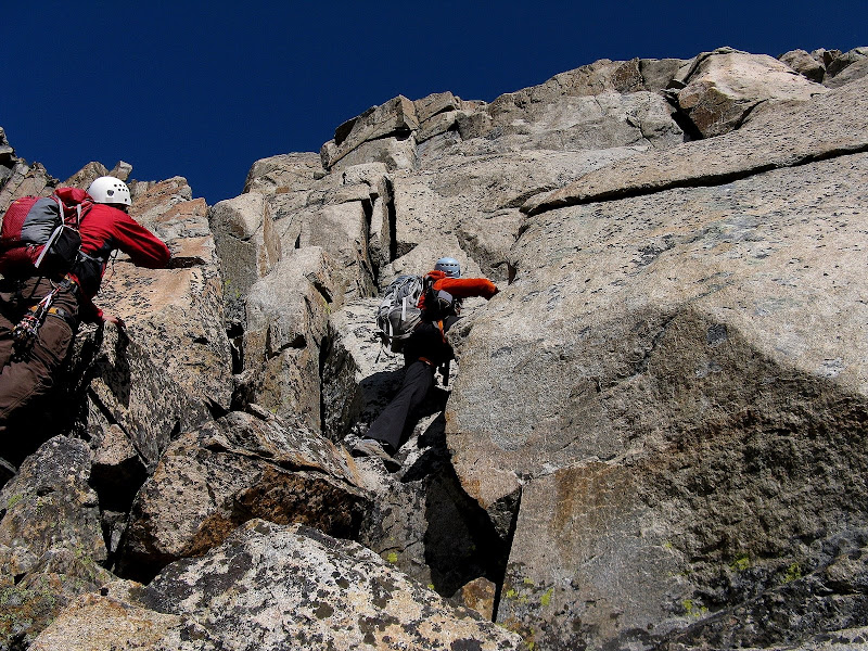
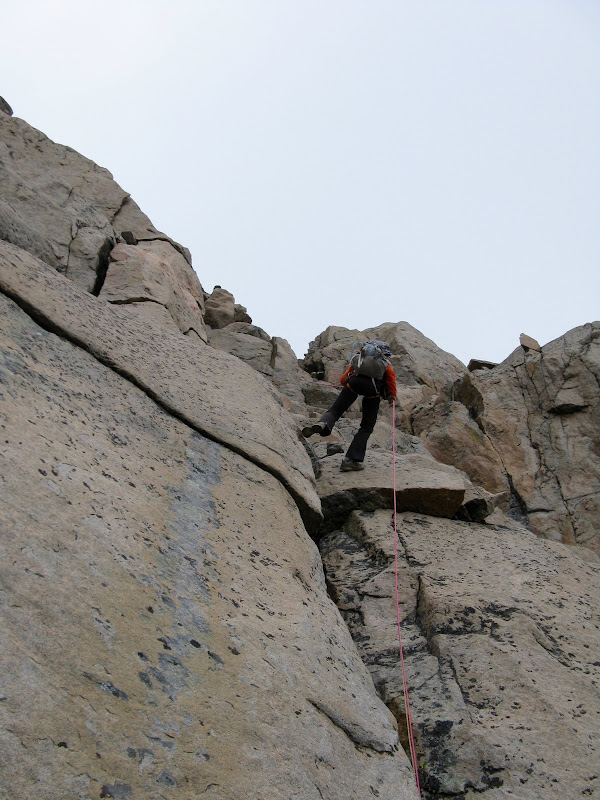
After making it up the first 3 chimneys, we passed through a notch and the rest of the upper route on the south face revealed itself. The rest of the remaining 200 feet on the south face is not obvious from here, so we looked at a photo of the remaining route. We scrambled up to a large flake on the face which formed a short dyhedral that we thought was low 5th class. When I saw Sarah think about it for a bit, I opted for a belay.
We then made an exposed traverse on a thin ledge at the top of the flake to easier terrain. There was one additional awkward section above this that I took a belay on. Above this we climbed another chimney with a chockstone in the middle of it that required a bit of a mantle move to get over. From here, we traversed left to the famous keyhole, passing below it to the right. The final obstacle to the summit ridge was another 15 foot chimney that was a lot of fun.
Pic by Sarah T. Meiser:
A short scramble on the ridge and low and behold there was the familiar block that I had seen many summit pics of! At 10:17am, we topped out on the roof of Montana! We were amazed that there wasn't even a hint of a breeze on the summit, although low clouds in the valley were beginning to rise.
Summit pano video
Granite completes the low 48 state highpoints for me and leaves only Denali to finish! Hard to believe this journey started some 25 years ago back in 1984when I did the driveups of Clingman's Dome and Mt Mitchell in the Smokies with my family as a kid. It has been quite the adventure.
We had pushed all the way to the summit from camp with only one break, so we were glad to have enough time to refuel for the rappelling action to come. We played it safe and rappelled down most of the 4th class stuff, which was probably faster than downclimbing. We lost count how many raps we did, but it was probably 5 or 6. We used two 30 meter ropes and ended up tieing them together further down for the longer raps.
Sarah raps one of the longer sections:
We moved efficiently as it looked like weather was going to move in and made it back down to the snowbridge in about an hour. We belayed across the bridge again as the snow hadn't softened up much. On the way back down the east ridge, we stuck closer to the crest, which afforded some airy scrambling.
As we made our way back up the side of Tempest, it began to snow. The talus got real slick and I took a hard fall and bashed my shin pretty good. Glad it was snowing on easy terrain and not higher up! We pushed up to the plateau and made it back to camp around 2:40. I must say Granite is one of my favorite highpoints despite the long approach and the inhospitable FTD plateau, but we got real lucky with the weather!
Mount Peal & Descent
Day 4 & 5- Mount Peal & Descent
15.2 miles, 3500' gain
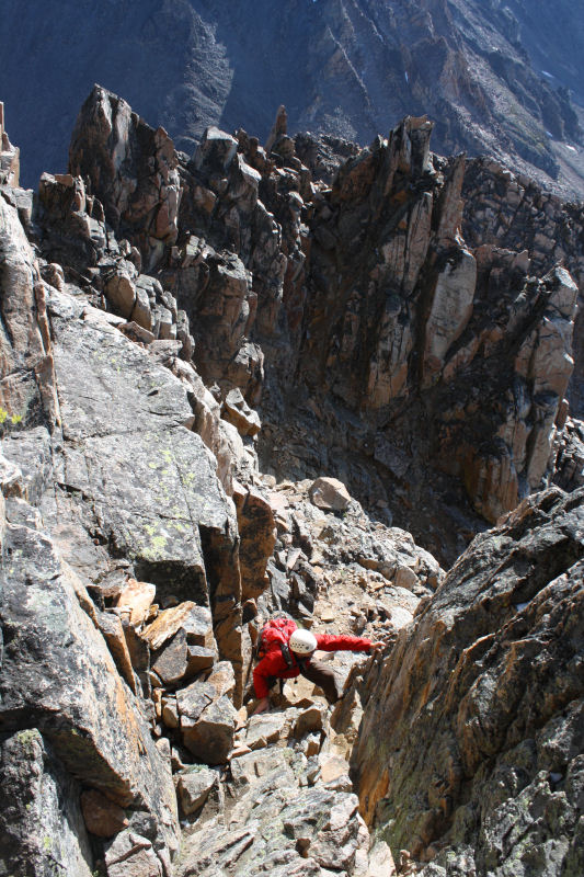
Just a short summary of our final climb since this report is long enough. Peal is the 9th highest summit in MT and is just south of our camp. We didn't have much beta on it, so we pretty much made up our own route. If you're looked for a "smell the flowers" hike, this slog is not for you! Hours and hours of tedious boulder hopping await. We dropped off FTD plateau about .6 mile east of camp and dropped 1200' on class 2 steep grass and boulders. We then traversed above Turgulse Lake on huge boulders, some the size of cars.
We then climbed a prominent gully of loose talus and scree that made the hourglass on Little Bear seem like a piece of cake, although this gully can be kept at a precarious class 2. I stepped on a huge block on a short ledge and knocked it loose, exploding it into a million pieces!
At the top of the nasty gully:
The final 900 feet to the summit up the n.e. ridge was on easy talus. Great views to the west and over to Granite from this summit, which is ringed with cliffs on the west side.
Looking n.w. from Peal summit:
The descent of the gully was really annoying, as stable footing was hard to find. On the way back, I decided to avoid the boulder field and traverse on scree above Turgulse Lake. I had to make sure I didn't slip, or it would be a chilly plunge into the lake! I met back up with Dwight and Sarah before climbing out of the valley back up the the plateau. The climb of Peal had taken a bit over 8 hours.
We had enough of camping on FTD plateau, so we packed up and headed down to the lower camp. We had great weather all the way down to our low camp, which probably doesn't happen too often on a given summer afternoon. I was tired of camping and lobbied to hike all the way out that evening, but Sarah overruled that idea as there would likely not be any restaurants open. It was good that we didn't, because the next morning the 4Runner battery was dead from a light that was left on! Dwight and Sarah flagged down a car quickly and we got a jump in about 30 minutes. What a trip!


Comments
Post a Comment