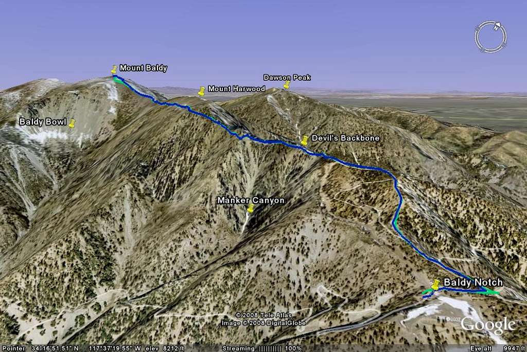
Google Earth rendition of my track up Mount Baldy from Baldy Notch
My track from Mount Baldy Notch to the summit of Mount Baldy as seen on Google Earth. GPS data on my Garmin GPSmap 60CSx were converted to a KMZ file by GPS Visualizer. Did the hike on June 8, 2008


