
|
|
Mountain/Rock |
|---|---|
|
|
39.63980°N / 120.6706°W |
|
|
Sierra |
|
|
Hiking |
|
|
Spring, Summer, Fall |
|
|
7569 ft / 2307 m |
|
|
Overview
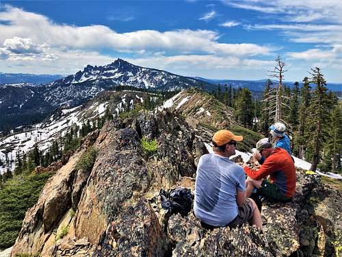
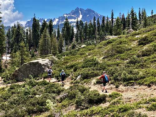
The unofficially named “Deer Lake Peak” is located near the Pacific Crest Trail (PCT) about 3.5 miles north of Sierra Buttes. The very popular Sierra Buttes dominates views in this area and leaves the very accessible Deer Lake Peak off the radar for most hikers.
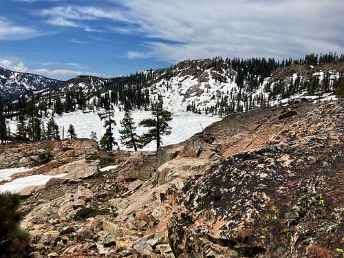
Deer Lake Peak sits just above Deer Lake in the northern edge of Tahoe National Forest. It is the southern edge of the Lakes Basin region near Graeagle – a very popular recreation area in Northern California. It has a prominence of 557’ with Sierra Buttes the higher peak. There aren’t many higher mountains nearby to the north, except for Mount Elwell at 7,818’.
The Golden Valley Rim Trail crosses only 60’ below the summit of Deer Lake Peak and connects with PCT, offering a loop option.
Deer Lake Peak is a very easy hike during summer months. It can be combined with Sierra Buttes or a longer hike along the PCT.
In an ordinary year, hiking can begin in May and go through November. 2023 wasn’t an ordinary year, with Deer Lake at just over 7,100’ still covered in snow and ice on June 24th.
Getting There
There are a couple primary options for hiking Deer Lake Peak. Both are from the south and can be done as a loop.
The first step is to get to the Packsaddle Campground west of Bassetts off the Gold Lake Highway, which is north of Sierra City, California. Off of Gold Lake Highway is the 621 Road. Take this road for a little over a quarter mile and take a right.
For the PCT route, continue on 621 for a couple miles to Packsaddle Campground. Park on the north side of the road across from the campground at the PCT entrance point where there is space.
For the shortest option, continue up the steep, windy 621 Road (which is paved) for another couple miles until you reach a trail sign at the top of the pass referred to as Packer Lake Saddle at a little over 7,000’.
Alternatively, if you want to make a loop out of it, a good place to park is about half a mile past the Packsaddle Campground at the Tamarack Lakes Trailhead. Packer Lake itself is in between these two points.
Route
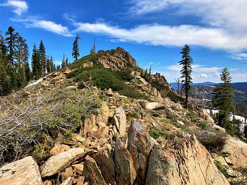
For the short option, take the Golden Valley Rim Trail for about 2 ¼ miles. The summit will come into view on the right, and it is just 80 yards to the summit off the trail. The summit is a rock fin, but no scrambling is required. Only 700’ of elevation gain is required.
If taking the PCT, hike for three miles until reaching a ridge above the north side of Deer Lake. Deer Lake Peak will be in view to the south and east of Deer Lake. There’s a trail that heads around towards Deer Lake Peak, or you can even descend to Deer Lake and then hike steeply up to Deer Lake Peak. The summit is reached in about 4 miles gaining about 1,500’.
For a loop, just head up the paved road on the ascent or down the paved road to descend. If starting at the Tamarack Lakes Trailhead, the loop is about 8 ½ miles.
If one was ambitious, you might be able to add Round Lake Peak 7,541', which is 3 miles further on the PCT. That would be a 12+ mile round trip hike from Packer Lake Saddle with a nice section of PCT to enjoy and only adding another 1,100’ or so total round trip.
Red Tape
The road may be closed during winter months, or due to fire restrictions. Otherwise, there are no restrictions to day use. There are multiple campgrounds in the area for additional sightseeing.