|
|
Mountain/Rock |
|---|---|
|
|
26.78416°S / 68.6011°W |
|
|
Hiking, Mountaineering, Scrambling |
|
|
20164 ft / 6146 m |
|
|
Overview
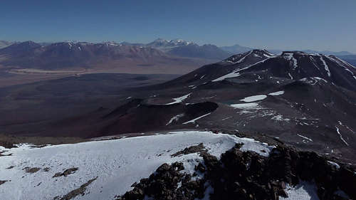
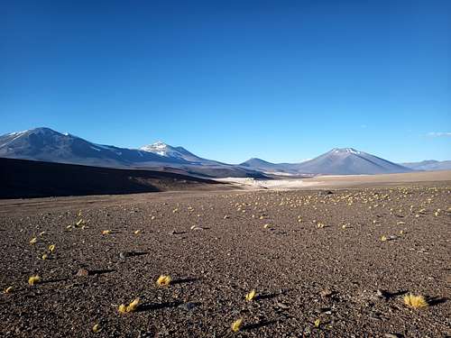
El Ermitaño is an obscure peak in the southern Puna de Atacama, infrequently climbed due to the presence nearby of many other taller, more interesting mountaineering objectives. Nevertheless, this peak is at 6146 m altitude roughly the 56th tallest mountain in the Americas and so has some appeal to Andes peakbaggers.
While perhaps marginally more challenging than its neighbour Volcan Peña Blanca due to steeper slopes, higher altitude, and rockier terrain, it is still an easy climb by any technical metric. Aside from warm clothes and good footwear, most climbers will not require any notable gear. A climb of El Ermitaño can be a viable warm-up in acclimatization for high-altitude climbs on Ojos del Salado or Cerro Tres Cruces, although other peaks in the area are likely more strategically located for such activities.
Getting There
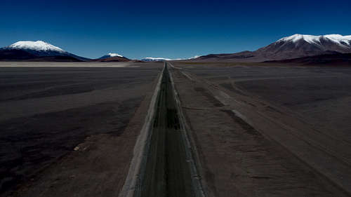
The only reasonable access to El Ermitano is from the Chilean highway C-31. The peak is about 14 km north of the road opposite Ojos del Salado. This is roughly 245 km of travel from Copiapo in Chile or 235 km from Fiambala in Argentina - both are common points of departure for mountaineering in this region.
The usual mode of transportation in the area is 4WD pickup trucks, and the drive from Copiapo can be made in about 5 hours. However, acclimatization is imperative for peaks at this altitude, so most parties will need to stop for at least one or two nights during the approach in order to camp safely and comfortably on the 4500 m plateau.
Cycling is a viable and recommended option for accessing climbs in this area. A fit rider can reach Refugio Claudio Lucero below Ojos del Salado in 3-4 days from Copiapo - only one day longer than a typical motorized approach - and will arrive in an excellent state of acclimatization. As well, this mode of transportation dramatically reduces the environmental footprint of an expedition, a worthy goal for any mountaineer.
From the highway, the intervening distance can be covered on foot, mountain bike, or a suitably equipped 4WD vehicle.
For the latter option, existing offroad trails should be used rather than driving fully off-road to preserve the local environment. The natural restorative processes in this area operate very slowly, so any new scars on the landscape from off-road driving will last for decades or more. There are already plenty of trails leading most anywhere one wishes to go, so there is no need to create more.
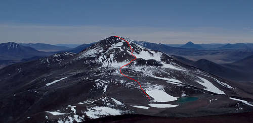
Route
As a non-technical peak, almost any desired line can be climbed. Most parties will approach from the south or south-west, and ascending from the col is a natural choice. From the col, climbers have the option of several slopes and rocky ridges leading to the summit. Depending on the line chosen, climbers may encounter short sections of moderate scrambling, or else simply steep hiking.
Red Tape
Chilean authorities generally desire that all mountaineers climbing in the border region register their expedition with the agency DIFROL. This is quickly and simply done at https://www.difrol.cl/en/procedures/expeditions/. As of 2023, there are no fees for this permit, and the system appears to be wholely or partially automated.
When to Climb
The usual climbing season in this area is November through March. Expeditions during this time can expect generally sunny conditions with frequent strong wind and occasional snowfall. The freezing level and snow line in the region vary considerably from season to season and even day to day, so be prepared for cold and snow at any camp.
The international border is generally closed from May through October and the highway may frequently be impassable due to snow during that time. As well, weather conditions in the region can be brutally cold and windy during the southern winter - climbing may be possible, but certainly inconvenient and uncomfortable.
Camping
Camping is permitted anywhere as desired. Some particularly convenient or aesthetic camps are:
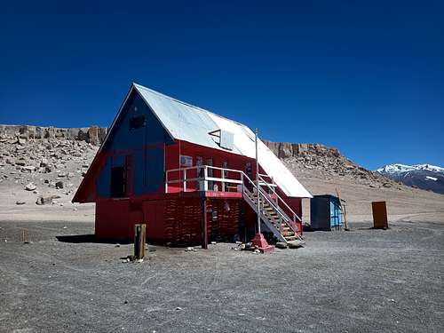
- Refugio Claudio Lucero - Located at 4850 m roughly 3 km south of the highway, this is the main base camp and mountain hut for Ojos del Salado. This 2.5 level structure sleeps roughly 25 climbers at full capacity and has a kitchen area and numerous bunk beds and mattresses. Tents can be set up outside as necessary. Snow and ice for drinking water can occasionally be found in the crevices of the cliffs behind the refugio, but this is sporadic at best.
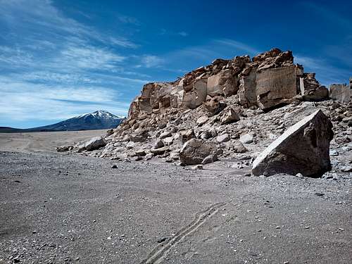
- Lava Cliffs adjacent C-31 - These cliffs extend both north and south of the highway and provide a beautiful setting for a base camp. While usually absent of any water source, the cliffs are great for casual scrambling on a rest day. A culvert where the cliff line crosses the highway is a convenient place to stash unneccessary gear (e.g. a bike).
- Col Pond - The pond at the col between El Ermitaño and Volcan Peña Blanca is a scenic and convenient location for a high camp to access both summits. The pond itself is highly mineralized and likely undrinkable, but there are persistent snowfields throughout the col that can provide a source of drinking water.