Toggle navigation
Mountains
Routes
Images
Trip Reports
Forum
What's New
People
Areas & Ranges
Articles
Trailheads
Canyons
Huts & Campgrounds
Albums
Logistical Centers
Fact Sheets
Lists
Custom Objects
Gear
Plans & Partners
WELCOME TO SUMMITPOST
SIGN IN
REGISTER
Mount San Antonio (Mount Baldy)
Additional Parents
San Antonio Ski Hut / Baldy Bowl Route
San Gabriel Mountains - High Country - Baldy Area
Image
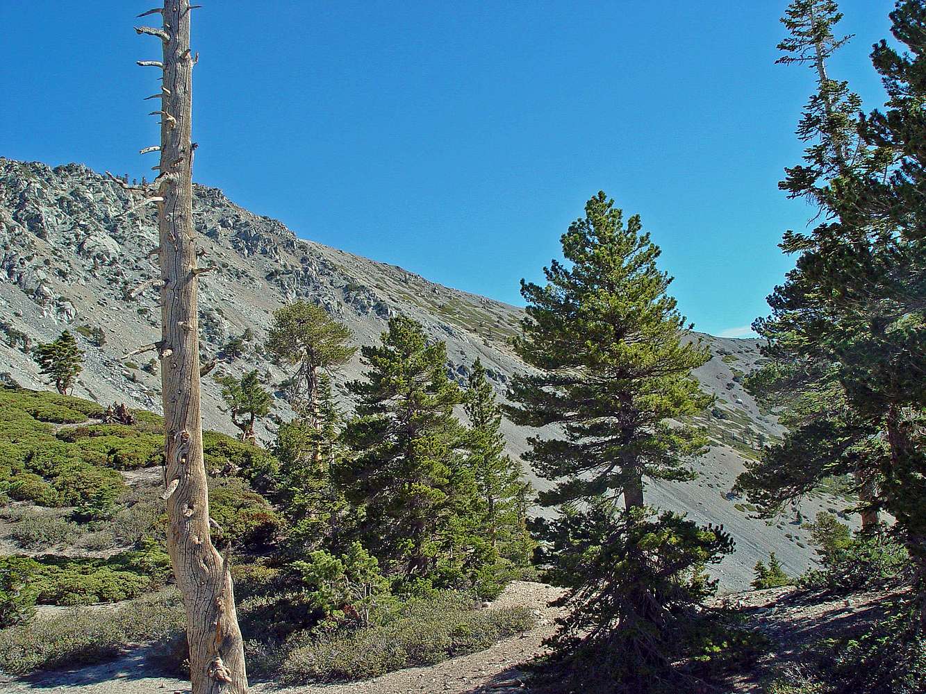
Baldy Bowl Trail
View High-Resolution Image
Baldy Bowl Trail
After about 3,000 vertical feet from Mankers Flat trailhead and a steep ascent to the southwest ridge of Mount Baldy, there are beautiful views across Baldy Bowl. Another steep 900 vertical feet takes you to the summit. June 15, 2008
« PREV
NEXT »
SoCalHiker
on
Jun 18, 2008 12:39 am
Comments & voting
Other parents
Image Type(s):
Hiking
Image ID:
413409
4471 Hits
80.49
% Score
12
Votes
Log in to vote
Comments
No comments posted yet.
to post!
Don't have an account?
Mount San Antonio (Mount Baldy)
(Mountain/Rock)
« PREV
Viewing
#26 of 551
GALLERY
NEXT »
SoCalHiker's Image Gallery
« PREV
Viewing
#569 of 3483
GALLERY
NEXT »
San Antonio Ski Hut / Baldy Bowl Route
(Route)
Loading....
San Gabriel Mountains - High Country - Baldy Area
(Album)
Loading....
×
You need to login in order to vote!
User Name
Password
Remember me
Forgot your password?
Log me out when I close my browser.
Keep me logged in all the time.
sign in as a user
Don't have an account?
Register now for FREE
Rating available
Suggested routes for you
People who climb the same things as you
Comments Available
Create Albums
Register Here


