Toggle navigation
Mountains
Routes
Images
Trip Reports
Forum
What's New
People
Areas & Ranges
Articles
Trailheads
Canyons
Huts & Campgrounds
Albums
Logistical Centers
Fact Sheets
Lists
Custom Objects
Gear
Plans & Partners
WELCOME TO SUMMITPOST
SIGN IN
REGISTER
Beaver Brook Trail
Additional Parents
Image
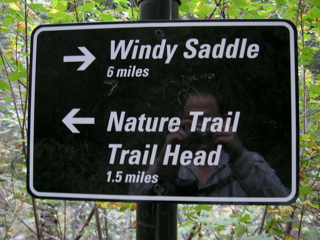
B/B and Chavez intersection
View High-Resolution Image
B/B and Chavez intersection
I don't believe this mileage is accurate, but it is a good reference point. Not sure why Chavez Trail isn't indicated.
« PREV
NEXT »
Jeremy Hakes
on
Sep 15, 2010 1:52 pm
Comments & voting
Other parents
Lat/Lon:
39.73161°N / 105.32537°W
Image Type(s):
Informational
Image ID:
661825
1907 Hits
71.06
% Score
1
Votes
Log in to vote
Comments
No comments posted yet.
to post!
Don't have an account?
Beaver Brook Trail
(Route)
« PREV
Viewing
#12 of 48
GALLERY
NEXT »
Jeremy Hakes's Image Gallery
« PREV
Viewing
#438 of 927
GALLERY
NEXT »
×
You need to login in order to vote!
User Name
Password
Remember me
Forgot your password?
Log me out when I close my browser.
Keep me logged in all the time.
sign in as a user
Don't have an account?
Register now for FREE
Rating available
Suggested routes for you
People who climb the same things as you
Comments Available
Create Albums
Register Here


