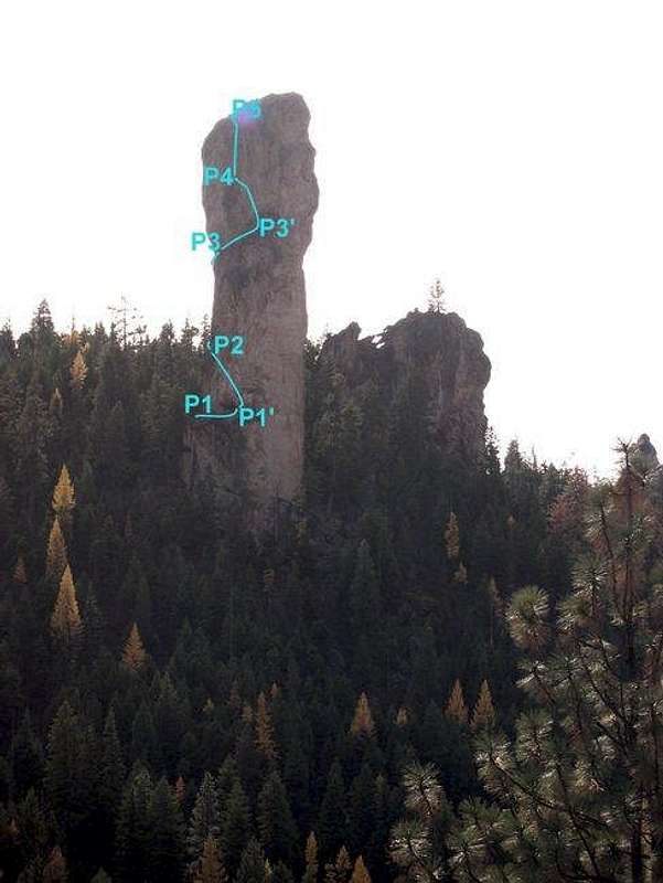
Approximate line of the
Northeast Face (III 5.11a or 5.8 A2) route as seen from the Steins Pillar overlook on Mill Creek Road (looking down from top toward parking lot:
photo). The route reaches the summit in five pitches (P1 5.5 chimney is out of picture as is most of P3). Sections between P1 and P1' (
photo) as well as P3 and P3' (
photo) are simple walks along wide ledge systems to relocate the belay. P4 and P5 are easily linked up. P4 belay sits atop what is called the High Black Knob. With exception of station P1', all other belays are nicely bolted with at least two new, beefy bolts. P1' has a single new bolt that can be backed up with small gear and is located on a huge ledge. Pitch lengths are roughly: P1 50 feet; P2 70 feet; P3 90 feet; P4 and P5 each 60 feet. Standard descent involves rapping from summit bolts ~160 feet down to P3 then rapping ~180 feet down to ground near start of route. Single rope raps also seem possible and they'd roughly follow the ascent route. Lastly, sorry about photo quality but the sun was in my face on that early afternoon (October 31, 2004).


