La montagna chiama i suoi figli, ed essi rispondono fedelmente al suo appello…
Osvaldo Cardellina, Diario alpinistico, 1964-65
Page texts: @ OsvaldoCardellina"Osva", passed away on May 2, 2022. Page owners: Christian Cardellina e Osvaldo Cardellina. Any updates from September 12, 2022: Antonio Giani, page administrator, friend and climbing companion.
Testi della pagina: @ OsvaldoCardellina "Osva", scomparso il 2 maggio 2022. Proprietari pagina:Christian Cardellina e Osvaldo Cardellina. Eventuali aggiornamenti dal 12 settembre 2022: Antonio Giani, amministratore della pagina, amico e compagno di salite.
Overview
This summary page has the aim to summarize the trips traveled through Snowshoeing on the entire territory of the Val d'Aosta. The primary purpose is to want to group all the work up to here executed and published waves have an organic picture of the situation, extrapolating from the same list of routine and intermingled of various Routes. This first part of the work dedicated to this discipline completely covers the whole territory of the Valle d'Aosta with all its valleys as well as the main walloons amongst the secondaries valleys, always personally paths in a dozen years with the use of this tool, not long returned "fashionable". Follow in the future of the more specific and targeted to a single trip, which will have the power to better analyze the same sport, which takes place always in contact and in the outdoors.
Low snow the tool can be temporarily removed, by Antonio
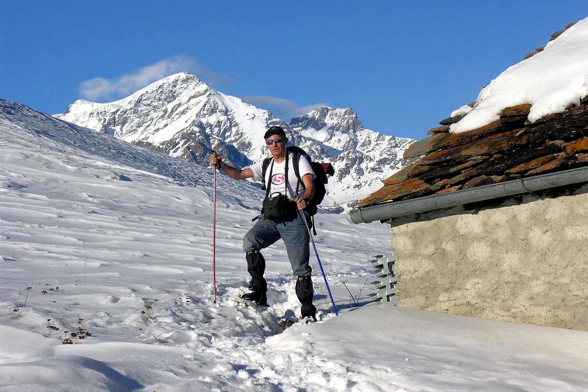
Typically will be oriented towards approach trips for the novices to this practice and hence simple and easy way, by initial walks for make a better contact. A small business is that you felt compelled to do to better frame this fascinating activity, that allows you to be able to go there too, where maybe walk, you can no longer proceed because of the height or the inconsistency of snow. Certainly the tool in today's plastic, also equipped with a small front crampon, offers several performance against the old and rudimentary wooden ties with rope; also from the point of view of weight that does not change here almost never, while the second was heavy greatly. Moreover, the lightness, plasticity and then the "articulation" of the new tool, now in vogue for more than twenty years, allow evolutions previously unknown. Its use is simple, but never trivial and requires adequate preparation, knowledge and technique of the same otherwise it can turn into a very dangerous tool, that lead to unpleasant consequences.
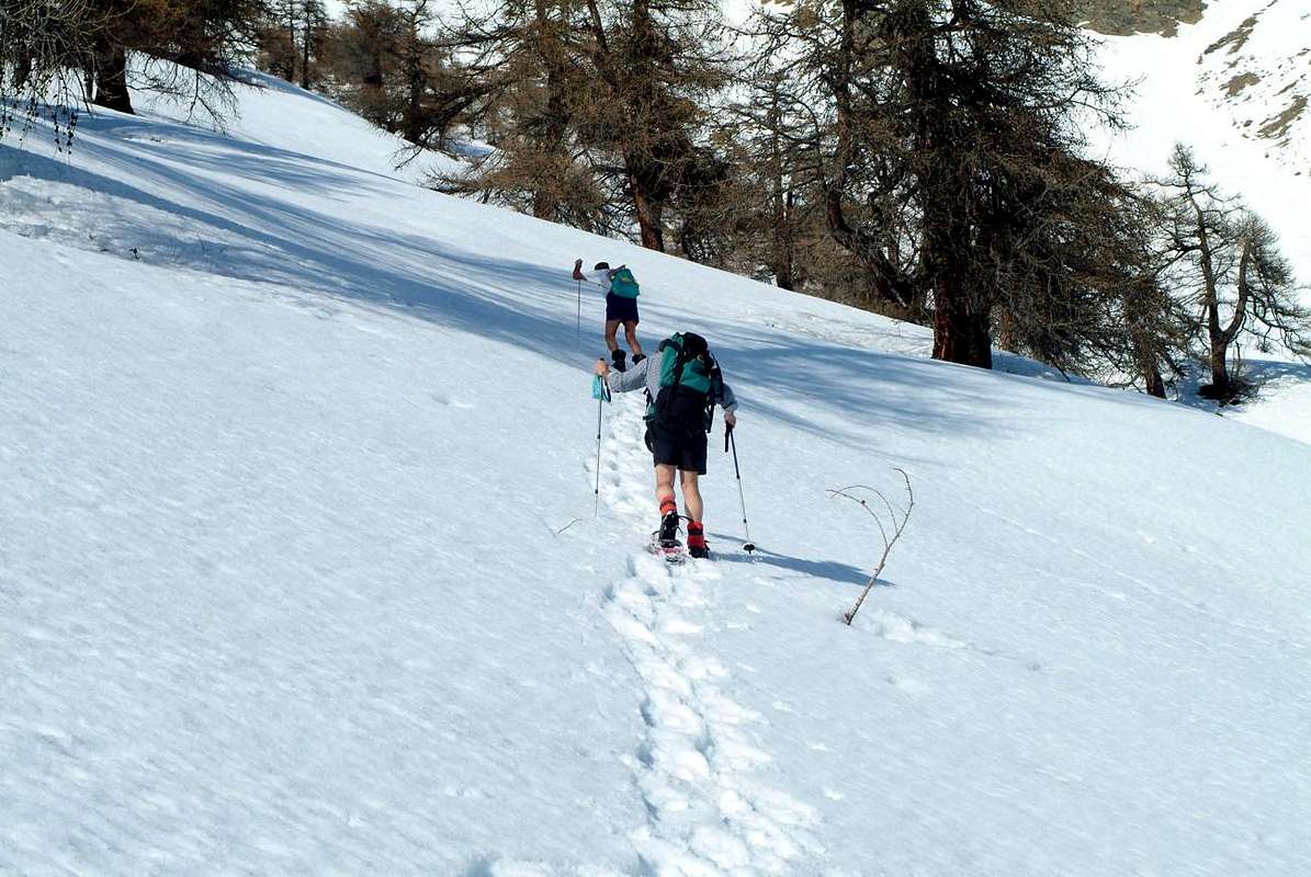
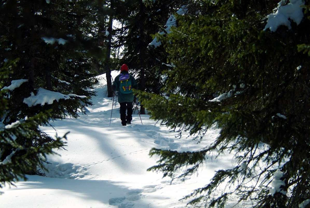
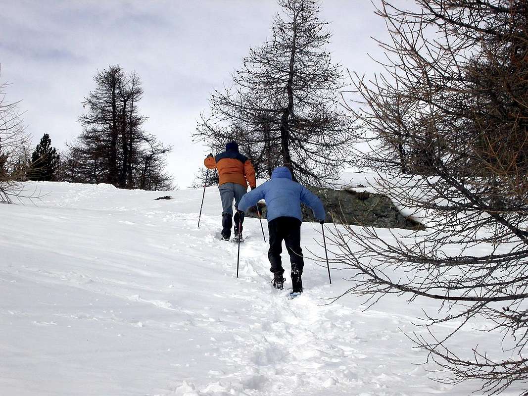
Path along torrents can become very dangerous, by emilius
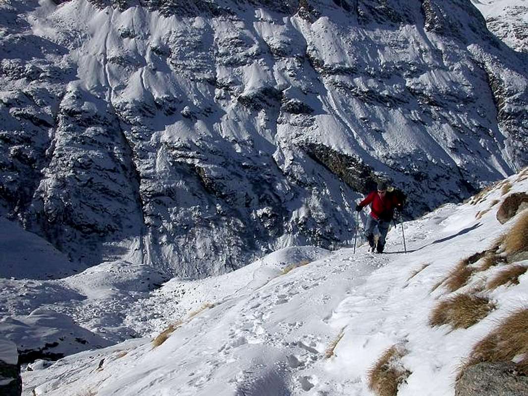
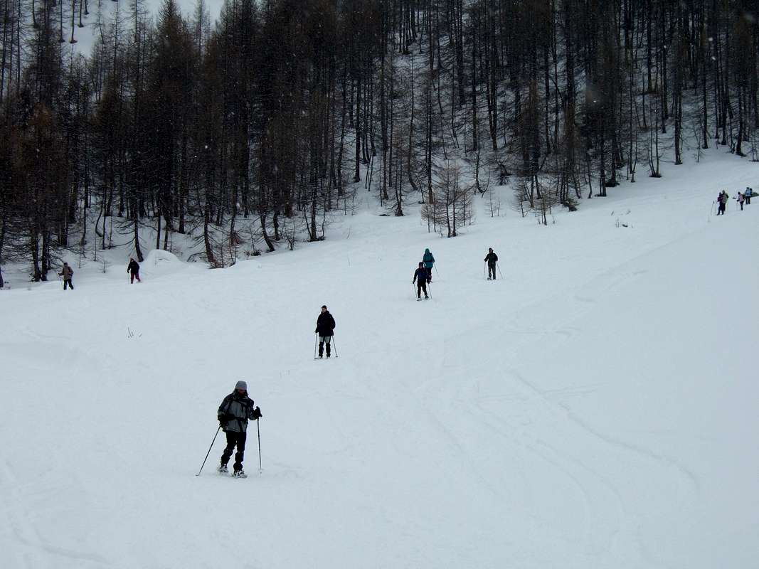
In fact, unlike the ski that can disengage automatically separating from the limbs, this always remains anchored to the same and produces an effect of screwing that makes it in practice uncontrollable body. Factor to be reckoned with and control rather closely. In case of a fall must try to stop immediately the same, possibly trying to avoid that type front but trying to fall with a look at the top or by placing your body sideways. Seem trivial considerations, but instead are fundamental; also because one must take into account that the event can occur. Please avoid too exposed slopes such as above rocky jumps or underlying icy gullies and steep couloir with soil, keeping in mind that the tool provides a good grip even on frozen slopes, but still has a limit. So do not overdo it ever in pushing the tool to the limit of its capabilities, while maintaining a margin of safety.
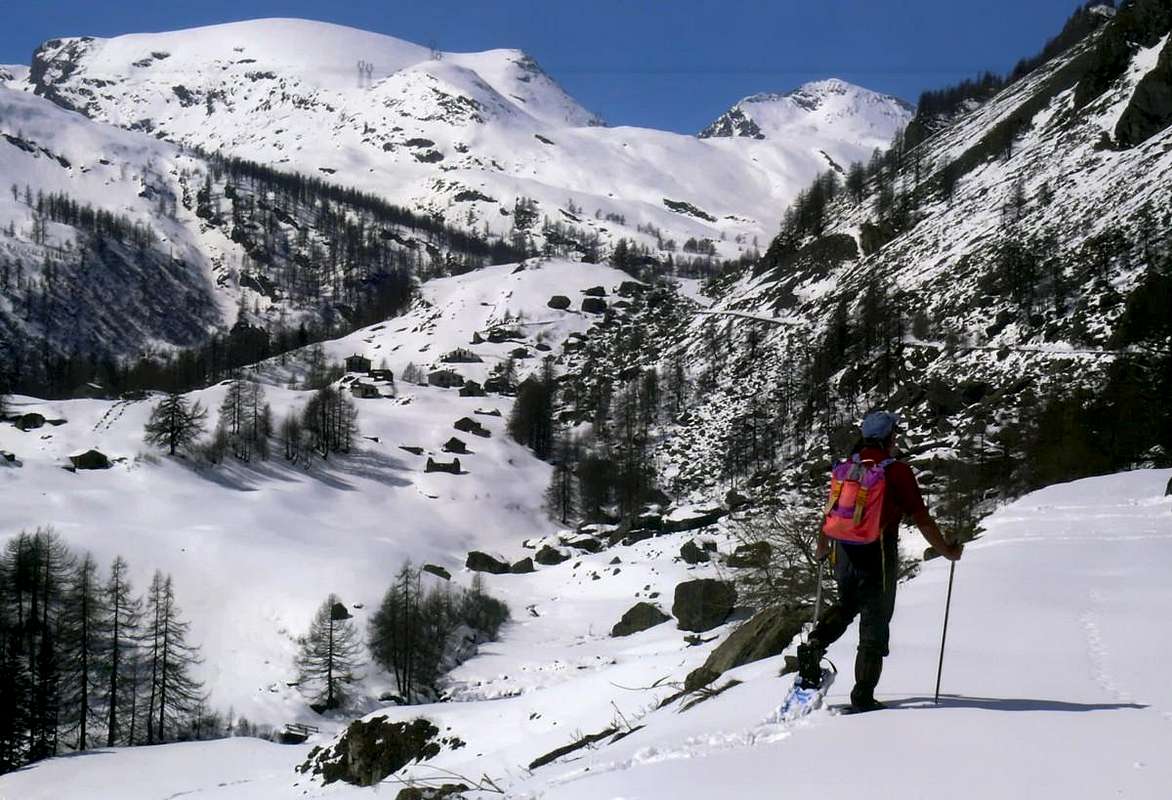
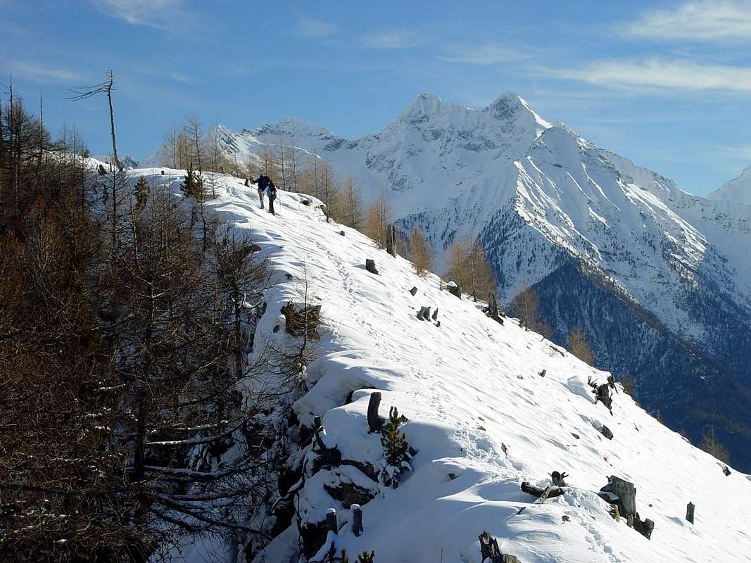
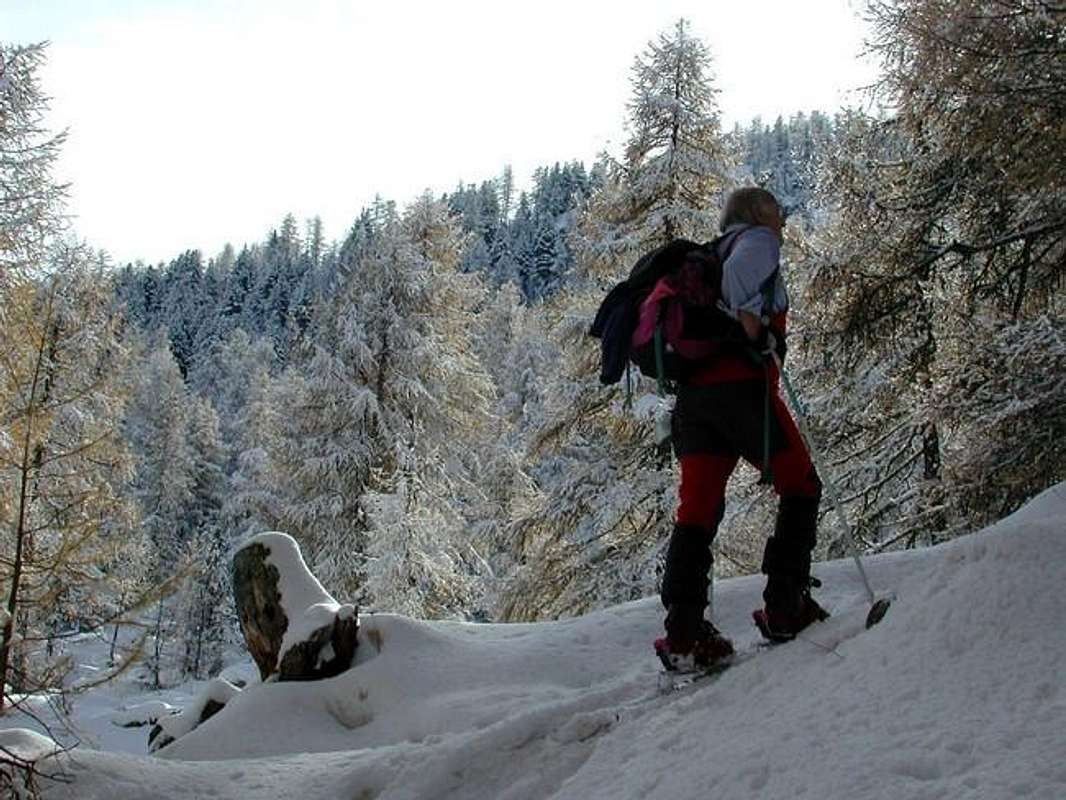
Starting from the Valley of Champorcher, by emilius
Aosta Valley Two main orographic and hydrographic divide for four principal Sector from East towards West & vice versa.
Southern Area in respect to Baltea:
Champorcher Valley: Bard, Pont-Bozet, Champorcher Municipalities; Vertex on Mont Glacier (3.186m). Champdepraz or of Lakes small Valley: Champdepraz Municipality; Vertex on Mont Avìc (3.006m). Valmeriana-Bellecombe small Valleys: Pontey Municipality; Vertex on Mont Rouìc (2.922m). Ponton deep Valley: Fénis Municipality; Vertex on Mont Avìc (3.006m). Fénis-Clavalité-High Comba Tersiva-Savoney-Lavòdilèc Valley-small Valleys: Fénis Municipality; Vertex on Punta Tersiva (3.515m). Saint Marcel Valley: Saint Marcel Municipality; Vertex on Punta del Tessonet (3.264m). Les Laures small Valley: Grand Brissogne Municipality; Vertex on Monte Emilius (3.559m). Arpisson deep Valley: Pollein Municipality; Vertex on Monte Emilius (3.559m). Dard Gorge: Charvensod Municipality; Vertex on Becca di Nona (3.142m). Pila Basin: Charvensod, Gressan Municipalities; Vertex on Punta della Valletta (3.090m). Val de Cogne: Cogne Municipality; Vertex on Gran Paradiso (4.061m). Val Savarenche: Villeneuve, Valsavarenche Municipalities; Vertex on Gran Paradiso (4.061m). Val di Rhêmes: Villeneuve, Introd, Rhêmes-Saint-Georges, Rhêmes-Notre-Dame Municipalities; Vertex on Pointe Tzantelèina (3.601m). Grisenche Valley: Arvier-Liverogne, Valgrisenche Municipalities; Vertex on Grande Sassière (3.751m). La Thuile Valley: Pré Saint Didier, La Thuile Municipalities; Vertex on Tête du Rutor (3.486m). Little Saint Bernard small Valley: Pré Saint Didier, La Thuile Municipalities; Vertex on Mont Berrio Blanc (3.252m).
Northern Area than the Dora Baltea:
Val Vény: Coumayeur Municipality; Vertex on Mont Blanc (4.811m). Val Ferret: Coumayeur Municipality; Vertex on Grandes Jorasses (4.208m). Western Central Valley: Courmayeur, Pré Saint Didier, Morgex, Arvier, Saint Nicolas, Avise, La Salle, Saint Pierre, Sarre, Aosta Municipalities; Vertex on Grande Rochère (3.326m). Gran San Bernardo Valley: Aosta, Gignod, Allein, Etroubles, Saint Rhémy en Bosses Municipalities; Vertex on Mont Velan (3.734m). By Conca-Ollomont Valley: Aosta, Gignod, Allein, Doues, Ollomont Municipalities; Vertex on Mont Velan (3.734m). Valpelline: Roisan, Valpelline, Oyace, Bionaz Municipalities; Vertex on Dent d'Hérens (4.175m). Easthern Central Valley: Aosta, Saint Chistophe, Quart, Nus, Chambave, Verrayes, Saint Denis, Châtillon, Saint Vincent and Emarese Municipalities; Vertex on Monte Faroma (3.073m). Saint Barthélemy Valley: Nus, Saint Barthélemy Municipalities; Vertex on Becca di Luseney (3.503m). Valtournanche: Châtillon, Antey-Saint-André, La Magdeleine, Torgnon, Chamois, Valtournanche Municipalities; Vertex on Monte Cervino or Matterhorn (4.478m). Val d'Ayas with Estoul Basin, Frudière, Chasten, Dondeuil small Valleys: Verrès, Challant Saint Victor, Challant Saint Anselme, Brusson, Antagnod-Ayas-Champoluc-Saint Jacques Municipalities; Vertex on Eastern Lyskamm (4.532m). Lys or Gressoney Valley: Pont Saint Martin, Perloz, Lillianes, Fontainemore, Issime, Gaby, Gressoney Saint Jean, Gressoney la Trinité Municipalities; Vertex on Punta Zumstein (4.564m).
*******
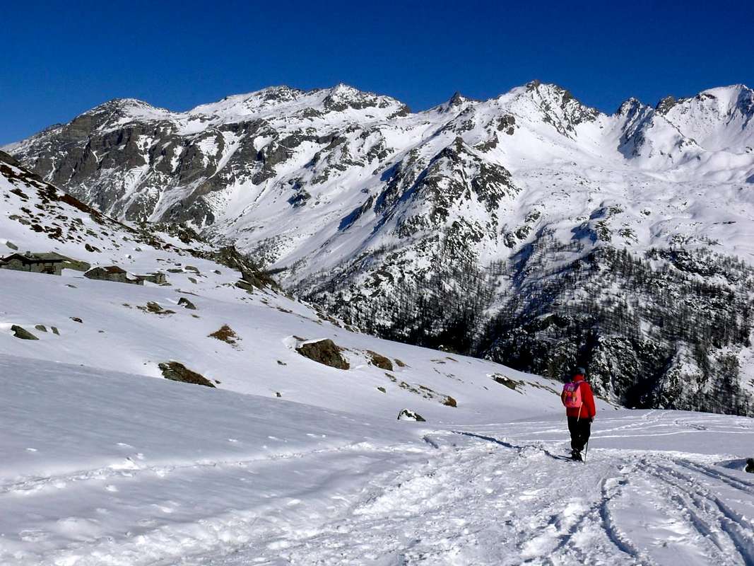
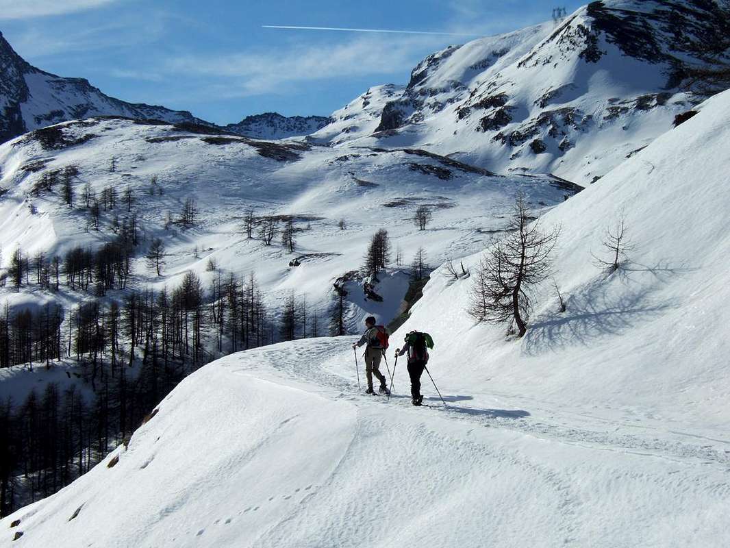
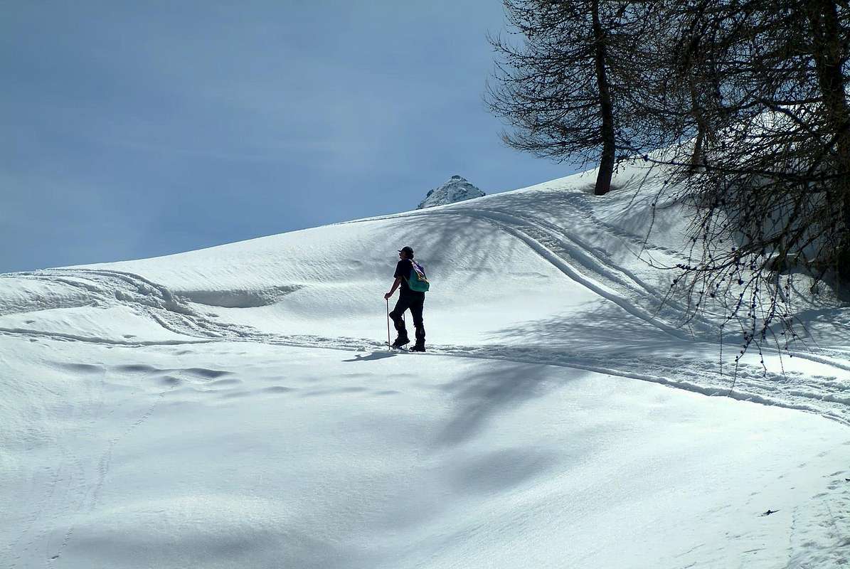
Last Southwestern Valleys up to La Thuile from Northeast, by lucabertollo
Questa pagina riassuntiva possiede lo scopo di ripielogare le gite percorse tramite Racchette sull'intero territorio della Val d'Aosta con le sue Vallate e Valloni. Lo scopo primario consiste nel voler raggruppare tutti i lavori sin qui eseguiti onde avere un quadro organico della situazione, extrapolando i medesimi dall'elencazione di routine e frammiste delle Routes. Questa prima parte del lavoro dedicato a questa disciplina ricopre interamente tutto il territorio della valle d'Aosta con tutte le sue valli nonchè i principali valloni, sempre personalmente percorsi in una dozzina d'anni con l'utilizzo di questo attrezzo, da non molto tempo ritornato "di moda". Seguiranno in futuro dei lavori più specifici e mirati ad una singola gita, che avranno il potere di meglio analizzare la stessa. In genere saranno orientati verso gite di avviamento a questa pratica e quindi di semplice e facile percorso. Un piccolo lavoro che si é ritenuto doveroso fare per meglio inquadrare questa affascinante attività, che permette di potere andare anche là, dove magari a piedi, non si può più procedere a causa dell'altezza o della inconsistenza della neve. Certamente l'attrezzo odierno in plastica, dotato anche d'un ramponcino anteriore, offre diverse prestazioni nei confronti del vecchio nonché rudimentale in legno con legacci in corda; anche dal punto di vista ponderale che qui non cambia quasi mai, mentre con il secondo si appesantiva notevolmente. Inoltre la leggerezza, la plasticità e quindi l'"articolarità" del nuovo attrezzo, ormai in voga da più duna ventina d' anni, consentono evoluzioni prima sconosciute. Il suo utilizzo risulta semplice, ma mai banale e richiede adeguata conoscenza e tecnica del medesimo altrimenti può tramutarsi in molto pericoloso.
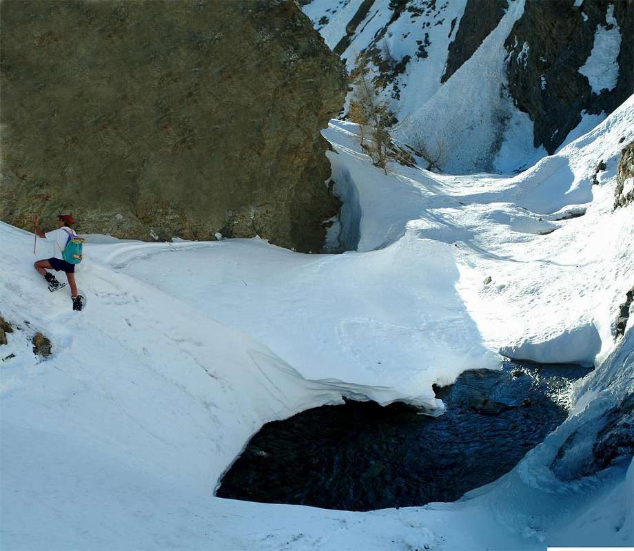
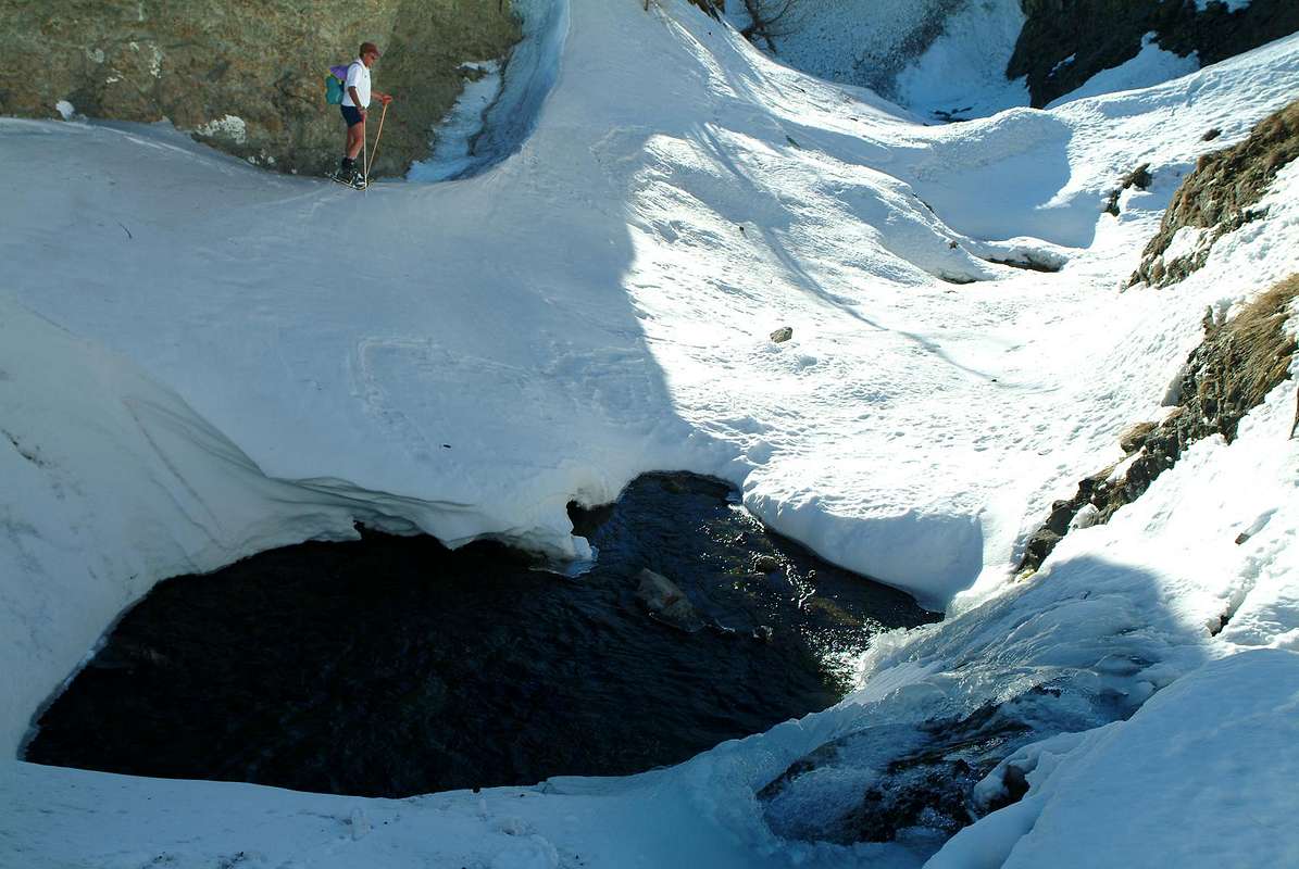
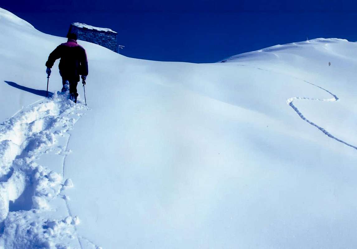
Pay attention to the slopes above pools of water, by emilius
Infatti, a differenza dello sci che può sganciarsi automaticamente separandosi dagli arti, questo rimane sempre ancorato ai medesimi producendo un effetto di avvitamento sugli arti inferiori tale da rendere in pratica incontrollabile il corpo. Fattore da non sottovalutarsi e controllare invece con molta attenzione. In caso di caduta bisogna cercare d'arrestare immediatamente la stessa, possibilmente cercando di evitare quella di tipo frontale ma tentando di cadere con lo sguardo in alto o di schiena, oppure disponendo il proprio corpo lateralmente. Sembrano considerazioni banali, mentre risultano fondamentali; anche perché bisogna tenere in conto che l'evento può verificarsi. Evitare quindi pendii troppo esposti come ad esempio salti rocciosi o soprastanti ripidi canaloni di terriccio, tenendo bene a mente che l'attrezzo offre una buona tenuta anche sui pendii gelati, ma pur sempre possiede un limite. Non esagerare mai nello spingere lo stesso al limite delle sue possibilità, mantenendo sempre un buon margine di sicurezza.
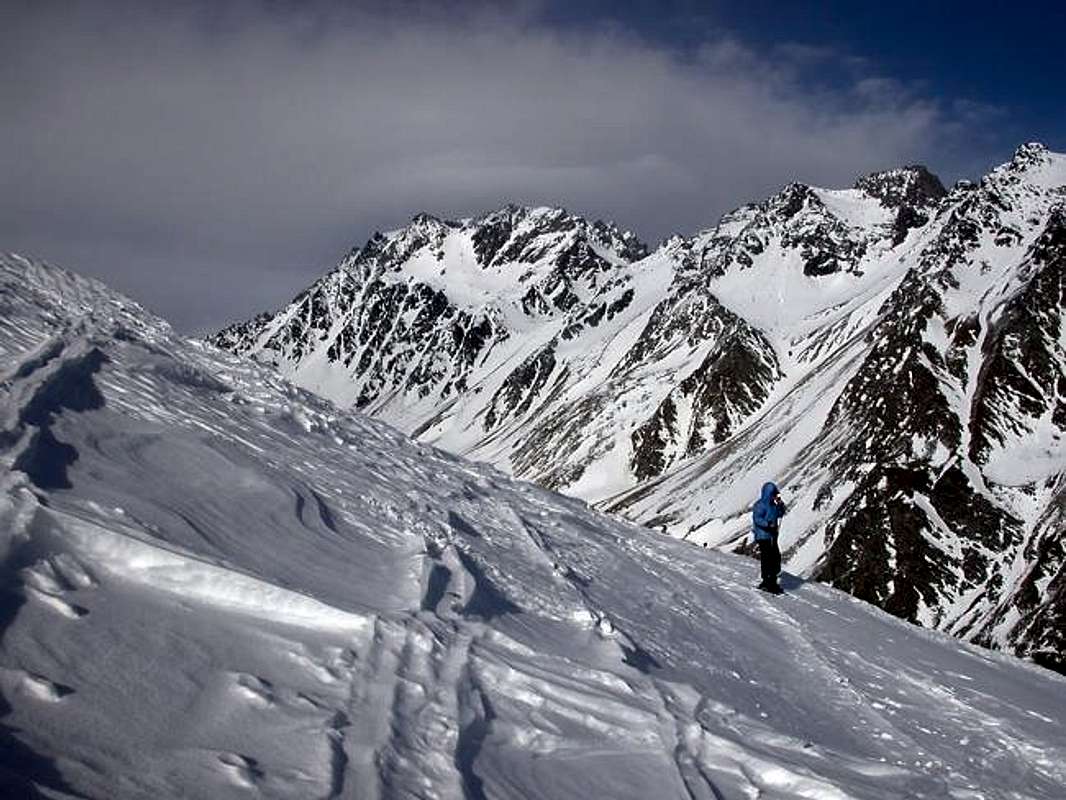
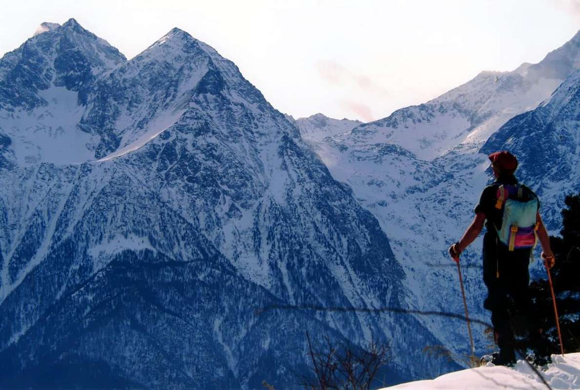
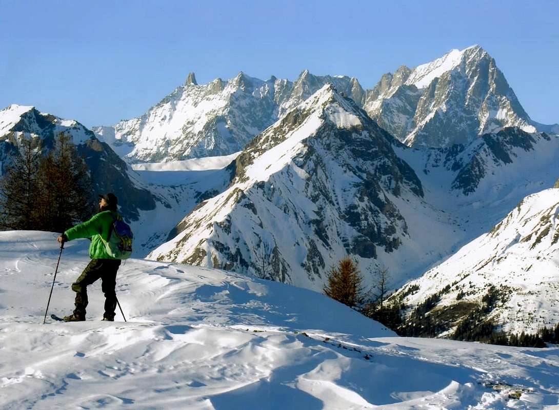
Ending to the East towards the Val d'Ayas & Gressoney, by emilius
Complete Getting There
BY CAR:
From TORINO, MILANO, etc: Motorway A5. Exit at IVREA or Quincinetto (PIEDMONT).
From IVREA Town: in West (Southern side) to Pont Saint Martin, Donnas, Bard, Champdepraz, Pontey, Fénis, Saint Marcel, Grand Brissogne, Pollein, Charvensod, Gressan, Jovençan, Aymavilles, to Villeneuve, Arvier, Avise, Morgex (Internal side) and to Pré Saint Didier, Courmayeur Municipalities (Western side).
From Courmayeur Resort: in East to Morgex, La Salle, Saint Pierre, Sarre, Aosta (Norhern side), Saint Chistophe; Quart, Nus, Chambave, Verrayes, Saint Denis, Châtillon, Saint Vincent, Emarese, Arnad, Verrès, Hone, Donnas, Pont Saint Martin (Northern and Northeastern sides) Municipalities.
Southeastern, Southern and Southwestern Sides:
From Hône-Bard towards La Thuile Valley and Little Saint Bernard small Valley From Hône-Bard towards Pont Bozet(775m) and from this to Champorcher Valley, Château (1.427m), Petit, Grand Mont Blanc, La Cort Villages, towards Dondena Village(2.092m), Dondena & Miserin Refuges, through Royal Road and dirt roads; Barbustel Refuge, through Royal Road and path towards Champdepraz small Valley. From Champdepraz(523m) to Lakes small Valley and Voella or Raye Chevrères Village (1.307m; by Regional Road). Barbustel Refuge with path from Voella. From Fénis(537m) to Clavalité-Grand'Alpe Pastures (2.129m; through dirt road), just below E. Borroz/Rotary-Clavalité Refuge (2.156m) at Cuneu Alp. From Saint Marcel(630m) to Saint Marcel small Valleys and Turati Reserve up to the Mulac & Grande Chaux Hunting Houses & Alp (1.937m, 2.370m). From Grand Brissogne(827m) to L'Arp, dirt road, Les Laures small Valley-Ernesto Ménabreaz Shelter at Lower Laures Lake (2.546m), path-muletrack. From Pollein (575m; secondary road) or from Charvensod (746m; main road and connection) to Martsaouchy Damon-Arpisson deep Valley, through dirt road, and to Arpisson Lower and Upper (2.010m) Alpages with path. To Federigo Zullo Bivouac (2.907m), through moraines on Western Arpisson Glacier. From Charvensod to Dard Gorge and Comboé-Arbolle small Valleys towards Ponteilles(1.697m) Alp/Waterfall, through dirt road, Comboé Alp/Saint Ours Shelter (2.114m), through dirt road, and Arbolle Refuge(2.516m), near Lakes (2.497m), by Chair Lift to Chamolé Station (2.309m), Lake (2.325m) and muletrack. From Charvensod (main road from Pont Suaz 567m) or from Gressan (603m; alternative road) to Tivet, Les Fleurs Hamlets (1.292m, 1.414m) Pila Basin and Pila Resort (1800m); upper parking 1.850m). Arno Shelter (2.660m), always open but unguarded, nearby Couiss Summit on watershed Pila/Cogne Valley. From Jovençan(631m) to Pila Conca, exclusively through path-muletrack to Tourlin Dessous(1.466m) and by dirt road to Pila-Posse Tennis (1.776m). From Aymavilles(646m) to Western Pila Conca, through Main Road to Cogne Valley, alternative to Ozein/Turlin Dessus Hamlets and dirt road to Pila-Posse. From Villeneuve to Rhêmes Valley From Villeneuve(670m) to Rhêmes Valley: Introd (880m), Rhêmes Saint Georges (1.171m), Notre Dame (1.725m) Communes, through Regional Main Road, up to the Thumel Village(1.887m) with Municipal Road and to Gian Federico Benevolo Refuge (2.280m), through dirt farms road or underlying path. From Liverogne (Arvier) to Valgrisenche From Arvier to Liverogne Fraction (730m) and from this to Valgrisenche Valley, up to the Valgrisenche Municupality(1.664m) and Mondanges, Surier, Us(s)eliéres Villages around the artificial Beauregard Dam, through Regional Road. Mario Bezzi at Vaudet and Chalet de l'Epée Refuges through paths. From Pré Saint Didier to La Thuile & Little Saint Bernard Valleys From Pré Saint Didier(1.010m), with State Road, to La Thuile Valley: Elévaz, Balme Villages, La Thuile Commune, (1.441m); from this to Little Saint Bernard small Valley towards the Little Saint Bernard Hill (2.188m), through State Road. To Albert Deffeyes Refuge with muletrack from La Joux Fraction.
Internal Dora Baltea Areas from Villeneuve to Arpy Conca From Villeneuve(620m), Martignon (823m), San Bernardo through dirt road in Southeast, towards Prorayé Alp to Upper Champlong in Poignon small Valley. From Introd(873m), with Municipal or dirt road towards Buillet (1.030m)/Biolay (1.042m) small Villages to Montagne. From Arvier(776m), with Regional Road, towards Crête, Verney, Petit Haury, Scierie, Grand Haury with Municipal Road, to Combes Basin. From Avise-Runaz(786m), with Municipal Road, to forks (956, 998, 1.115 meters), Marbrière Pasture, Faveroy Alp to Monte Colombo. From Derby-Chez Les Gontiers(839m) Village, with short Municipal Road through path in South towards Créton (1.523m), Dailley (1.621m) Alpages. Through two parallel secondaries small paths, to fork 1.823 meters with dirt road and Tillac Alp (1.848m) to Faveroy Area. From Morgex(920m), with Regional Road in South, towards Liarey, Pre Villair, Mont Rotie, alternative around 1.275m just before Tirecagne Pasture (1.532m), with dirt road in Southeast, towards Costablinaz de Meitin Pasture (1.420m), after through path, towards Damon (1.445m), Champex (1.519m) Pastures, Plan Rançon Alp (2.098m) to Becca Pouignenta Northern Area. From Morgex(920m), crossing the bridge above Baltea with Regional Road in South, towards Liarey, Pre Villair, Mont Rotie small Villages, alternative around 1.275m) just before Tirecagne Pasture (1.532m) and the Main Roads to Arpy Basin.
Western, Northwestern and Northern Sides: From Courmayeur to Aosta Town From Courmayeur(1.198m) towards Pont des Chèvres, Notre Dame de la Guérison, Lassy Dèsot/Perthud Villages, Gabba, Chalets du Miage, La Visaille Cave, Plan de Lognan Alp (1.676m), with Municipal Road; from this to Lake Combal (1.950m) and to Refuge Elisabetta-Soldini (2.197m), through dirt road. From Courmayeur-Notre Dame de la Guérison Sanctuary(1.444m), through private dirt road, to Monte Bianco Refuge (1.666m). From Courmayeur-la Palud(1.370m), towards Montitaz, Planpincieux (1.593m) Villages, Tronchey (1.620m), Praz Sec du Milieu, Lavachey (1.640m), Arnouva Dèsot (1.769m) Villages, through Municipal Road, to Malatrà small Valley and Walter Bonatti Refuge. Also from Arp Nouva to Elena Refuge, through dirt road on valley floor; or from the fork after Planpincieux, small bridge, towards Leuchey Dèsott, Damon Pastures to Mont de la Saxe Hump/Giorgio Bertone Refuge. From Courmayeur-Villair Dessus(1.282m), with Municipal Road and through dirt road to fork 1.470 meters and path to Refuge Bertone in Val Sapin. From La Salle1.001m), with Regional Road, towards Challancin (1.610m), Cheverel, Morges (1.829m), Planaval Hamlets (1.750m); from this, through dirt road in North-northeast, passing Maison Blanche Pasture, to Rantin (2.333m) and Bonalé (2.340m) Alpages, in Upper Planaval small Valley. From La Salle, with Regional Road, towards Challancin Village, Ponteilles (1.741m), Arpilles (1.862m) Pastures to Bard Pass (2.178m) in Arpilles Conca. From Saint Pierre-Pommier(783m), Champretavy, Rumiod, alternative just after Persod (1.351m), Ravoise, Chaillod, Clavel, Cerlogne (1.580m) to Vens small Villages (1.750m), with Regional Road in West-northwest. From this last to Joux Saddle (1.930m): through short descent to Vertosan small Valley From Saint Pierre-Château Sarrod de la Tour, Rumiod, Petit and Grand Sarriod (1.444/5m), Gerbore, Vetan Dessous (1.670m) and Dessus (1.737m), with Regional Road to Vetan Basin. From this, through dirt road, towards Genevrine Pasture, Chatalanez, Toules, Grand Arpilles Alps to Chaz Creuse Alp(2.398m). From Sarre(657m), with Regional Road, towards Plèod, Vert Dessous and Dessus, Vareille, Caillod/Ville sur Sarre/Remondet, Moulin/la Cort, forks 1.225, 1.301 meters, Salet, Chavalançon (1.426m) small Villages to Thouraz Dessous and Dessus Hamlets(1.652m); from the last to Closella and Met small Valleys.
Northern and Eastern Sides than in the course of Dora:
From Aosta Town to Verrès Municipality From Saint Christophe-Prevot (about 640m), reached by Regional Road from Aosta, to Sorreley Village; from this, with Municipal, towards Veynes Fraction. From subsequent alternative before Lumian (1.025m): *** in East deviation to Cretallaz, Jeanceyaz, Morgonaz Villages at the entrance on Senevé Comba). On asphalt road in Northwest, to Parléaz Village (1.274m), Blavy Hamlet (1.475m) and, through dirt road or path, to Viou Alpages, in Blavy Viou small Valleys. From Quart-Villair towards Epilaz, Argnod Villages or from SS.26 nearby La Plantaz (540m), with Regional and Municipal Roads, towards Chétoz, Vignil, Fornail, Ville sur Nus-Planeville, Buignod, Porsan Villages to Trois Villes-Avisod Village (1.398m). From this to Senevé Alps (2.206m), in Senevé Comba. From Quart to Fonteil with previous route; from this through dirt road, towards La Seyvaz (2.184m), Valchourda Alps (2.392m), in Comba Dèche. From Nus-La Plantaz in State Road to Ville sur Nus-Planeville (1.113m); from this, towards Buignod, Avion (1.312m) Villages. Also from Porsan through Trois Villes (1.398m), Avion, fork (1.250m) to Effraz Village (1.487m), with Municipal Roads. From this to Ronc (1.737m), Machaussy Alps, in Effraz Comba. From SS.26, nearby Chambave, to Regional Road; towards Ollières, Marseiller (801m) to Verrayes (991m). With Municipal Road towards Tessellaz, Marquis, Dorinaz (1.323m), Charrière Villages to Grand-Villa Hamlet (1.437m), in Verrayes/Saint Denis Basin and to Aver-Longhede Area. From A)- Verrayes, with Regional Road, towards Del (1.260m), Plau (1.305m), Semon to Cheresoulaz (1.487m) Villages. Also from B)- Saint Denis (803m; reached from Chambave, Marseiller) with Regional Road towards Gubioche, Etrobleyaz, Petit Bruson, to Del Villages. C*** Road Connection towards Roves, Lozon (1.520m), Clavon, Fontane Villages, Pastures to Bornes Alp). From Cheresoulaz, through Municipal/Regional Roads, to Saint Pantaléon Hill (1.650m). From Châtillon(549m), with Municipal Road, towards Chavod, Domianaz to Nissod Villages (1.371m); from this, through dirt road to Nuarsaz Alp (1.713m). From Saint Vincent(575m), with Regional Road, towards Moron (844m), Grun (991m), Salirod (1.102m), Amay (1.466m) Hamlets to Joux Hill (1.635m). From Saint Vincent, towards Cillian, Feilley Villages also from State Road n°26, towards Estaoud (595m), the both with Regional Roads, to Emarese Commune (1048m); from this towards Erésaz (1.163m), Cuignon/Sommarèse/Longeon (1.549m, 1.536m, 1.516m) Hamlets to Zuccore Hill (1.607m). From Verrès(390m), before with Regional Road after through path, to Collegiate Church of Saint Gilles, immediately below Mount Saint Gilles (967m).
Southwestern Side of Northwestern Area:
From Aosta Town to Merdeux Basin From Gignod Commune(988m) with Great Saint Bernard State Road n°27 to alternative nearby Condemine Hamlet (1.137m); leaving left through Municipal Road to Grand e Petit Buthier Villages (1.302m, 1.439m) in Chaligne Comba. From this last, with private dirt farms roads and through Mendey, Roncaille, Rombason Pastures up to the Chaligne Shelter(1.936m), below Costa Tardiva (2.380m), Tardiva Hill (2.410m) and neighbor the Punta Chaligne (2.608m). From Etroubles Commune(1.270m), with dirt road and through Champ-Reclos (1.425m), Yettes (1.591m), Eteley (1.716m), fork before Praz-Gallet (1.626m), Ars (1.975m) Pastures on Arsy small Valley, up to Chaz d'Arsy (2.543mn); from this paths to Ars Pass (2.534m), Costa Labiez (2.632m). From Etroubles Commune(1.270m), with dirt road through Champex (1.411m; fork), Flassin de Meitin (1.654m), Flassin (1.700m), Tsa de Flassin (2.258m) Pastures on Flassin small Valley; from this paths to Fenêtre Pass (2.729m), Flassin Hill (2.605m), Testa Cordella (2.663m) and Tête Bois de Quart (2.248m). From Saint-Oyen Commune(1.377m), with SS.27 to alternative 1.502 meters; leaving North the same to great St. Bernard Hill, continue West to St. Leonard Fraction. From this to Citrin small Valley up to the Mont Flassin (2.772m) Citrin Hill (2.484m), Punta Valletta (2.801m) and La Raye du Sodzé (2.640m). From Saint-Oyen Commune(1.377m), with previous Municipal Road to Mottes (1.660m) Fraction, Farettes (1.666m) Village; from this, with path through Arp du Bois Dèsott Pastures (1.936m), alternative 1.959 meters to Serena small Valley up to the Hill Serena (2.547m) and Testa Serena (2.830m). Variant: continue West from Farettes Village to Saint Michel (1.732m) Fraction; from this last, tourning South always with Municipal Road, to Arp du Bois Dèsott Pastures.
Northwestern Side relative to the position Gran San Bernardo State Road:
From Malatrà Hill to Grand Saint Bernard Basin Basin up to the From Saint-Oyen(1.377m), with previous road to Mottes, continue West-northwest to Devies Village (1.723m) at the beginning of Merdeux Comba; from this with paths through Merdeux Dèsott (1.919m), Cotes (1.930m), Manda (1.973m), Tsa de Merdeux (2.285m) Pastures to Malatrà Hill (2.928m). From Saint Rhémy en Bosses Commune(1.619m), through Municipal Road, on Merdeux Comba to Tsa de Merdeux (2.285m) and Malatrà Hill (2.928m). From Saint Rhémy en Bosses Commune(1.619m) to Tula Comba to Saulié Pass (2.817m), Aiguille des Cengles (2.869m) and Angroniettes Pass (2.936m). From Saint Rhémy en Bosses Commune(1.619m) to Grand Saint Bernard Valley up to the Crévacol Hill and Testa (2.498m, 2.610m) Saint Rhémy Hill (2.540m), Mont Rodzo (2.632m), Pain de Sucre (2.900m), Mont Fourchon (2.902m), Fenêtre de Ferret Hill (2.600m) and Grand Saint Bernard Hill (2.469m).
Northern Side compared with the position of the Aosta City:
From Allain/Doues to Ollomont/Valpelline Communes with By Basin From Allein Commune(1.251m), with Regional and Municipal Roads, to By Basin; from the entrance of this (various alpages reached by private dirt farms roads), through paths, up to the Mont Saron Southern Antesummit (2.681m) and traverse on crest to Tête de la Praz (2.751m) and Crou de Bleintse (2.824m). From Doues Commune(1.176m), with in asphalt Municipal Road, to By Basin; from this, with paths or dirt roads, to Mont Saron (2.681m), Crou de Bleintse (2.824m), Letey Refuge below Champillon Pass (2.430), Mont Chenaille two Summits (3.144m), Tsa d'Ansermin (2.388m) and Monte Rotondo (2.572m). From Ollomont Commune(1.356m), trhough noumerous paths and variaous upper dirt farms roads, to By Conca; from this various routes in all directions up to the Maria Cristina Rosazza at Savoie Bivouac(2.674m), Refuge Franco Chiarella-Amiante(2.979m), Filon Alp (2.478m), Bonne Mort Pass (2.646m), Fenêtre Durand Hill (2.797m), Nino Regondi Bivouac(2.599m) and Lakes, Tsa de Berrio Alp (2.165m), Cormet Hill (2.354m) and Breuson Hill (2.194m).
Northeastern Side relative to the position of the City of Aosta:
From Valpelline towards Valpelline Valley From Valpelline(580m), with Regional Road, to Oyace Commune (1.316-1.377m); from this to Northern and Southern Vallons (Brison, Crête Sèche, Vertsan, Comba be la Tsa, Comba du Grand Chamin, Comba des Lacs and Comba d'Orein up to the entrance on Petite/Grande Murailles/Valpelline Hill small Valley. From Oyace(1.377m), with R.R., to Bionaz Commune (1.612m) and Places Moulin artificial Dam (1.970/80m) and Northern and Southern small Valleys (Bella Tsa, Combes de Valcornière, Livourneaz, Montagnayes; Vessonaz, Verdonaz, Vieille, Verdzignolaz, Arpisson, Gran Comba and Roisan-Praperiaz Basin.
Northern Sides than in the course of Baltea:
From Nus, Chatillon, Verrès, Pont Saint Martin Municipalities towards Saint Barthélemy, Valtournanche, Val d'Ayas and Gressoney Valleys From Nus(960m), with Regional Road, to Lignan-Saint Barthélemy Municipality; from this, through various dirt roads and numerous paths, (1.628m) up to the Becca de Luseney (Luca Reboulaz Bivouac(2.575m neighbor the Luseney Lake), Livourneaz Pass 2.840m and Cian Fenêtre (2.736m)). From Châtillon(549m), with Regional Road, to Valtournanche and Breuil Cervinia Municipalities(2.004m); from this, through paths in West, to Tsan Bivouac, Lake (2.489m, 2.441m), Cignana Lake (2.149m) or, through dirt road and paths more in East, to Gran Sometta (3.166m). From Verrès(549m), with Regional Road, to Champoluc and Saint Jacques Communes (1.697m); from these, path in West, to Grand Tournalin Refuge(2.544m). From shelter, through path in North, to Mont Brun (2.895m); also in valley floor to Lake Bleu (2.211m) and in East to Pinter Pass (2.776m). From Pont Saint Martin(345m), with Regional Road in Gressoney Valley, to Gressoney La Trinitè (1.468m); from this, through dirt roads and paths in East, up to the Upper Bettolina Pass (3.058m); also in West to Gabiet Loch (2.363m) and from this, with path, to Corno del Camoscio (3.026m).
From FRANCE: through the Mont Blanc Tunnel to Entrèves-crossroads to Vény/Ferret Valleys - Mountain Guides of Courmayeur - La Saxe Rock Gym - Courmayeur. By Little Saint Bernard Pass, closed since November until half May to La Thuile Valley - Pré Saint Didier - Courmayeur.
BY PLANE:
Aeroporto "Corrado Gex" Saint Christophe (Aosta).
Already Published in SP
At the foot of Grand Combin, by Osw
This box summarizes all the Excursions by Snowshoes in valleys, small Valleys and gorges until now published and edited in SP. The scan has seen follow a logical and topographically accurate, starting from East, Southern area, to return to the same but on the opposite side. From the entrance of Aosta Valley with the appendices of the Eastern Group of Gran Paradiso until you reach the Mont Blanc Mountain Range to the West; this back along the Northern sector until the Chain of Monte Rosa, as well as its offshoots Southern until Pont Saint Martin Common, and again on the border with Piedmont Region. This first work has seen to consider the Valleys perpendicular (Valsavarenche with the Plan of Nivolé) or diagonal (Champorcher and Cogne) towards the course of Baltea; then between the Municipalities of Pont-Bozet and Champorcher East and those of Aymavilles, Cogne, Villeneuve, Introd and Valsavarenche in West. In subsequent work has been addressed rather an analysis of all the internal zones overhanging the course of Dora, with full 360° of the entire Aosta Valley, as well as understanding of the two valleys at the foot of Mont Blanc, or the Val Veny and the Ferret.
A Sport tiring but rewarding in Natural Environment, by Antonio
In the third has been addressed the First Part of the Northern Sector, which includes the great Valley of the Great St. Bernard, with its three sides or South up to Aosta, West towards the Combe du Merdeux and Malatrà Hill and North to the Great St Bernard Pass, as well as the adjacent By Conca (Basin), above the Ollomont Valley. The Second of these two Parties has visited a much more extensive overview that includes all those valleys that stretch toward the Northeast in respect to the City of Aosta: Valpelline, Valley of Saint Barthélemy, Valtournanche or Marmore, Val d'Ayas or Evançon and Valle del Lys or Gressoney. The Southern offshoots of the same, ie from Aosta to Pont St. Martin and just above the Baltea, had already been visited in Second job. And last but not least to complete the last who completed the Southern Sector beyond the Dora with the remaining Valleys Rhêmes, Valgrisenche, La Thuile and the Walloon complementary Little St. Bernard. Perhaps this work was inserted immediately after the first, but it is preferred the decision to put the exposure of all the ramifications on the South and North Dora around with, as already noted, to 360°. But, if not just a certainly more continuous sequence, found in the Getting There, where the valleys are observed in the topographic scanning more orthodox, while access to the foothills above the Dora come included from time to time and between one and the other. This work, therefore, formed by five separate pages, was made by the beginning of April to the end June 2014: surely offers a wide range of opportunities for day trips with Snowshoeing on the entire territory of the Valley, but we think in the future to envisage work better targeted, and especially aimed at novices in this discipline also trying to offer a sequence of education aimed at increasing commitment, certainly to be proposed in a progressive way. But it is also an invitation for Young to return to the Nature with an approach and a different step.
NOTEWORTY "READING ROOM" published in SUMMITPOST.org. to bring in My Areas & Ranges since September 2013 until 2015:
Seventy-seven Southern Streets in 7 Valleys by Snow Shoes/1a, by Osvaldo Cardellina; Edit. Apr 07th, 2014. Seventy-seven Streets in Central Valleys by Snow Shoes/2, by Osvaldo Cardellina; Edit. Apr 13th, 2014. Seventy-seven Northern Streets in Seven Valleys by Snow Shoes/3-First Part, by Osvaldo Cardellina; Edit. May 12th, 2014. Seventy-seven Northern Streets in Seven Valleys by Snow Shoes/3-Second Part, by Osvaldo Cardellina; Edit. May 15th, 2014. Seventy-seven Southern Streets in 7 Valleys by Snow Shoes/1b, by Osvaldo Cardellina; Edit. Jun 27th, 2014. Gran San Bernardo with snowshoes, by Osvaldo Cardellina; Edit. May 04th, 2015. Snowshoeing: three easy trips initiation, by Osvaldo Cardellina; Edit. May 20th, 2015.
*******
In questo riquadro vengon riassunte tutte le gite tramite Racchette da neve in valli e valloni fino ad ora pubblicate in SP.La scansione ha visto seguire un criterio logico e topograficamente esatto, partendo da Est, settore Meridionale, per ritornare al medesimo ma su quell'opposto. Cioé dall'ingresso in Valle d'Aosta con le appendici Orientali del Gruppo del Gran Paradiso fino a raggiungere la Catena del Monte Bianco ad Occidente; da questo percorrendo a ritroso il settore Settentrionale fino alla Catena del Monte Rosa, nonché alle sue propaggini Meridionali sino a Pont St. Martin e nuovamente al confine con la Regione Piemonte. Questo primo lavoro ha visto prendere in considerazione le Vallate perpendicolari (Valsavarenche con il Pian del Nivolé) o diagonali (Champorcher e Cogne) verso il corso della Dora; quindi tra i Comuni di Pont-Bozet e Champorcher ad Est e quelli di Aymavilles, Cogne, Villeneuve, Introd e Valsavarenche ad Ovest. Nel successivo lavoro invece é stata affrontata un'analisi di tutte le zone interne soprastanti il corso della Dora, con giro completo a 360° di tutta la Valle, nonché comprensivo delle due Valli ai piedi del Monte Bianco, ovvero la Val Vèny e quella di Ferret.
Tiring but always talking to the Great Forest, by maria grazia s
Nel terzo é stata affrontata la Prima Parte del Settore Settentrionale, che comprende la grande Valle del Gran San Bernardo, con i suoi tre lati o Sud fino ad Aosta, Ovest verso il Colle Malatrà e Nord verso il Colle del Gran San Bernardo, nonché la Conca di By, soprastante la Valle di Ollomont. La Seconda di queste due Parti ha visionato una panoramica ben più estesa che comprende tutte quelle vallate che si estendono verso Nordest ripetto alla Città di Aosta: Valpelline, Valle di Saint Barthélemy, Valtournanche, Val d'Ayas e Valle del Lys o di Gressoney. Le propaggini Meridionali delle medesime, cioé da Aosta a Pont saint Martin e subito sopra la Dora Baltea, erano già state visitata nel Secondo lavoro. Buon ultimo ed a completamento lo ultimo che ha completato il Settore Meridionale al di là della Dora con le restanti Valli di Rhêmes, Valgrisenche, La Thuile ed il Vallone complementare del Piccolo San Bernardo. Forse questo lavoro andava inserito subito dopo il primo, ma si é preferita la scelta di anteporre l'esposizione di tutte le propaggini Meridionali e Settentrionali sulla Baltea con giro, come già osservato, a 360°. Ma la, se non giusta almeno continuativa successione, la trovate in Getting There, dove le valli vengon osservate nella scansione topografica più ortodossa, mentre gli accessi alle propaggini sopra la Dora Baltea vengo inserite di volta in volta e tra una e l'altra. Questo lavoro, formato dunque da cinque distinte pagine, è stato realizzato dall'inizio di Aprile a fine Giugno 2014: offre sicuramente una vasta gamma di opportunità per effettuare gite con Racchette da neve sull'intero territorio della Valle di Aosta, ma pensiamo nel futuro di prospettare dei lavori maggiormente mirati e soprattutto rivolti ai debuttanti in questa disciplina cercando di offrire anche una sequenza didattica mirata al sempre maggiore impegno in rapporto alle difficoltà, sicuramente da proporre sempre in modo progressivo.
Ma é anche un invito per i Giovani a ritornare verso la Natura con un approccio ed un passo diversi.
A little farther on the Grandes Jorasses, by emilius


 2643 Hits
 79.04% Score
 10 Votes