
Comments
No comments posted yet.
|
|
Trip Report |
|---|---|
|
|
28.59540°N / 83.81990°E |
|
|
Oct 31, 2019 |
|
|
Hiking |
|
|
Fall |
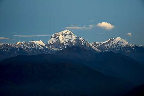
It's surely a big dream of every mountain lover - to visit the Himalayas at least once in his lifetime. The highest and the largest mountain range in the world. We made our dream come true last year in November...
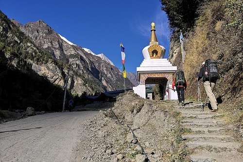
You can choose from many treks, trips and ascents in Himalayas. We decided for Annapurna mountain range and specially for The Annapurna Circuit Trek in Nepal. This trek is great for its proximity to the highest mountains, for a stunning views and many interesting places to visit. You can ascent to the high altitude of 5416 meters in the Thorang-La Pass, you can ascent to the altitude of 5000 meters to the marvelous Tilicho Lake, you can visit the 3300 year old Buddhistic temple in Manang for example.
The Annapurna Circuit Trek offers a lot of options for hiking. You can travel by foot or you can use a bus or an off-road vehicle in some parts of the trek. You can hike for 10 days or 2 or 3 weeks.
The best period of the year for hiking is spring and autumn. We decided for November - the weather is colder but stable and usually without rainfall. November is the driest month of the year in Nepal. We were lucky, we had very nice weather during almost all of our Annapurna Curcuit Trek - sunny and warm days but cold nights.
We recommend a hiking with a Nepalese guide. There are many agencies with many guides and sherpas in Nepal and Nepalese guides are usually very friendly and talkative and look after you during the whole trek, we were very satisfied.
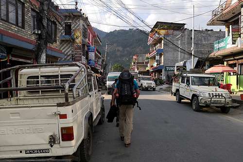
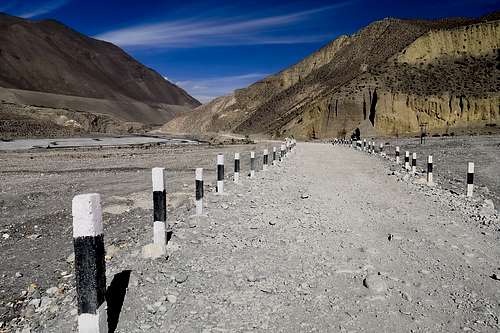
We started our circuit trek in Kathmandu. We had bought our bus tickets in advance and set off at 8 am to Besisahar. The road from Kathmandu to Besisahar is narrow and winding, full of cars, trucks, buses, bikes and people. We were sitting on the bus to Besisahar for about 7 hours...it was a very slow way and it seemed to take forever.
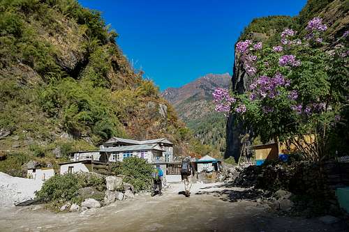
Besisahar is the starting point of the Annapurna circuit trek but we hired an off-road vehicle and travelled another 3 hours to the village of Tal. There was an unpaved road from Besisahar to Tal along the Marsyangdi river with many landslide areas and a few dangerous places. It was dark when we arrived to Tal and our Nepalese guide went with us direstly to our overnight accomodation in the Tashi Delek Guesthouse. We had the first of many Dal Bhats for supper, it`s the most common meal in Nepal which consists of boiled rice and lentil soup.
Time: 7 hours by bus from Kathmandu to Besisahar / 3 hours by car from Besisahar to Tal
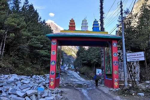
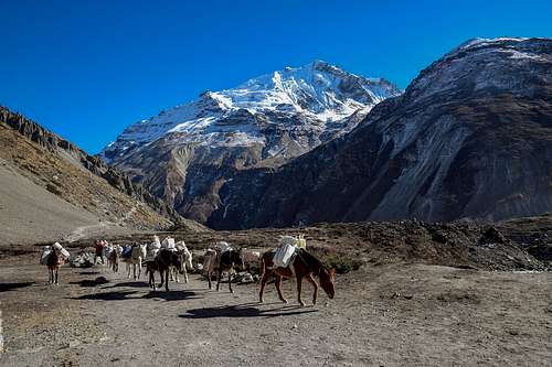
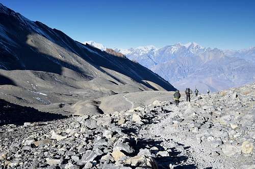
The first day of real hiking. We set off from Tal at 8 am. We were going at a quick pace because our Nepalese guide wanted to go to the small village of Koto and it was around 8 hours of a fast paced walking. The quick tempo was not entirely pleasant because of the weight of our backpacks - about 16 kg (more than 35 lb) each one. The way was gently ascending the Marsyangdi river up stream and we came to the village of Bagarchhap after 3 hours, there we had a small lunch - Momo dumplings filled with a spicy vegetables, other typical Nepalese food.
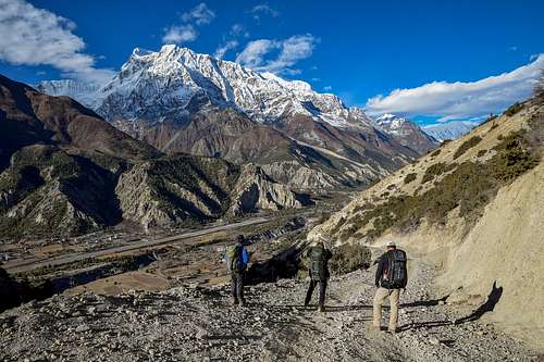
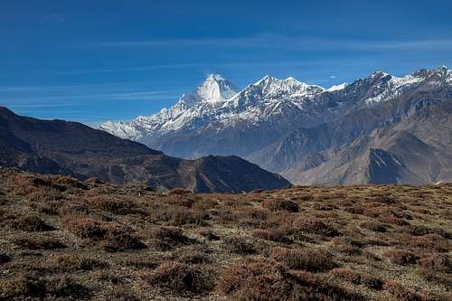
We went on, the gently ascending way changed into a steep ascent to the village of Timang. Not far from Timang we could see for the first time the huge massif of Manaslu with its highest point at an altitude of 8163m/26781ft in the background to the west. Finally we arrived in Koto after 4 p.m., we stayed in the Walnut lodge. In general it was a demading day with a lot of great experiences.
Hiking time: 8 hours
 |
 |
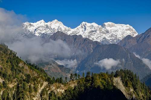 |
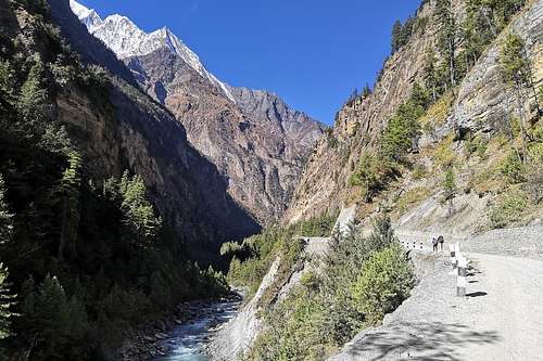
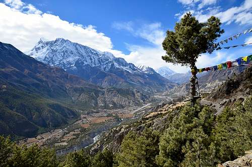
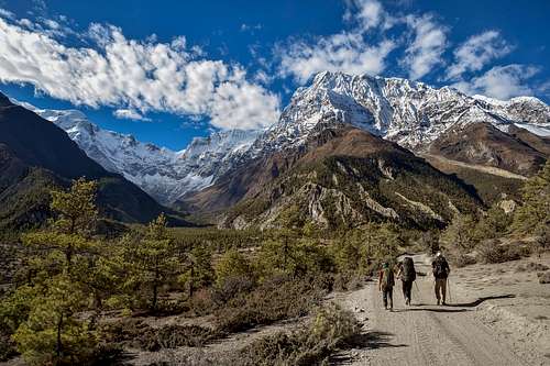
We went on again following the Marsyangdi river up stream. We came to the village of Chame in 30 minutes, it`s one of the bigger villages in the valley with many lodges, restaurants and shops. The valley was getting broader and boader and we could see on the left the top of Annapurna II (7937m/26040ft) from time to time. It was stirring feeling to have so huge mountain just above us. An altitude difference between us and the top of Annapurna II was more than 5000 meters (16400ft).
 |
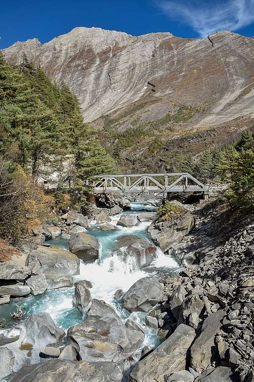 |
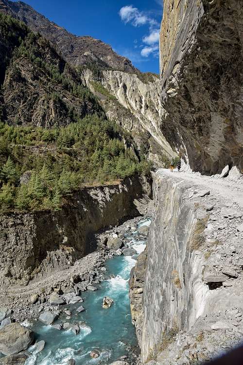
We took a short break in the next village of Bratang where there is a big teahouse. Then we carried on and we could soon see the very steep, smooth west slope of the Paungda Danda Mountain which is also known as Great Wall of Pisang and is over 1500 (4920ft) meters high. It looked very strange. Just below the mountain we went across the bridge on the other side of the river and went on to the village of Dhikur Pokhari. There were many lodges and we had lunch - Curry soup. The last part of the day`s track was combined with a gorgeous view of the broad valley with its deep river bed in the middle.
We stayed in the village of Upper Pisang in the Tukuche lodge with a roof terrace and a fantastic view on Annapurna II and IV on the opposite side of valley. Upper Pisang is interesting for its new small monastery at the highest point of the village.
Hiking time: 7,5 hours
 |
 |
 |
We set off at 8 am just after breakfast. We had been walking for 1 hour when we came to a steep rise - an altitude difference of 400 meters (1300ft) and there was a small village Ghyaru (3700m/12140ft) at the end of rise. Heavy backpacks...the southern slope...sunny weather...it didn`t matter, we were up in 1 hour.
Ghyaru offered us very nice views of the broad valley and the massif of Annapurna II and IV on the opposite side of valley. The next part traversed the steep slope around 400 meters (1300ft) above the bottom of the valley. Finally we were in front of the gate of the village of Ngawal. We stayed overnight in a completely newly built lodge called The Buddha Kitchen which has a terrace and great views of the massif of Annapurna III (7555m/24787ft). It was so new, that we were the first guests in our room.
Hiking time: 5,5 hours
 |
 |
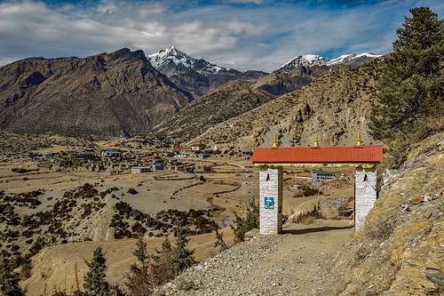 |
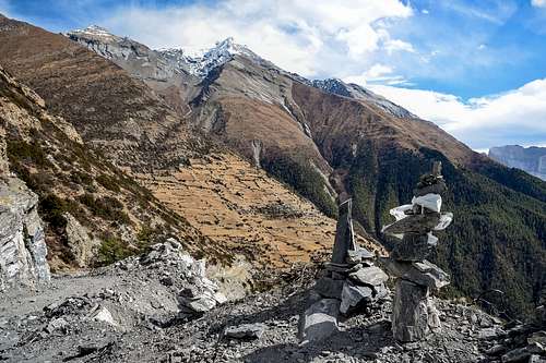
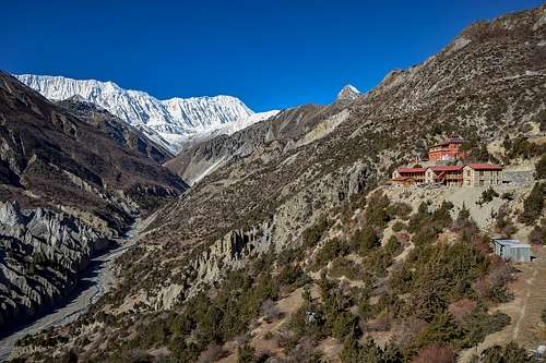
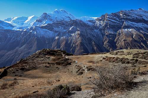
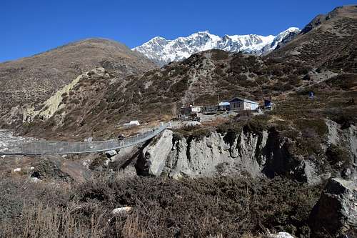
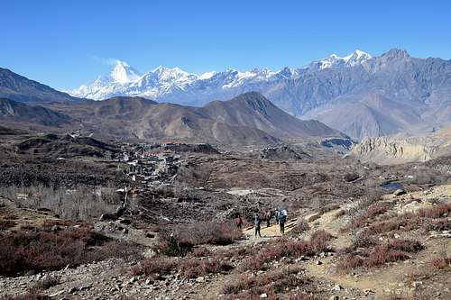
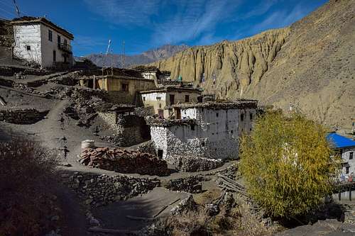
We had to ascend gradually down to the valley again after breakfast. It was a really nice morning (but very cold) and we could see a fantastic scenery: the massif of Annapurna III in the morning sun and an abandoned airport on the bottom of the valley just below it. What a contrast - a huge inaccessible wild mountain and a long runway, a modern man-made construction in the immediate vicinity. We at the bottom of the valley in 1 hour. The landscape was still like in a fairy tale - the road meandering between some small pines and the huge snow-capped mountain above it. We had gone through the village of Mungii and then the trail passed right next to the Marsyangdi river. We had a small break in Bhraga and then went directly to Manang. It took 3,5 hours from Ngawal to Manang.
We went for a short trip after lunch - there is a small teahouse at an altitude of 3750m/12300ft above Manang - Chongkor view point tea shop. I have to recommend it, short but very nice trip with a wonderful view of Manang.
Hiking time: 3,5 hours (from Ngawal to Manang)
Hiking time to Chongkor view point: 45 min up / 30 min down
 |
 |
 |
 |
 |
 |
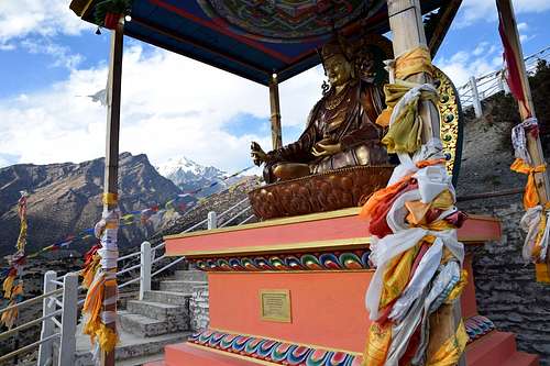
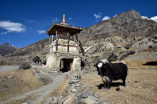
It snowed during the night and was cloudy in the morning. We had a rest day and walked in Manang and its surroundings. There is the oldest Buddhistic temple in the world, more than 3300 year old. It was closed for tourists but we met in front of the main door a caretaker of the temple and he opened the temple just for us. What a magical place!
It was sunny again. We set off from Manang early in the morning. We had a long and demanding trail before us and our Nepalese guide wanted to be in the Tilicho Base Camp in time, because it is a popular place among hikers and there are not so many chances of accomodation.
Tilicho Base Camp and Tilicho Lake is not located on the main route of the Annapurna Circuit Trek but it is good to go there because of the really amazing landscape and as acclimatization for later higher altitudes of course.
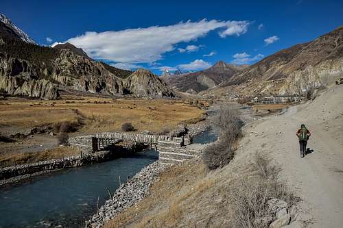
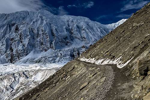
We had to turn left from the main route just behind Manang. We crossed the bridge over the Jharsang Khola river and went on to the village Khangsar. Not far behind the Khangsar we went past a newly built Khangsar temple. It was a really big contrast: the new building of the Khangsar temple and the iced ridge of "The Great Barrier" in the background...gorgeous! The trail was steeply ascending to the small village of Shri Kharka at an altitude 4050m/13300 ft. We had a short break there and then went on. The trail leads through strange picturesque rocks with many landslide areas where we had to move quickly but carefully. Our Nepalese guide didn`t give us a chance for a rest because of the danger of a landslide. We were lucky and finally arrived at the Tilicho Base Camp after 2 p.m. It was sunny and a completely blue sky and we spent the whole afternoon in the sun looking at the surrounding mountains.
Hiking time: 5,5 hours
 |
 |
 |
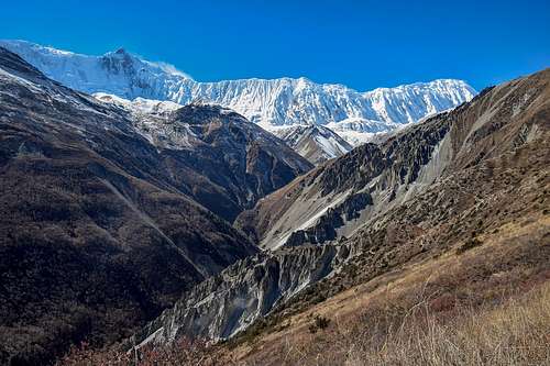
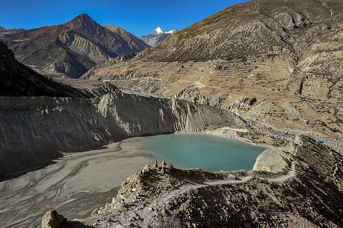
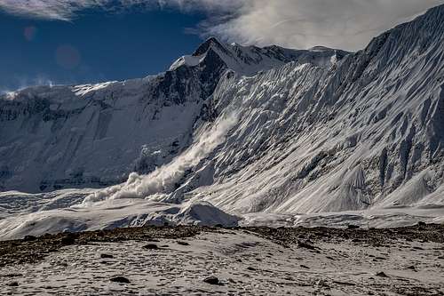
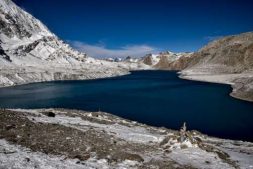
Tilicho Lake is the highest and largest mountain lake locations in the world - at an altitude of almost 5000 meters. The lake is surrounded by mountains - the north-east wall of Tilicho Peak (7134m) and the Great Barrier is really monumental. The ascent to the Tilicho Lake is suitable as a gorgeous acclimatization ascent before the Thorang-La pass crossing. 850 meters up to almost 5000 meters and back down to the Tilicho Base Camp are really good for acclimatization.
It had snowed 2 days before and there was snow around the Tilicho Lake. We saw an avalanche falling directly from the iced ridge of "The Great Barrier" during the ascent - an interesting experience.
The weather was really great - it was sunny - but there was a terribly strong cold wind blowing around the lake. We spent there only a few minutes and went down to the Tilicho Base Camp.
We went back to Shri Kharka after short lunch.
Hiking time: 3 hours up / 1,5 hour down (Tilicho Lake) + 3 hours to Shri Kharka
 |
 |
 |
 |
 |
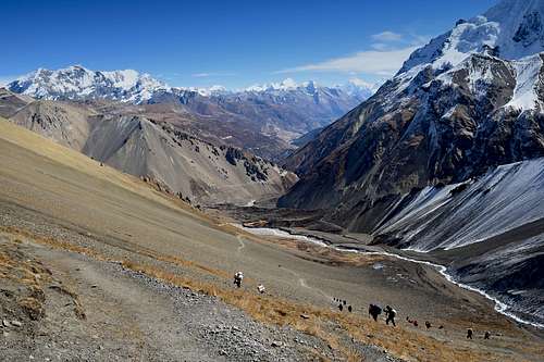 |
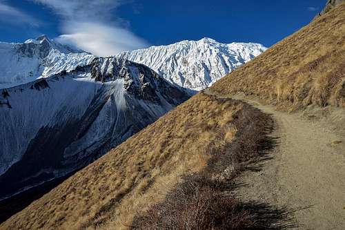
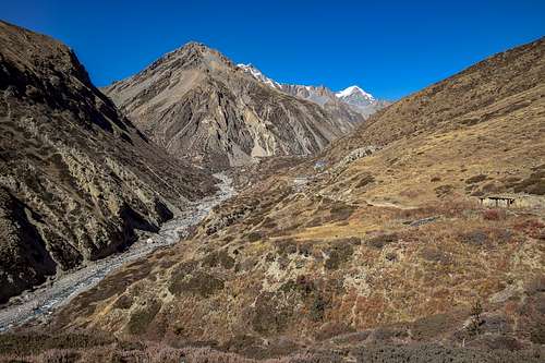
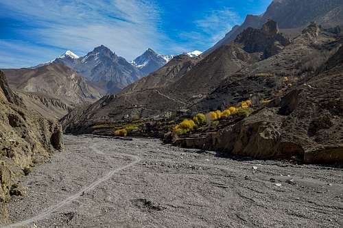
A very nice morning again. Our trek started with a short descent and then we ascended gradually to the village of Upper Khangsar. We were there in 45 minutes. Upper Khangsar is an entirely abandoned mountain village at an altitude 4150m/13615ft. There were many empty stone houses and it looked like a village of ghosts. There was a big contrast between the abandoned village and the huge marvelous massif of Annapurna III (7555m/24787ft) and Gangapurna (7455m/24459ft) in the background on the other side of the valley. We went on and came to the edge of the ridge. There was a place for rest with a wonderful view on Manang and the whole Marsyangdi river valley. We started to descend to the Jharsang Khola river valley which extends to Thorung Phedi. The descent to the Jharsang Khola river was steep and we could look at a little bit different character of the landscape. We crossed over the bridge and went on along the river to Yak Kharka.
Hiking time: 4 hours
 |
 |
 |
It was one of our shortest parts of the Annapurna Circuit Trek. Our Nepalese guide didn`t want to go to the High Camp because of its high altitude for overnight accomodation (4870m/15980ft). The high altitude is bad for good sleeping and we had to be fit before the most demanding part of the Annapurna Circuit Trek over the Thorang-La Pass.
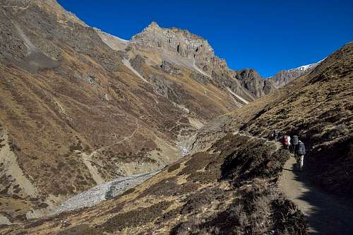
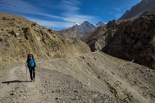
We were slowly ascending following the Jharsang Khola river up stream again. The valley of the Jharsang Khola river was getting more narrow, especially in comparison with the valley of the The Marsyangdi river around Manang or Pisang. Our breathing became more difficult and we had to make stops due to the high altitude. There was a short landslide area not far from Thorung Phedi. We arrived at Thorung Phedi around noon and the rest of the day we relaxed in the sun.
Hiking Time: 3,5 hours
 |
 |
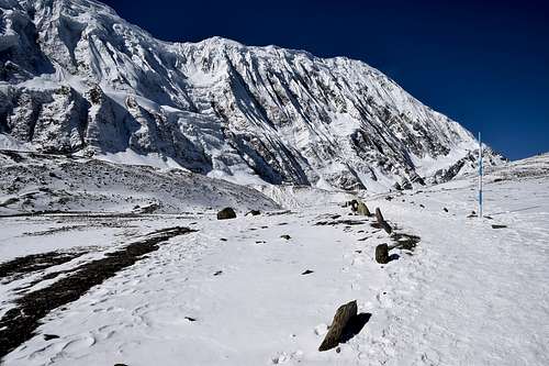
It was probably the most demanding part of the Annapurna Circuit Trek. And surely the highest. We set off from Thorung Phedi at 4 a.m. after a quick breakfast. We had a long long way to go. And around 1000 meters (3280ft) of an altitude difference. The outside temperature fell to almost fifteen degrees below zero. We put on all the clothes we had. It was pitch-black and we had to use our head lamps.
It took about 1 hour to High Camp and then the way became a little worse - there were some tricky places with the slippery remaining frozen snow.
It was still dark when we arrived to a small stone teahouse at an altitude around 5200m/17060ft. It was very pleasant to warm our hands with a small mug of hot tea:-).
Our walk was getting slower and slower because of the high altitude and a rarefied air.
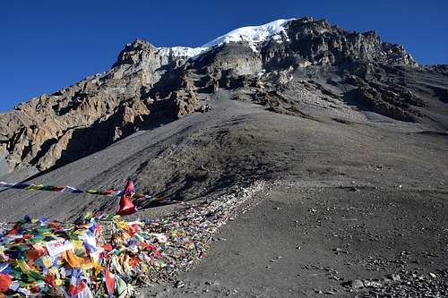
Finally, at 7:30, we were standing at the highest point of the whole Annapurna Circuit Trek - in the Thorang-La Pass at an altitude of 5416m/17770ft. There was a terribly strong, freezing wind and we were happy that we could stay more than 30 minutes with a cup of hot tea among many other hikers inside a small stone teahouse in the pass.
The descent to Muktinath was neverending (1700 meters (5580ft) of an altitude difference) but in just over 3 hours we were standing in front of Hotel Buddha, our lodging.
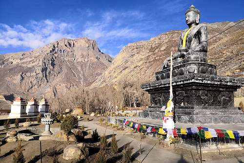
I have to recommend a visit to the Muktinath temple - a large area with Buddhistic and Hindu temple.
Hiking time: 8 hours
 |
 |
 |
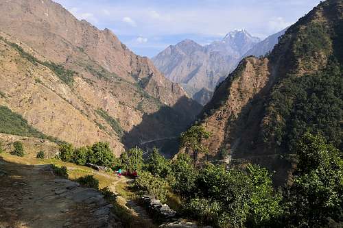
In general, it was one of the most beautiful days of the whole Annapurna Citrcuit Trek - a different but amazing character of landscape in the Kali Gandaki river valley, the majestic pyramid of Dhaulagiri in front of us and only a few hikers in this part of the trek. Most hikers used the usual way from Muktinath to Jomsom over the village Kagbeni (by bus, by off-road vehicle or on foot). Our Nepalese guide recommended us another way: over the ridge of the mountain Dhangladanda and down to the valley of the Panda Khola river with the village of Lupra.
I have to recommend this way, it was really an awesome day. The trail from Muktinath to the valley of the Panda Khola river went over the fascinating hills with marvelous views on the majestic pyramid of Dhaulagiri in the background. It was stunnning!
The bed of the Panda Khola river was dry, there was only a narrow stream. We went on after a short break in Lupra. We had two options: we could go on the right or left side of the river. Our Nepalese guide recommended us the right side for its easier way. I can say that we were fortunate, the trail on the right side could be more interesting but there was a big landslide and the end of the way was impassable.
The last part of the trip to Jomsom passed right next to the bed of the Kali Gandaki river.
Jomsom is a town in the broad valley between the Dhaulagiri and Annapurna massif. There is a small airport next to the town. You can buy a flight to Pokhara - the easiest way back.
Hiking time: 7 hours
 |
 |
 |
 |
 |
 |
We went by bus from Jomsom to Tatopani. It was a neverending journey again, many parts of the road were broken and we had to go through the dry bed of the Kali Gandaki river. Tatopani is a village on the right side of the Kali Gandaki river at an altitude of 1200m/3940ft with many options of accommodation. We stayed in the Old Kamala Hotel with a nice terrace with lemon and orange trees.
Hiking time: 6 hours by bus from Jomsom to Tatopani.
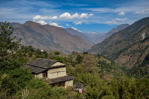
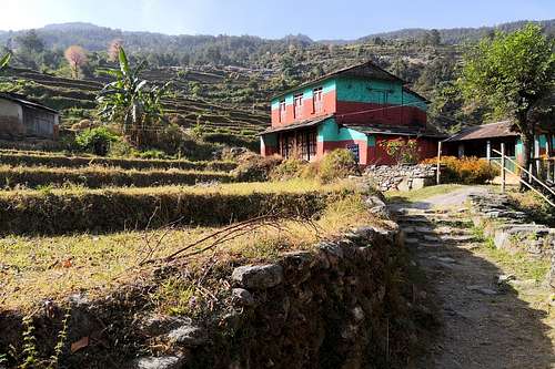
We had a big altitude difference before us: almost 1700 meters (5580ft). We set off at 8 a.m. after breakfast. We followed the road pass along the Kali Gandaki river and then turned to the left across the bridge over the Kali Gandaki river after 20 minutes. Then we ascended almost 7 hours to Ghorepani. We went through the small villages of Ghara, Sikha, Phalate and Chitre. The landscape and climate were entirely different from previous days - a warm and humid air and green nature among us - bananas, bamboo, lemons, harvested rice fields...We arrived at Ghorepani after 3 p.m.
Hiking time: 7 hours
 |
 |
 |
It was our last day of hiking in the mountains. We set off very early - after 5 a.m. and went to Poon Hill - it is a gorgeous and very popular view point for sunrise pictures of Annapurna and Dhaulagiri. We had a bad luck - the sky over us was clear but there were some thick clouds on the east and the tops of Annapurna and Dhaulagiri were in the shadow. It was a pity, the orange tops of Annapurna and Dhaulagiri at sunrise are beautiful and very famous.
We took some pictures and went back for breakfast to the lodge in Ghorepani.
Our Nepalese guide had hired for us an off-road vehicle from the village Uleri to Pokhara and we started to descend to Uleri at 8 am. It was a long way through the forests but we were standing in Uleri next to our car after 11 am.
The way to Pokhara by car was interesting because the roads were very bad and broken but we were finally standing in front of our accommodation - New Annapurna Guest House on the 1st street near the popular Phewa Lake after 2 pm.
Hiking time: 30 min up to Poon Hill / 20 min back to Ghorepani
3 hours to Uleri
3 hours by car to Pokhara