Toggle navigation
Mountains
Routes
Images
Trip Reports
Forum
What's New
People
Areas & Ranges
Articles
Trailheads
Canyons
Huts & Campgrounds
Albums
Logistical Centers
Fact Sheets
Lists
Custom Objects
Gear
Plans & Partners
WELCOME TO SUMMITPOST
SIGN IN
REGISTER
Annapurna Circuit
Additional Parents
Image
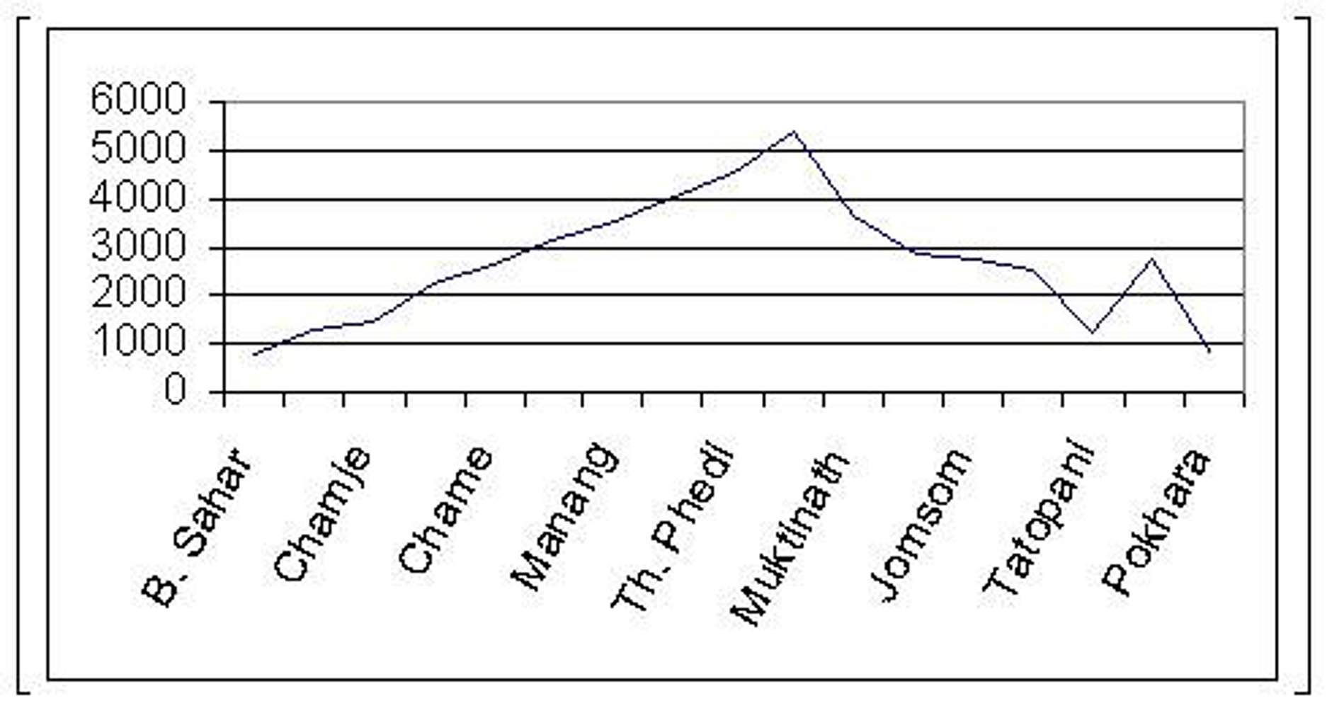
Altitude profile of the trek
View High-Resolution Image
Altitude profile of the trek
Just intended to give you a fair idea of the altitudes involved in this trekking route. Distances between stages are not in scale, though. ¡Oh! and altitude is (of course!) in meters above sea level.
« PREV
NEXT »
eza
on
Apr 20, 2007 9:52 am
Comments & voting
Other parents
Lat/Lon:
28.56670°N / 83.83330°E
Image Type(s):
Topo/Diagram
Image ID:
286713
2174 Hits
0
% Score
0
Votes
Log in to vote
Comments
No comments posted yet.
to post!
Don't have an account?
Annapurna Circuit
(Custom Object)
« PREV
Viewing
#133 of 152
GALLERY
NEXT »
eza's Image Gallery
« PREV
Viewing
#1350 of 1490
GALLERY
NEXT »
×
You need to login in order to vote!
User Name
Password
Remember me
Forgot your password?
Log me out when I close my browser.
Keep me logged in all the time.
sign in as a user
Don't have an account?
Register now for FREE
Rating available
Suggested routes for you
People who climb the same things as you
Comments Available
Create Albums
Register Here


