Toggle navigation
Mountains
Routes
Images
Trip Reports
Forum
What's New
People
Areas & Ranges
Articles
Trailheads
Canyons
Huts & Campgrounds
Albums
Logistical Centers
Fact Sheets
Lists
Custom Objects
Gear
Plans & Partners
WELCOME TO SUMMITPOST
SIGN IN
REGISTER
Pelister
Additional Parents
Image
A view on the eastern...
View High-Resolution Image
A view on the eastern...
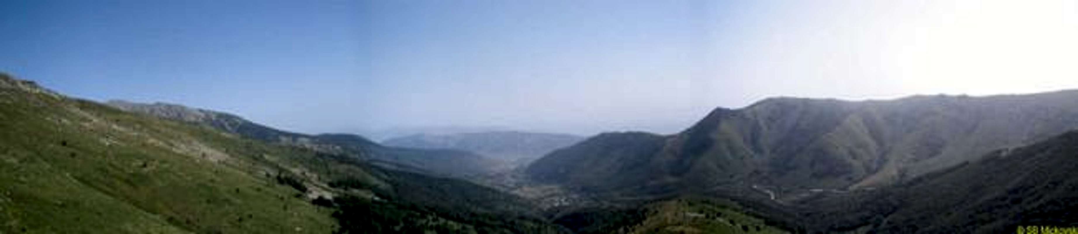
A view on the eastern approach to Pelister. Nizhopole village lies in the foot of the Debel Rid hill (middle) over which the hiking path is clearly marked. On the right side is the Babin Zab ridge, great for mountainbiking.
« PREV
NEXT »
Mickovski
on
Aug 31, 2005 6:39 am
Comments & voting
Other parents
Lat/Lon:
41.05000°N / 21.18750°E
Image ID:
123486
1323 Hits
0
% Score
0
Votes
Log in to vote
Comments
No comments posted yet.
to post!
Don't have an account?
Pelister
(Mountain/Rock)
« PREV
Viewing
#57 of 69
GALLERY
NEXT »
Mickovski's Image Gallery
« PREV
Viewing
#2 of 11
GALLERY
NEXT »
×
You need to login in order to vote!
User Name
Password
Remember me
Forgot your password?
Log me out when I close my browser.
Keep me logged in all the time.
sign in as a user
Don't have an account?
Register now for FREE
Rating available
Suggested routes for you
People who climb the same things as you
Comments Available
Create Albums
Register Here


