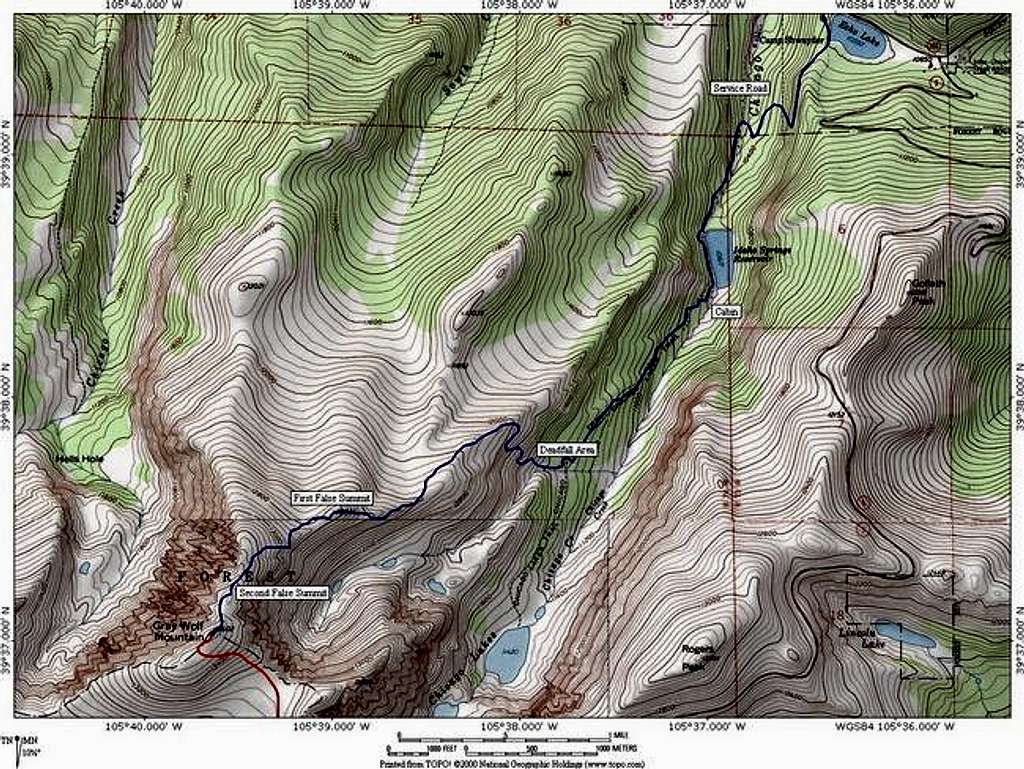
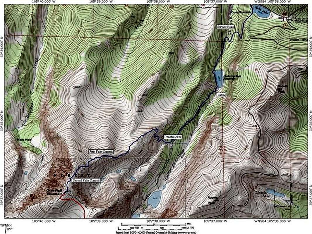
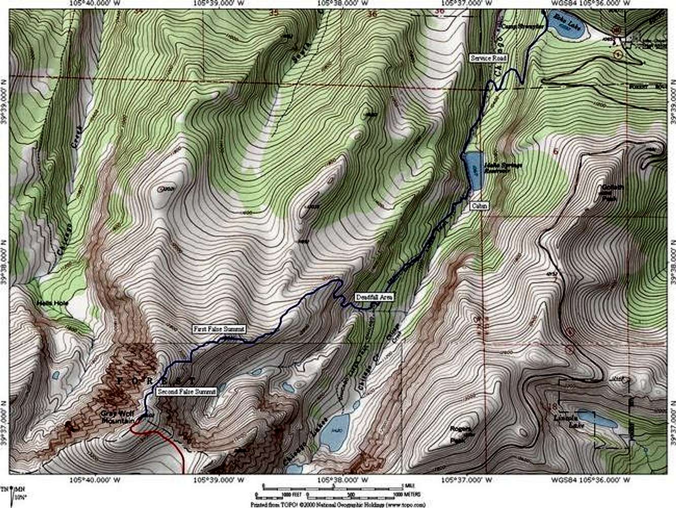
A topo of the Chicago Creek...
A topo of the Chicago Creek Route on Gray Wolf Mountain. The route is 11.2 miles roundtrip, 3,000 feet elevation gain (including the ascent out of the Chicago Creek Drainage on the way out), and class 2. Software by National Geographic.


