

Comments
No comments posted yet.
|
|
Trip Report |
|---|---|
|
|
42.60536°N / 0.52136°E |
|
|
May 14, 2018 |
|
|
Mountaineering |
|
|
Spring |
After a couple of years basing our annual trip in the UK, Ken and I decided to return to Benasque for our 2018 trip. Ken came down to our house on Sunday as we were flying out from my local airport at Southend on Sea to El Prat in Barcelona.
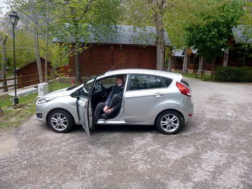
Our flight was scheduled for around 1:00 pm and with the hour lost across the time zone we arrived a bit later than most of our previous trips. Ken had arranged a “swipe and go” car with Gold Car but when we found the office with the machine in the car park the computer said no! It was out of order and the attendant said we would have to go back into the terminal to get our contract sorted. Not an auspicious start to our trip. Ken left me with our luggage and trudged back to the terminal where he had a bit of an argument with the staff when they wanted to see my license to log a second driver. Ken with his innate executive persona soon kicked that idea into touch.
Anyway, we had decided to drive through the night and arrive in Benasque early morning. We headed west on the A2 Autopista and around midnight arrived at Lerida (Lleida). We found ourselves a lively 24/7 garage/restaurant/bar and headed in for a coffee which we enjoyed surrounded by a coachload of Japanese tourists.
Heading north from Lerida we were on a familiar route so navigation was not an issue. Passing through Barbastro and Graus we saw few other travellers so we had a smooth run, a Badger and two Foxes crossing the road provided our only excitement.
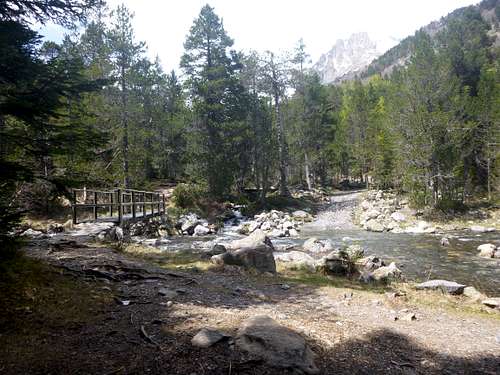
Arriving in Banasque at 2:00 am we got our heads down for a doze until later and then we headed for the Hotel Ciria and a nourishing breakfast. Fully reinforced we drove up the valley to Camping Aneto. We were assigned our familiar old room in their refugio and soon settled in. We were glad to find that the kitchen area had been fully refurbished since our last visit and was complete with a new electric stove and a full range of cutlery and cooking utensils. Although there was a slight increase in the overnight charge to €19 it was still very reasonable.
 |
 |
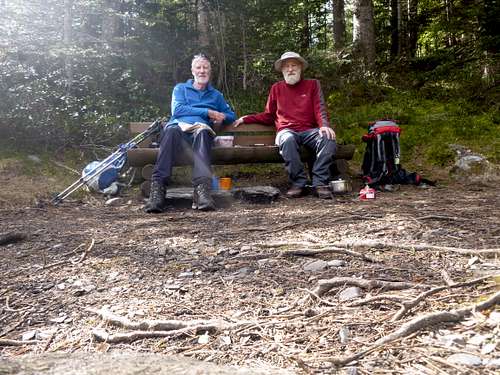
| Arriving at Camping Aneto's refugio. |
 Ken tucks into his 'Plato combinado' Ken tucks into his 'Plato combinado' |
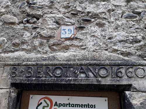
Returning to town later for dinner at the Ciria, we felt our usual welcome feeling at the familiar bar and were soon tucking into our ‘Platos Combinados’ washed down with a couple of cervesas. Strolling around town after our meal we noticed a historical reminder of the age of some of Benasque’s buildings. |
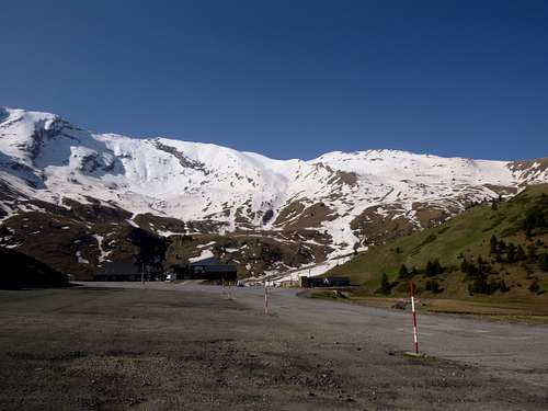
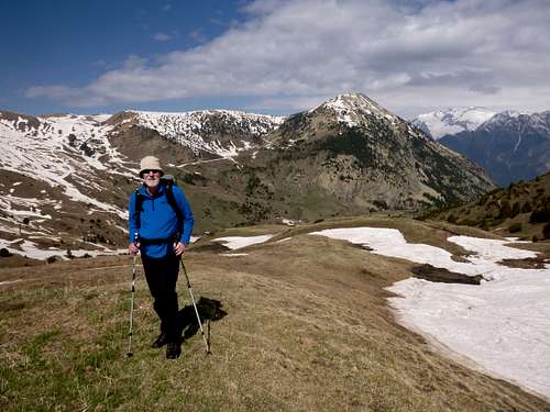
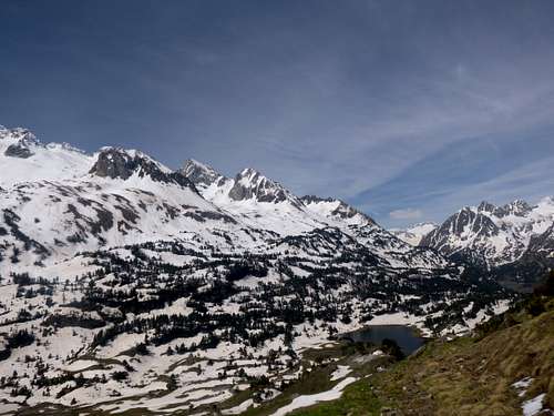
After breakfast we agreed that our first day on the hills would be to traverse the ridge above the Ski resort of Ampriu which was beyond Cerler, a small village above the town of Benasque, theoretically we thought it an easy day to warm up. A couple of days before, this had been the last stage of the ‘Vuelta a Aragón’ a professional cycle tour and the evidence was all around for as usual the fans had liberally painted the names of their cycling heroes on the tarmac road.
 |
 |
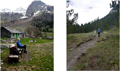
| Pico Cerler from our breakfast bar. | Looking towards Posets from Cerler. |
|
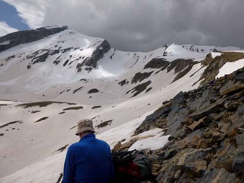
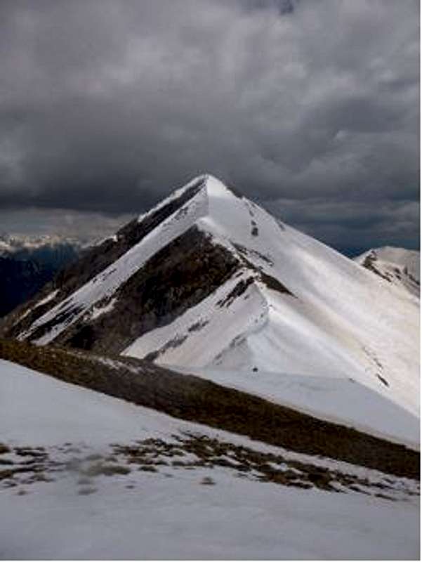
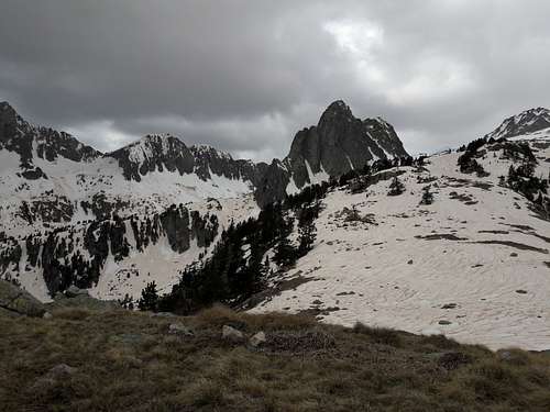
The Ridge above the resort car park |
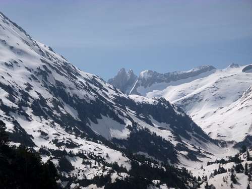
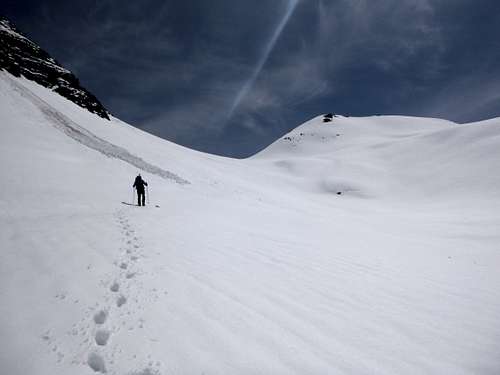
Parking our car in the vast parking area we contemplated the ridge above. On a previous visit we had ascended Pico de Cerler and Tuca Cibolles, the latter being situated at the west end of a nice ridge. Our idea was to climb up to this ridge from the eastern end and traverse along to top out on the Tuca Cibolles. Setting off around 10:00am we crossed the Collado Basité into the Pleta Chobe. The whole area above was heavily snowed over and the Estang de Basibe was invisible below the snow. We navigated towards the supposed location of the lake, avoiding wet feet and planned to ascend the slopes between Tuca de Besibe and Pala L’Estan. Above the estan, the slopes rose steeply towards the ridge above. From there we could study the full length of the ridge and decide on the best line of ascent to reach |
 |
 |
| Ken above the hidden estang, Pico Cerler behind. |
Contemplating the Ridge. |
|
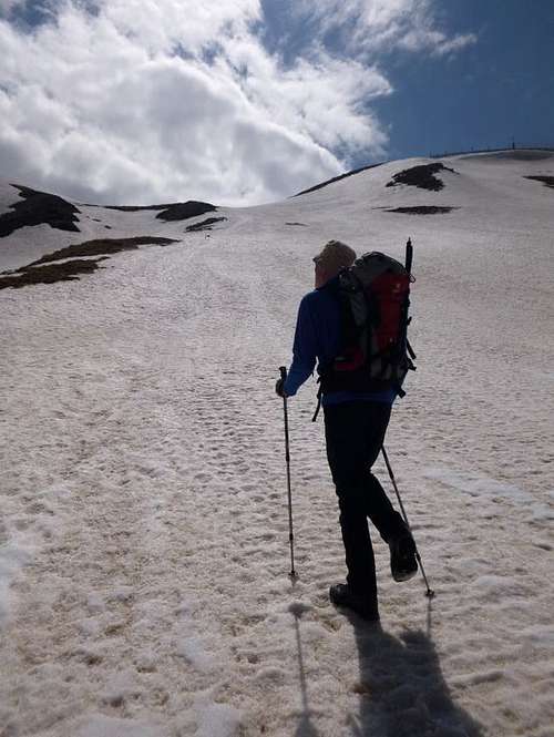
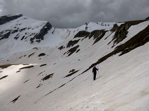
It was hard going over the steep snow but luckily for us it was reasonably firm avoiding any ‘post holing’. Initially the slopes were even and at a constant angle but higher up we saw that access to the ridge directly would mean ascending a much steeper section of the snowfield. After about half an hour of climbing we decided to take a short rest and look ahead for the best line to ascend. We found ourselves a dry section of rock and sat down to enjoy a few minutes in the warm sunshine. Looking up into a large bowl shaped are ahead we watched Marmots running across the snow field above us but as we climbed higher they swiftly disappeared down into their burrows leaving us with only the sight of their trails in the snow. |
 |
We take a five minute rest.
 |
 |
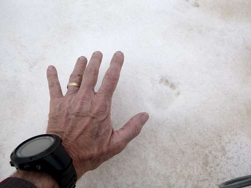
| Johnnie checks the size of a Marmots paw print. | Ken approaches the ridge. |
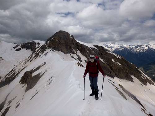
As we rose closer to the crest of the ridge, we noticed that the angle of the snow steepened much more and conscious of the risk of avalanche we looked for the safest line of approach. To our right hand side above we noticed a rib of bare rock and using this seemed to be a potential way of avoiding the steepest section of the snow. It was a tricky move to gain the rocky section but we soon made it and took another short rest.
|
Taking a short rest with a long range view of the Posets area on the horizon.
|
Using the rib to avoid avalanche risks. |
|
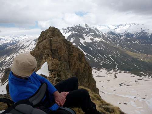
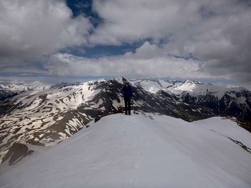
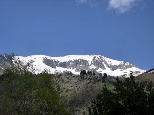
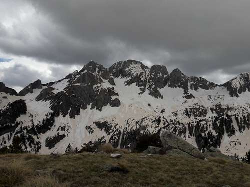
Ascending the rib itself was also quite steep but apart from an initial deep section of snow, it was quite lightly covered and so we were able to make steady progress. At the high point of the rib, the angle eased and we were able to see that the crest of the ridge was only a sort way ahead. The views from there were stunning and looking back at the surrounding panorama we could see both the Maladeta and Posets massifs. Memories of climbing both of these fantastic areas came flooding back and brought smiles to our weary faces. |
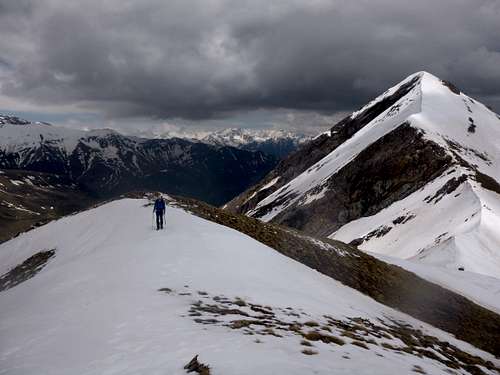
Just before 1:30 pm we reached the top of the ridge and were able to see how the potential routes along it in either direction were situated. Our plan was to head west along the ridge to Tuca Cibolles so we looked in that direction and took some tentative steps forwards. The ridge undulated considerably and the way ahead was not completely visible. We ascended a slight dome and were able to get a much better view. |
Ken reaches the top of the ridge.
 Looking East along the crest of the ridge. Looking East along the crest of the ridge. |
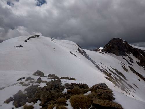 A domed section hides the view to the West. A domed section hides the view to the West. |
 |
 |
| Looking East as Ken reaches the top of the domed section of the ridge. | Looking West, our planned route lies ahead. |
 |
Looking forward we saw that the snowline along the crest of the ridge ahead was like a knife edge. From below, we imagined that the ridgeline would be fairly straightforward and probably be just a walk along the snow with some rock scrambling.
However looking at the situation and having the lack of a rope for protection should the crest avalanche or cornices fall off, we decided not to pursue our planned traverse as the risks were unavoidable.
We took a while to enjoy the views from our high vantage point the started to make our way back down. |
 |
We were pleased to see a Lammergeir or a Vulture soaring overhead but without a tele lens on my camera it was impossible to see which variety of raptor it was. We soon descended back to the car park at Ampriu and from there we drove back down the road through a deserted Cerler to Benasque for a beer. |
Day 3 – May 17th – Hospital de Benasque & the French Border.
|
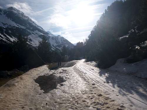
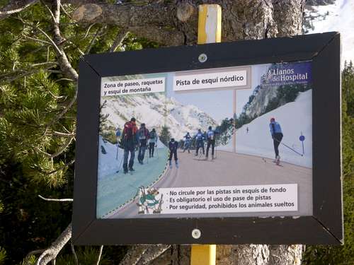
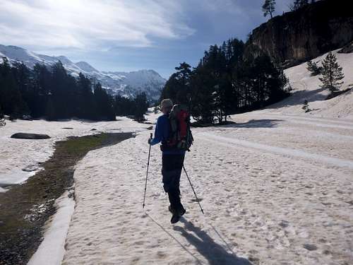
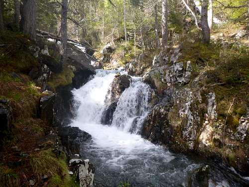
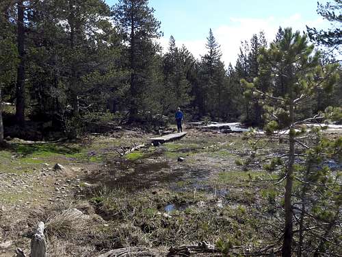
For our second hill day we decided to go up the valley from our refugio and into La Besurta. We arrived at the fork in the road by the Hospital and saw that the road to La Besurta was totally snowed in with deep hard packed snow and ice and was seriously rutted from off road vehicles, definitely not suitable for our ‘on road’ Fiesta. So we parked at the side of the road above the Hospital in a kind of layby just after 8:00 am which turned out to be a bad mistake but more of that later. As I mentioned earlier, the whole area was heavily snowed in, much more than we had ever seen before in May. So after kitting ourselves up we strolled down the Besurta track and debated what sort of a day we might have in view of the conditions. I spite of the rather crisp weather we enjoyed our walk into the valley and were pleased to see a Red Squirrel hopping about through the pine trees. The conditions had obviously been ideal for skiers as clearly seen by their tracks in the road. We also noted a notice indicating that we should walk on the left side of the road going up leaving the way clear for skiers on the piste. |
 |
 |
 |
|
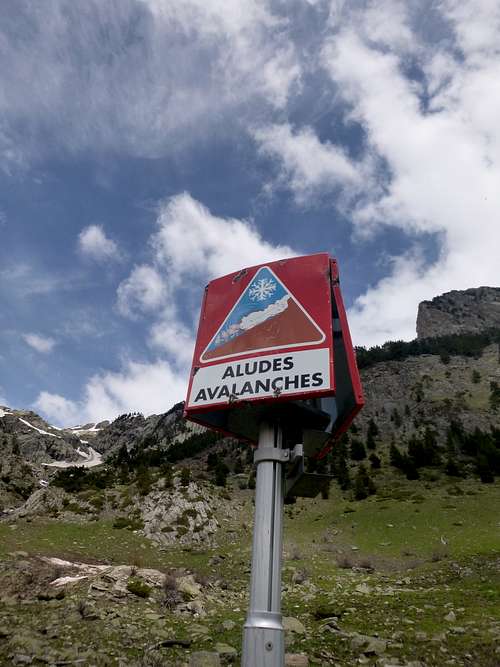
Dire warning to walkers. |
Ken looks ahead to La Besurta |
Once up into the Besurta we needed to discuss a possible route for the day.
During our many visits to this beautiful National Park, we had climbed many of the peaks on both sides of the valley and I had a desire to complete our explorations by climbing one that had eluded us so far. This unusual mountain is the twin peaked Forcanada or Mahl des Pois. We had been close to it on a previous visit when we ascended to the Col D’Alfred but then we turned south to climb the Tuc de Molieres.
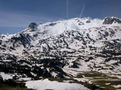
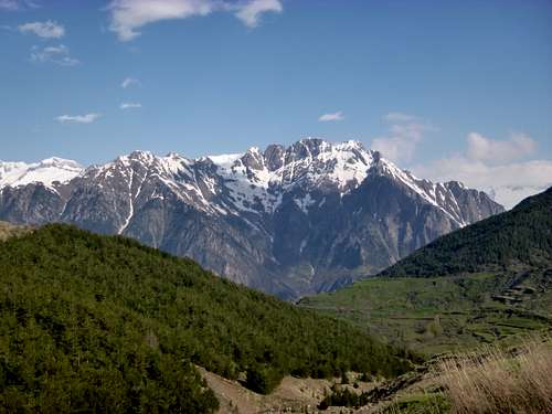
The Maladeta.
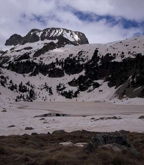
As we looked around we saw that an ascent of Forcanada in these snow conditions would be beyond our reach, not so much for the ascending but to travel down on soft snow for a much longer duration would require snow shoes to do it in a practical amount of time and we were not blessed with a long enough vacation for that or any snow shoes. We looked around the surrounding peaks and searched for some new ground that we could explore that day. As I said we had topped out on most of the peaks and crossed some of the cols too. After perusing our map, we decided to head for the Port dera Picada (2477 metres) which was an area that we had not previously visited.
The col there is close to the border with France but also being across the valley from the Maladeta promised to give some fine views of the highest peaks in the area.
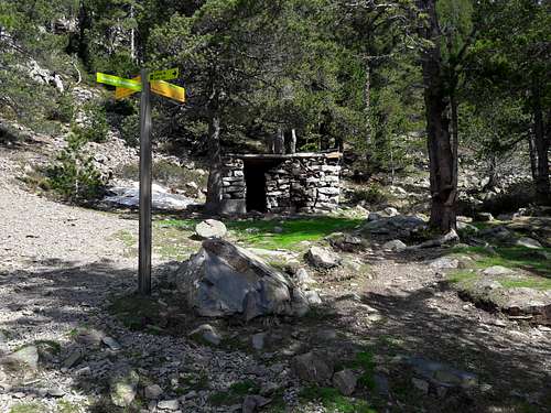
So we carried on down the trail through La Besurta to pick up the path leading to our chosen route and watched the Marmots scampering across the snow and diving into their burrows. The path was rising up the hill just as we passed the small refugio hut of the Plan d’Estan.
 |
 |
|
Looking back down from our path into the Plan d’Estan. |
Forcanada beckons but it will have to be future year for us. |
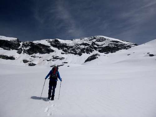
We soon reached a snowfield leading up to the Port dera Picada which crosses a ridge between the Pic de Pessó and the Toronet deth Port dera Picada.
 |
 |
|
Lovely crisp snow on the approach to the col. |
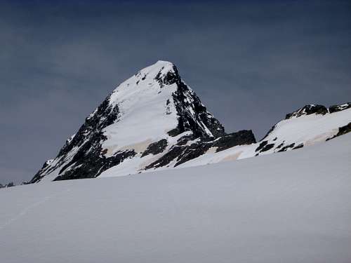
The Pic de Pessó |
As we approached the col, the angle of the snow increased considerably and so our progress slowed down but we kept going steadily upwards.
 |
 |
|
Final approach to the Port dera Picada. |
Ken takes a well earned rest. |
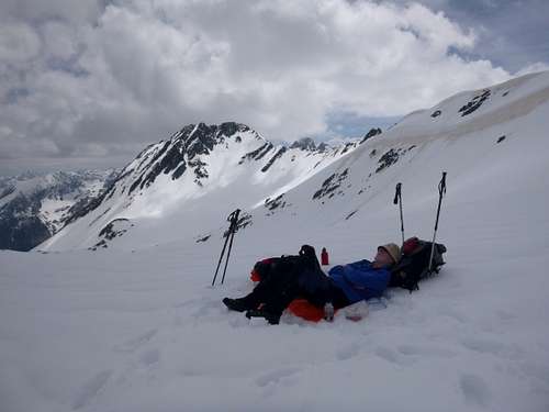
At last we reached the top of the col and crashed down for a rest in the snow just after 12 noon. After a short breather we unpacked our sandwiches and drinks for a restorative lunch break. We stayed around a half hour enjoying the pleasant day and the brilliant views all around.
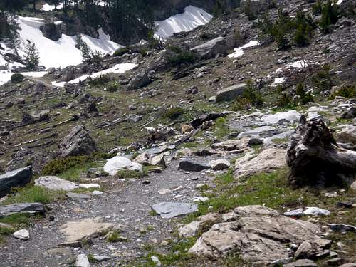
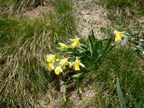
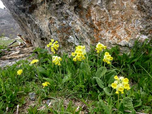
Eventually we had to head back and on the way back down, we had time and breath to notice the flattened trees below the trail that had resulted from previous avalanches and some lovely spring flowers bursting out of the rocky ground.
 |
 |
|
The trail back down with Marmots. |
Daffodils on the trail |
|
Eventually we arrived back to the car and as we changed to street clothes we noticed a notice stuck under a windscreen wiper. This was a handwritten note from Park Wardens telling us that we had parked illegally! The note was timed, dated and signed by two persons. To say we were gobsmacked was an understatement as we had parked neatly without creating any obstruction as we had always done. Back in Benasque we contacted the local tourist office who sent us to the local Government office where a lovely young lady made a call to the National Park officials to find out what the score was. After a long discussion on the telephone she said that the officials stated that parking in the National Park must be done in official car parks and we “may” therefore incur a €50 fine. As far as I know this has not occurred yet. Back at the 'Ciria we devoued our dinner with gusto whilst glowing slightly from the day's sunshine. |
 |
Day 4 – May 18th – The Estos valley and the refugio.
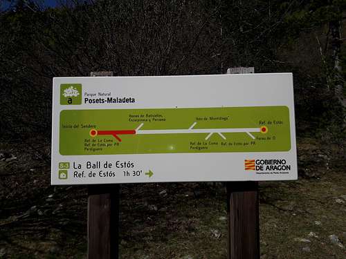
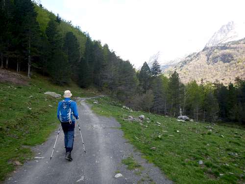
A fine day dawned and after breakfasting and making sandwiches for lunch we crossed behind the Refugio at 9:00 am and headed up the GR11 trail into the Estos valley. This is our favourite walk up to the Estos Refugio.
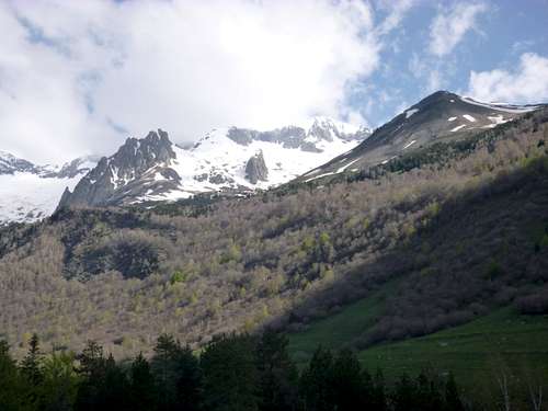
After the lower wooded section, the valley opens out and we got our first sight of one of our previous mountains. High above to the north of the trail was the imposing massif of the Pico Perdiguero. We had climbed this after an overnight stay at the Estos refugio in 2008 but then, the top of the mountain was in total whiteout, so our view of the precipitous eastern flank was invisible.
We had carefully ascended the final few hundred metres and after Ken had viewed a video of the same ascent later he realised that we had been quite close to the corniced edge.
This year we saw that the summit was reasonably clear of cloud and would have allowed excellent views of Posets to the south. Unfortunately we didn’t have that pleasure in 2008.
We had previously climbed Posets in 2006 after an initial recce and so at least we were able to have seen Perdiguero from there.
 |
 |
 |
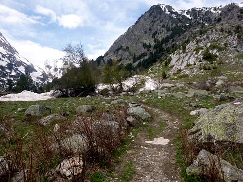
The GR11 trail through the Estos valley has excellent signage arranged by the National Park authorities giving all the trekkers a good guide to likely times between points of interest. Red and White markers indicate the GR11 path. Thermometer type signs also indicate your progress along the trail.
Perdiguero towers above the GR11 Trail.
 |
 |
| The GR11 trail follows a farm track down the Estos valley. |
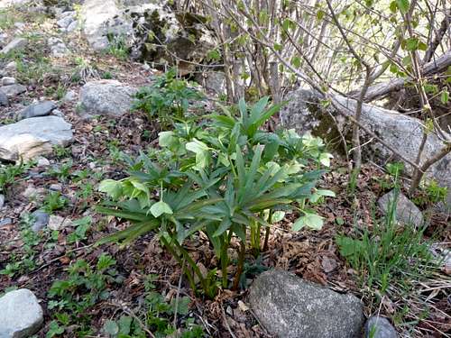
A fine Hellibore brightens up the side of the GR11 trail. |
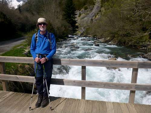
We reprise an earlier year's photograph at the Palanca de Batisielles.
 |
It was around 10:30 when we arrived at the Palanca de Batisielles so we decided it was time for tea. With water freely available we brewed up, filled our water bottles and enjoyed our tea on the fine bench. |
 |
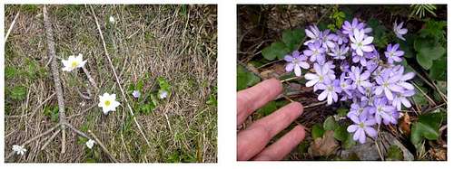 |
| Ken has a short rest at the Cabaña del Turmo before continuing up the GR11. | Delicate spring blooms brighten our way. |
As we neared the refugio we saw that the path was completely blocked by the remains of an earlier avalanche. A tangles mass of snow and broken trees provided an awkward obstacle to be passed but over or around it we soon went and arrived at the refugio at about 12:30pm a steady 31/2 hours after leaving our own refugio.
We said 'hola' to the guardian, bought a couple of beers to wash down our sandwiches and relaxed on the patio enjoying the midday sunshine.
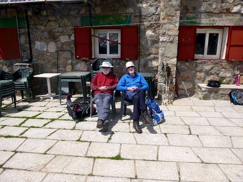
Outside the excellent Estos refugio.
We had seen quite a selection of wildlife on our walk, including the ubiquitous Marmots, Rebecco on the higher slopes and a Lammergier sailing high overhead.
Setting off back we tackled the avalanche debris head on and soon walked back to the Palanca de Batisielles.
 |
 |
|
|
Avalanche warning on the trail. |
Avalanche debris across the trail, hopefully no trekkers were there at the time. |
|
Palanca de Batisielles.
 |
 |
| A fine patch of Primula. | Just a short walk from here to the Camping Aneto refugio. |
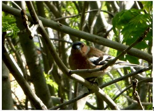 |
As we made a brew back at the kitchen of the Camping Aneto refugio, a friendly Chaffinch tapped on the kitchen window, hoping for a few crumbs. In the evening after cleaning up, we went to the Hotel Ciria for our dinner but after ordering a beer we decided that the miserable barman who served us would put a downer on our evening meal and subsequent relaxation, so we crossed over the road to the facing Hotel Araguells where a very nice lady took our order and served us with an excellent meal. I must admit that the unfriendliness we found that evening at the Hotel Ciria was very unusual as we normally got on very well with all the staff. Maybe the guy had an off day but he shouldn’t have taken it out on the customers. |
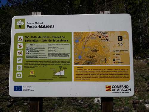
Day 5 – May 19th – The Estos valley and the Ibóns de Batisielles.
For our last day in Benasque we decided to return to the Estos valley and explore the plateau above the GR11 trail where the Ibón Gran de Batisielles is situated.
Clear skies over Perdiguero.
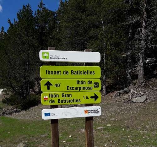 |
As we moved along the trail we had another view of Perdiguero with no clouds on top. The sign indicating the trail up to the plateau was found along the route after the small cabin called Santa Ana. A pleasant if steep trail through a heavily wooded area followed until we reached the small Ibonette de Batisielles at 11:00 at which was located an equally small stone cabin. It was a very pleasant place to stop at the side of the Ibón and we soon had a brew going to wash down a small snack to boost our energy for the continuing climb up to the big Ibón. Another walker arrived as we took our refreshments but he didn’t seem to want to engage with us. The trail onwards was quite indistinct and required some careful route finding through thick undergrowth and tangled trees. |
 |
 |
|
The placid Ibónet de Batisielles. |
The small stone cabin. |
Reluctantly we left the peaceful side of the beautiful small ibón and headed off across boggy ground to the forested slopes.
A rustic boardwalk crosses an area of boggy ground.
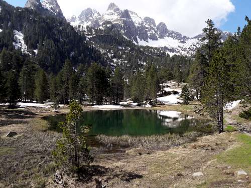
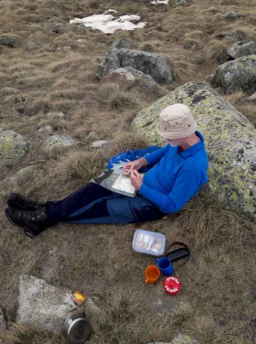
Before too long we had arrived at the upper ibón and were amazed at the sheer panorama of peaks surrounding it on all three sides.
 |
 |
|
The large ibón is frozen over and dwarfed by the peaks around it. |
Ken compares our navigation to the area map. |
We found ourselves a grassy knoll just above the frozen ibón with a flat spot suitable for our bivvy stove and started setting up our gear to boil water for a brew. Ken had his GPS device with him and was trying to rationalise our position with it and the Editorial Alpina map. We drank our respective teas, ate our lunch sandwiches and marvelled at the impressive ridges above. These would make a fine Alpine type expedition some day. The grassy knoll would make a fine spot for an overnight stay.
Generally campingt is not allowed in the National Park but if you bed down late in the evening and clear away early in the morning you should have no troubles with the park wardens. (just don't park you car in the wrong place !!)
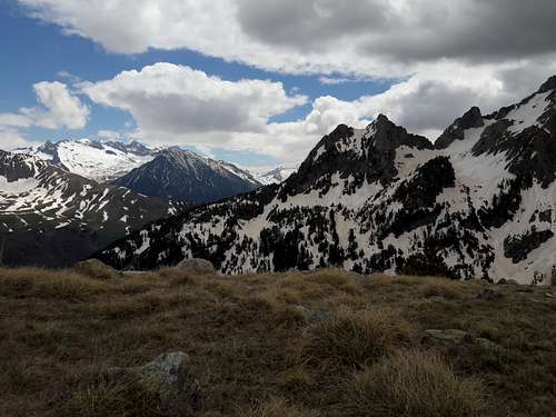
Fine views from our grassy knoll, looking North towards the French border.
 |
 |
|
Ridges galore surround the Ibón Gran de Batisielles. |
So many oportunities for an Alpine style traverse. |
Sadly we returned to our refugio as this was our last day on the hills. Tomorrow we had to travel back to Barcelona to fly home.
Day 6 – May 20th – Traveling home.
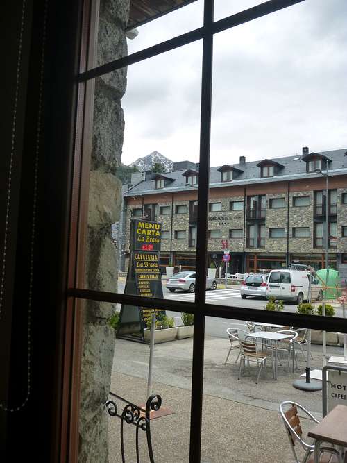
After a nourishing breakfast in Benasque we drove back to Barcelona with a short stop at the café we called into on our outward journey.
We struggled get a parking spot near the café as there was a street market on and the surrounding area was rammed. As is traditional with our visits to the Barcelona area we decided to stop off in Sitjes for a lunch break of tapas and cerveza before we had to return our hire car and check in at EasyJet desk.
 |
We had a great week in Benasque and in spite of the unusually heavy snow conditions for the season, we had manged to do some new stuff and see parts of the national Park that we had not been to before. If you’ve not been there, we definitely recommend that you do. It is so beautiful and quiet at that time of year that you can easily go all day without meeting anyone else. The facilities in the town of Benasque are available throughout the year so it can make an excellent base for your explorations. |