Toggle navigation
Mountains
Routes
Images
Trip Reports
Forum
What's New
People
Areas & Ranges
Articles
Trailheads
Canyons
Huts & Campgrounds
Albums
Logistical Centers
Fact Sheets
Lists
Custom Objects
Gear
Plans & Partners
WELCOME TO SUMMITPOST
SIGN IN
REGISTER
Via Italiana
Additional Parents
Image
"Via Italiana" to Mangart...
View High-Resolution Image
"Via Italiana" to Mangart...
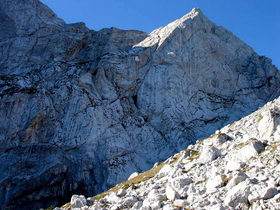
"Via Italiana" to Mangart (summit is to the left - not visible on this picture) seen from Bivouac Nogara. The first part of the route leads through some small caves, which you can see in the center of the picture.
« PREV
NEXT »
Herb
on
Oct 25, 2005 9:43 am
Comments & voting
Other parents
Lat/Lon:
46.44170°N / 13.66070°E
Image ID:
132593
4364 Hits
76.66
% Score
7
Votes
Log in to vote
Comments
No comments posted yet.
to post!
Don't have an account?
Via Italiana
(Route)
« PREV
Viewing
#10 of 14
GALLERY
NEXT »
Herb's Image Gallery
« PREV
Viewing
#204 of 313
GALLERY
NEXT »
Mangart
(Mountain/Rock)
Loading....
×
You need to login in order to vote!
User Name
Password
Remember me
Forgot your password?
Log me out when I close my browser.
Keep me logged in all the time.
sign in as a user
Don't have an account?
Register now for FREE
Rating available
Suggested routes for you
People who climb the same things as you
Comments Available
Create Albums
Register Here


